
| Memorials | : | 0 |
| Location | : | Jacket, McDonald County, USA |
| Coordinate | : | 36.5154300, -94.1321700 |
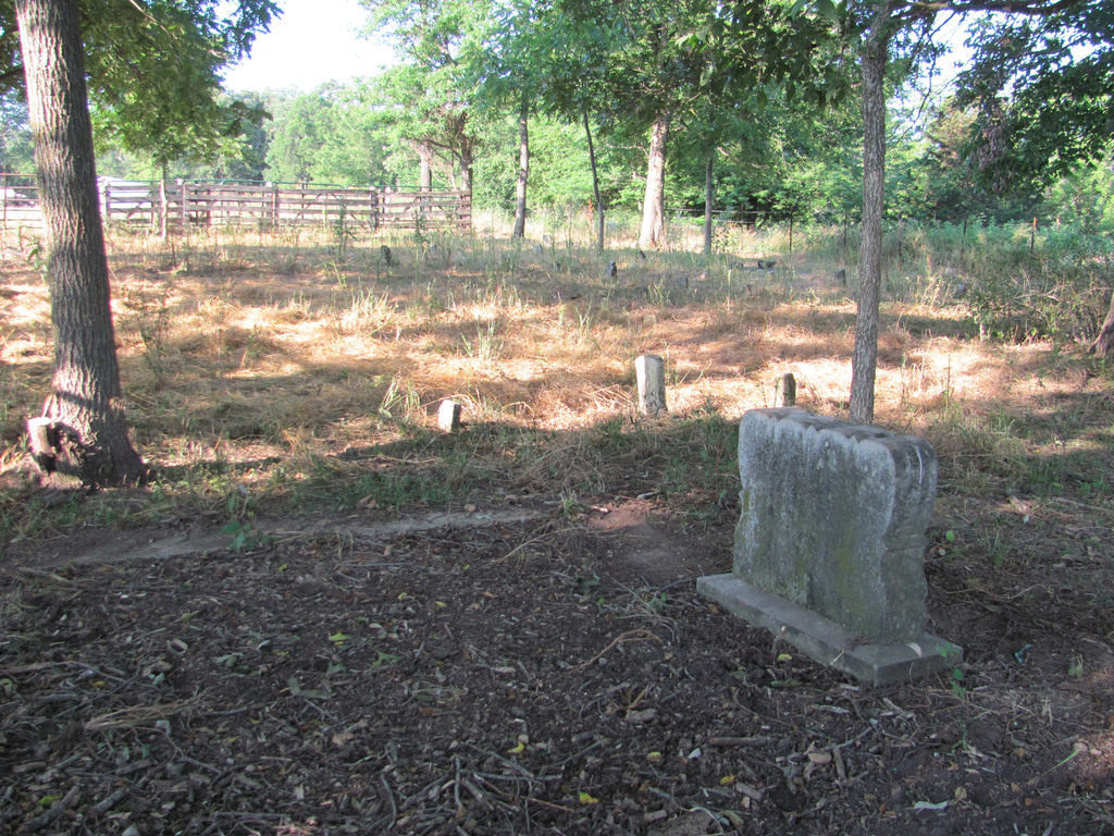
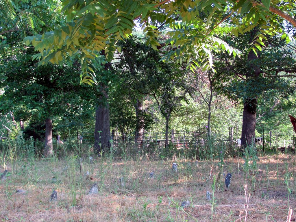
| Description | : | Community Graveyard located on old Jeremiah & Sarah (Schell) Burnett homeplace in White Oak Hollow - Section 25, T21N, R30W, McDonald County, Missouri. The cemetery is on private property and is surrounded by fields, with no public access. There are 20 to 30 graves, most marked only by field stones. A few gravestones have inscribed names and dates, the earliest burial dated 1881 (John C. Johnston), and the latest in 1938 (Sarah Schell Burnett). The area was settled about 1845, so some graves are probably much earlier than 1881. APPROXIMATE GPS: 36.515431, -94.132166 |
frequently asked questions (FAQ):
-
Where is Burnett Cemetery?
Burnett Cemetery is located at Jacket, McDonald County ,Missouri ,USA.
-
Burnett Cemetery cemetery's updated grave count on graveviews.com?
0 memorials
-
Where are the coordinates of the Burnett Cemetery?
Latitude: 36.5154300
Longitude: -94.1321700
Nearby Cemetories:
1. Antioch Cemetery
Jacket, McDonald County, USA
Coordinate: 36.5177900, -94.1172400
2. Gates To Heaven Cemetery
McDonald County, USA
Coordinate: 36.5133000, -94.1082000
3. Banks Cemetery
Benton County, USA
Coordinate: 36.4869003, -94.0950012
4. Dent Cemetery
Jacket, McDonald County, USA
Coordinate: 36.5012100, -94.0781000
5. Simsberry Cemetery
Arnett, McDonald County, USA
Coordinate: 36.5487300, -94.1838700
6. Foster Cemetery
Benton County, USA
Coordinate: 36.4611015, -94.1577988
7. Pea Ridge Cemetery
Pea Ridge, Benton County, USA
Coordinate: 36.4536018, -94.1200027
8. Roller Cemetery
Powell, McDonald County, USA
Coordinate: 36.5810547, -94.1393204
9. Summit Cemetery
Bella Vista, Benton County, USA
Coordinate: 36.4613650, -94.1904300
10. Twelve Corners Cemetery
Pea Ridge, Benton County, USA
Coordinate: 36.4700012, -94.0622025
11. Patterson Cemetery
Pea Ridge, Benton County, USA
Coordinate: 36.4453011, -94.1055984
12. Buttram Chapel Cemetery
Pea Ridge, Benton County, USA
Coordinate: 36.4411011, -94.0886765
13. Hickman Cemetery
Pea Ridge, Benton County, USA
Coordinate: 36.4317017, -94.1324997
14. Scott Cemetery
Garfield, Benton County, USA
Coordinate: 36.4822006, -94.0314026
15. Miser Family Homestead Cemetery
Pea Ridge, Benton County, USA
Coordinate: 36.4307133, -94.0875982
16. Potts Cemetery
Garfield, Benton County, USA
Coordinate: 36.4873620, -94.0228990
17. Dug Hill Cemetery
Bella Vista, Benton County, USA
Coordinate: 36.4766998, -94.2453003
18. Saint Theodores Episcopal Columbarium
Bella Vista, Benton County, USA
Coordinate: 36.4524350, -94.2281480
19. Cargile Cemetery
Washburn, Barry County, USA
Coordinate: 36.5598000, -94.0210000
20. Post Oak Cemetery
Bentonville, Benton County, USA
Coordinate: 36.4238760, -94.1831220
21. Ford Cemetery
Benton County, USA
Coordinate: 36.4557991, -94.0261002
22. Wardlaw Cemetery
Pea Ridge, Benton County, USA
Coordinate: 36.4193400, -94.0768120
23. Mills Cemetery
Bella Vista, Benton County, USA
Coordinate: 36.4411970, -94.2279980
24. Hollingworth Cemetery
Powell, McDonald County, USA
Coordinate: 36.6157690, -94.1831300