
| Memorials | : | 0 |
| Location | : | Brownsville, Cameron County, USA |
| Coordinate | : | 25.9659100, -97.5855600 |
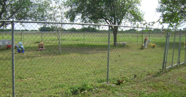
| Description | : | The Cabrera Family Cemetery is on the north side of Military Hwy (US 281), a short distance east of the larger El Carmen cemetery. . . |
frequently asked questions (FAQ):
-
Where is Cabrera Family Cemetery?
Cabrera Family Cemetery is located at Brownsville, Cameron County ,Texas ,USA.
-
Cabrera Family Cemetery cemetery's updated grave count on graveviews.com?
0 memorials
-
Where are the coordinates of the Cabrera Family Cemetery?
Latitude: 25.9659100
Longitude: -97.5855600
Nearby Cemetories:
1. El Carmen Cemetery
Brownsville, Cameron County, USA
Coordinate: 25.9672200, -97.5879200
2. Montemayor Cemetery
San Pedro, Cameron County, USA
Coordinate: 25.9727800, -97.5916000
3. Raul Cavazos Cemetery
San Pedro, Cameron County, USA
Coordinate: 25.9822500, -97.5968900
4. Russell's Cemetery
San Pedro, Cameron County, USA
Coordinate: 25.9845200, -97.5947700
5. Sabas Cavazos Cemetery
San Pedro, Cameron County, USA
Coordinate: 25.9846900, -97.5948600
6. Ysidro Leal Memorial Cemetery
San Pedro, Cameron County, USA
Coordinate: 25.9857270, -97.5949000
7. Villa Nueva Cemetery
Villa Nueva, Cameron County, USA
Coordinate: 25.9543700, -97.5590000
8. Panteón del Ejido Tahuachal
El Tahuachal, Matamoros Municipality, Mexico
Coordinate: 25.9690687, -97.6216367
9. La Muralla Cemetery
Cameron County, USA
Coordinate: 25.9994000, -97.6117000
10. Panteón La Campana
Matamoros Municipality, Mexico
Coordinate: 25.9255880, -97.5556090
11. Panteón Santa Cruz
Las Rusias, Matamoros Municipality, Mexico
Coordinate: 25.9169440, -97.5606000
12. Alejandro Garza Memorial Cemetery
Villa Cavazos, Cameron County, USA
Coordinate: 26.0169200, -97.6075300
13. Rodriguez Family Cemetery
Ranchito, Cameron County, USA
Coordinate: 26.0176600, -97.6155900
14. Escamilla-Pablo Cemetery
Ranchito, Cameron County, USA
Coordinate: 26.0176400, -97.6177100
15. El Naranjo Cemetery
Ranchito, Cameron County, USA
Coordinate: 26.0191200, -97.6212200
16. Cementerio del Ejido Las Rusias
Las Rusias, Matamoros Municipality, Mexico
Coordinate: 25.9132050, -97.5430650
17. La Palma Cemetery
Brownsville, Cameron County, USA
Coordinate: 25.9795800, -97.5134000
18. Esparza Cemetery
Cameron County, USA
Coordinate: 26.0245400, -97.6270200
19. Sanchez Cemetery
Ranchito, Cameron County, USA
Coordinate: 26.0263000, -97.6323300
20. Zepeda Cemetery
Ranchito, Cameron County, USA
Coordinate: 26.0269500, -97.6351800
21. Avalos Family Cemetery
Ranchito, Cameron County, USA
Coordinate: 26.0267650, -97.6358410
22. Vasquez Cemetery
Ranchito, Cameron County, USA
Coordinate: 26.0267700, -97.6358400
23. Old Garcia Cemetery
Ranchito, Cameron County, USA
Coordinate: 26.0260800, -97.6399200
24. San Pedro Cemetery
Rancho Viejo, Cameron County, USA
Coordinate: 26.0472740, -97.5513950