
| Memorials | : | 0 |
| Location | : | Cameron County, USA |
| Coordinate | : | 25.9994000, -97.6117000 |
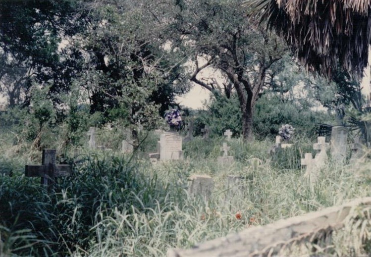
| Description | : | Located app. 1/2 mile NW of hwy. 281 and FM 1421, "Caveseno" is said to be one of the oldest of the ranch cemeteries along the river road. It is very difficult to find and get to -- all on dirt roads thru farms. It is in a large clump of trees and brush, very overgrown but it appeared to still be visited, when viewed in the 1990's. The wire fence was falling down, and many markers had fallen over. It was difficult to determine the number of graves, and the dates were not legible on most.... Read More |
frequently asked questions (FAQ):
-
Where is La Muralla Cemetery?
La Muralla Cemetery is located at Cameron County ,Texas ,USA.
-
La Muralla Cemetery cemetery's updated grave count on graveviews.com?
0 memorials
-
Where are the coordinates of the La Muralla Cemetery?
Latitude: 25.9994000
Longitude: -97.6117000
Nearby Cemetories:
1. Alejandro Garza Memorial Cemetery
Villa Cavazos, Cameron County, USA
Coordinate: 26.0169200, -97.6075300
2. Rodriguez Family Cemetery
Ranchito, Cameron County, USA
Coordinate: 26.0176600, -97.6155900
3. Escamilla-Pablo Cemetery
Ranchito, Cameron County, USA
Coordinate: 26.0176400, -97.6177100
4. Ysidro Leal Memorial Cemetery
San Pedro, Cameron County, USA
Coordinate: 25.9857270, -97.5949000
5. Sabas Cavazos Cemetery
San Pedro, Cameron County, USA
Coordinate: 25.9846900, -97.5948600
6. Russell's Cemetery
San Pedro, Cameron County, USA
Coordinate: 25.9845200, -97.5947700
7. El Naranjo Cemetery
Ranchito, Cameron County, USA
Coordinate: 26.0191200, -97.6212200
8. Raul Cavazos Cemetery
San Pedro, Cameron County, USA
Coordinate: 25.9822500, -97.5968900
9. Esparza Cemetery
Cameron County, USA
Coordinate: 26.0245400, -97.6270200
10. Panteón del Ejido Tahuachal
El Tahuachal, Matamoros Municipality, Mexico
Coordinate: 25.9690687, -97.6216367
11. Montemayor Cemetery
San Pedro, Cameron County, USA
Coordinate: 25.9727800, -97.5916000
12. Sanchez Cemetery
Ranchito, Cameron County, USA
Coordinate: 26.0263000, -97.6323300
13. Zepeda Cemetery
Ranchito, Cameron County, USA
Coordinate: 26.0269500, -97.6351800
14. Avalos Family Cemetery
Ranchito, Cameron County, USA
Coordinate: 26.0267650, -97.6358410
15. Vasquez Cemetery
Ranchito, Cameron County, USA
Coordinate: 26.0267700, -97.6358400
16. Old Garcia Cemetery
Ranchito, Cameron County, USA
Coordinate: 26.0260800, -97.6399200
17. El Carmen Cemetery
Brownsville, Cameron County, USA
Coordinate: 25.9672200, -97.5879200
18. Cabrera Family Cemetery
Brownsville, Cameron County, USA
Coordinate: 25.9659100, -97.5855600
19. El Calaboz Cemetery
Ranchito, Cameron County, USA
Coordinate: 26.0340800, -97.6503200
20. Escamilla Cemetery
El Calaboz, Cameron County, USA
Coordinate: 26.0340800, -97.6503200
21. Escamilla Family Cemetery
Ranchito, Cameron County, USA
Coordinate: 26.0343900, -97.6506100
22. Villa Nueva Cemetery
Villa Nueva, Cameron County, USA
Coordinate: 25.9543700, -97.5590000
23. La Paloma Cemetery
La Paloma, Cameron County, USA
Coordinate: 26.0451170, -97.6710500
24. San Pedro Cemetery
Rancho Viejo, Cameron County, USA
Coordinate: 26.0472740, -97.5513950