
| Memorials | : | 0 |
| Location | : | Ranchito, Cameron County, USA |
| Coordinate | : | 26.0269500, -97.6351800 |
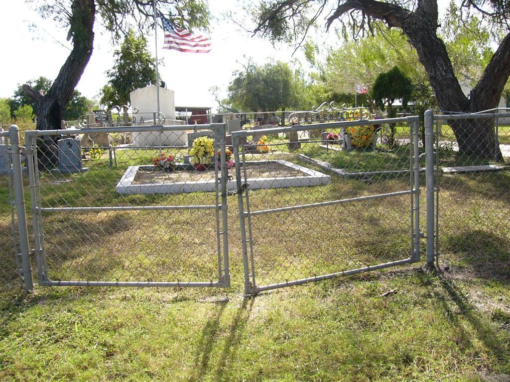
| Description | : | Named to honour the memory of Pedro Zepeda, the Zepeda Cemetery is located in the middle part of the middle league of the San Pedro de los Carricitos Land Grant. It is on the south side of the Old Military Highway, now State Highway 281. Pedro Zepeda purchased the land in 1874 where the Zepeda ranch was established along with the cemetery. The Zepeda family continues to own the cemetery and the Zepeda Ranch. The large white above ground vault ("boveda") holds the remains of Pedro Zepeda Sr., who died in 1903, and his wife Luisa who died in 1912.... Read More |
frequently asked questions (FAQ):
-
Where is Zepeda Cemetery?
Zepeda Cemetery is located at Ranchito, Cameron County ,Texas ,USA.
-
Zepeda Cemetery cemetery's updated grave count on graveviews.com?
0 memorials
-
Where are the coordinates of the Zepeda Cemetery?
Latitude: 26.0269500
Longitude: -97.6351800
Nearby Cemetories:
1. Vasquez Cemetery
Ranchito, Cameron County, USA
Coordinate: 26.0267700, -97.6358400
2. Avalos Family Cemetery
Ranchito, Cameron County, USA
Coordinate: 26.0267650, -97.6358410
3. Sanchez Cemetery
Ranchito, Cameron County, USA
Coordinate: 26.0263000, -97.6323300
4. Old Garcia Cemetery
Ranchito, Cameron County, USA
Coordinate: 26.0260800, -97.6399200
5. Esparza Cemetery
Cameron County, USA
Coordinate: 26.0245400, -97.6270200
6. El Naranjo Cemetery
Ranchito, Cameron County, USA
Coordinate: 26.0191200, -97.6212200
7. El Calaboz Cemetery
Ranchito, Cameron County, USA
Coordinate: 26.0340800, -97.6503200
8. Escamilla Cemetery
El Calaboz, Cameron County, USA
Coordinate: 26.0340800, -97.6503200
9. Escamilla Family Cemetery
Ranchito, Cameron County, USA
Coordinate: 26.0343900, -97.6506100
10. Escamilla-Pablo Cemetery
Ranchito, Cameron County, USA
Coordinate: 26.0176400, -97.6177100
11. Rodriguez Family Cemetery
Ranchito, Cameron County, USA
Coordinate: 26.0176600, -97.6155900
12. Alejandro Garza Memorial Cemetery
Villa Cavazos, Cameron County, USA
Coordinate: 26.0169200, -97.6075300
13. La Muralla Cemetery
Cameron County, USA
Coordinate: 25.9994000, -97.6117000
14. La Paloma Cemetery
La Paloma, Cameron County, USA
Coordinate: 26.0451170, -97.6710500
15. Ysidro Leal Memorial Cemetery
San Pedro, Cameron County, USA
Coordinate: 25.9857270, -97.5949000
16. Sabas Cavazos Cemetery
San Pedro, Cameron County, USA
Coordinate: 25.9846900, -97.5948600
17. Russell's Cemetery
San Pedro, Cameron County, USA
Coordinate: 25.9845200, -97.5947700
18. Raul Cavazos Cemetery
San Pedro, Cameron County, USA
Coordinate: 25.9822500, -97.5968900
19. Panteón del Ejido Tahuachal
El Tahuachal, Matamoros Municipality, Mexico
Coordinate: 25.9690687, -97.6216367
20. Landrum Cemetery
Los Indios, Cameron County, USA
Coordinate: 26.0453400, -97.6977600
21. Garcia Cemetery
Ranchito, Cameron County, USA
Coordinate: 26.0455250, -97.6993560
22. Montemayor Cemetery
San Pedro, Cameron County, USA
Coordinate: 25.9727800, -97.5916000
23. Palm In Field Cemetery
Carricitos, Cameron County, USA
Coordinate: 26.0442510, -97.7071330
24. Juan Garza Jr Memorial
San Benito, Cameron County, USA
Coordinate: 26.0948700, -97.6125200