
| Memorials | : | 0 |
| Location | : | Copeland Borough, England |
| Coordinate | : | 54.4441670, -3.4661110 |
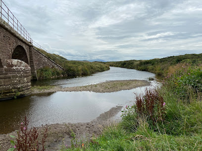
| Description | : | Calder Abbey in Cumbria was a Savigniac monastery founded in 1134 by Ranulph de Gernon, 2nd Earl of Chester and moved to this site following a refoundation in 1142. It became Cistercian in 1148. It is near to the village of Calderbridge. At the Dissolution Henry VIII gave the abbey to Sir Thomas Leigh, who pulled off the roof and sold it and anything else he could and reduced the church to a ruin. Ownership passed through many secular hands, in which it still remains. Much of the cloister buildings remain either incorporated into Calder Abbey House, now a largely early-nineteenth century... Read More |
frequently asked questions (FAQ):
-
Where is Calder Abbey?
Calder Abbey is located at Calderbridge Copeland Borough ,Cumbria ,England.
-
Calder Abbey cemetery's updated grave count on graveviews.com?
0 memorials
-
Where are the coordinates of the Calder Abbey?
Latitude: 54.4441670
Longitude: -3.4661110
Nearby Cemetories:
1. Ponsonby Parish Churchyard
Ponsonby, Copeland Borough, England
Coordinate: 54.4367970, -3.4782480
2. Haile Parish Churchyard
Haile, Copeland Borough, England
Coordinate: 54.4653770, -3.4972620
3. St. John's Churchyard
Beckermet, Copeland Borough, England
Coordinate: 54.4463280, -3.5145220
4. St Bridget’s Churchyard
Beckermet, Copeland Borough, England
Coordinate: 54.4404100, -3.5205000
5. St Mary's Churchyard
Gosforth, Copeland Borough, England
Coordinate: 54.4192540, -3.4313680
6. Beckermet Cemetery
Beckermet, Copeland Borough, England
Coordinate: 54.4573120, -3.5180770
7. Ss Mary & Michael Churchyard
Egremont, Copeland Borough, England
Coordinate: 54.4805480, -3.5274700
8. Egremont Cemetery
Egremont, Copeland Borough, England
Coordinate: 54.4889990, -3.5316450
9. St Paul Churchyard
Irton, Copeland Borough, England
Coordinate: 54.3915480, -3.4006870
10. St. Peter Churchyard
Drigg, Copeland Borough, England
Coordinate: 54.3796400, -3.4328800
11. St Michael and All Angels Churchyard
Nether Wasdale, Copeland Borough, England
Coordinate: 54.4245000, -3.3508600
12. St Leonard Churchyard
Cleator, Copeland Borough, England
Coordinate: 54.5068480, -3.5239520
13. Nether Wasdale Cemetery
Nether Wasdale, Copeland Borough, England
Coordinate: 54.4242140, -3.3463910
14. St Mary Roman Catholic Churchyard
Cleator, Copeland Borough, England
Coordinate: 54.5126240, -3.5145410
15. St John Churchyard
Cleator Moor, Copeland Borough, England
Coordinate: 54.5233900, -3.5237530
16. St Mary's Church Extension
Ennerdale, Copeland Borough, England
Coordinate: 54.5293120, -3.4414480
17. St Mary's Churchyard
Ennerdale, Copeland Borough, England
Coordinate: 54.5294970, -3.4416310
18. Priory of St. Mary and St. Bega
St Bees, Copeland Borough, England
Coordinate: 54.4941300, -3.5931700
19. St. Paul's Churchyard
Frizington, Copeland Borough, England
Coordinate: 54.5387380, -3.4965600
20. St Joseph's Roman Catholic Cemetery
Frizington, Copeland Borough, England
Coordinate: 54.5403370, -3.4863890
21. Saint Michael and All Angels
Muncaster, Copeland Borough, England
Coordinate: 54.3567850, -3.3802270
22. St. John‘s Old Churchyard
Hensingham, Copeland Borough, England
Coordinate: 54.5366130, -3.5685310
23. Hensingham Cemetery
Whitehaven, Copeland Borough, England
Coordinate: 54.5393790, -3.5647590
24. St John's Church
Waberthwaite, Copeland Borough, England
Coordinate: 54.3433418, -3.3854907