
| Memorials | : | 0 |
| Location | : | Muncaster, Copeland Borough, England |
| Coordinate | : | 54.3567850, -3.3802270 |
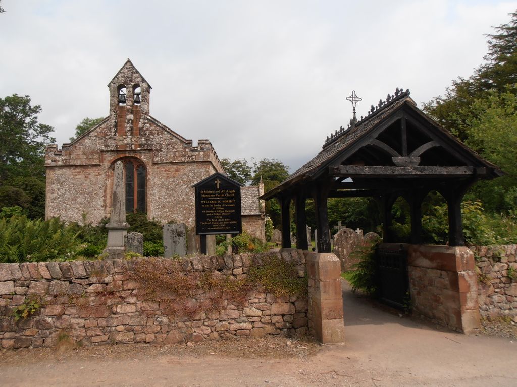
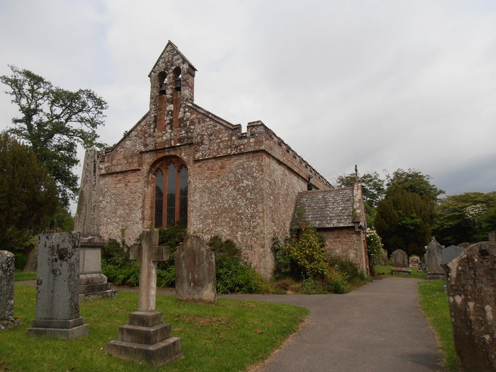
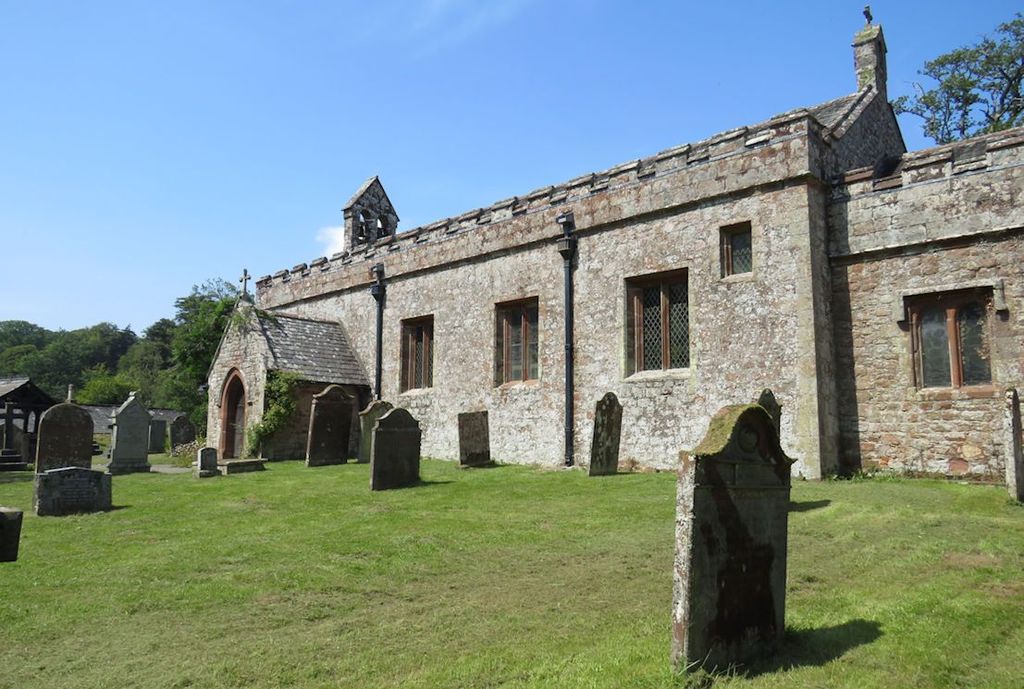
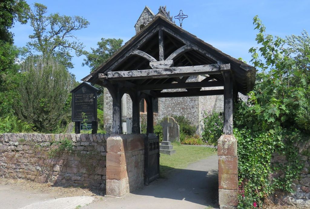
| Description | : | There has been a church on this site since 1140. The current building dates from the 16th century with various later alterations, including in the late 19th century by the famous architect Anthony Salvin. The church has some fine stained glass windows including by Pre-Raphaelite artist Henry Holiday, who was a frequent visitor to Muncaster. They include a window installed as a memorial to friends of the then Lord Muncaster, who were kidnapped while travelling in Greece and held to ransom. They were all killed during an attempt to rescue them. Lord Muncaster had been in the party but having... Read More |
frequently asked questions (FAQ):
-
Where is Saint Michael and All Angels?
Saint Michael and All Angels is located at Muncaster, Copeland Borough ,Cumbria ,England.
-
Saint Michael and All Angels cemetery's updated grave count on graveviews.com?
0 memorials
-
Where are the coordinates of the Saint Michael and All Angels?
Latitude: 54.3567850
Longitude: -3.3802270

Nearby Cemetories:
1. St John's Church
Waberthwaite, Copeland Borough, England
Coordinate: 54.3433418, -3.3854907
2. St Paul Churchyard
Irton, Copeland Borough, England
Coordinate: 54.3915480, -3.4006870
3. St. Peter Churchyard
Drigg, Copeland Borough, England
Coordinate: 54.3796400, -3.4328800
4. St. John The Baptist Churchyard
Corney, Copeland Borough, England
Coordinate: 54.3099720, -3.3656840
5. St Mary's Churchyard
Gosforth, Copeland Borough, England
Coordinate: 54.4192540, -3.4313680
6. St Michael and All Angels Churchyard
Nether Wasdale, Copeland Borough, England
Coordinate: 54.4245000, -3.3508600
7. Nether Wasdale Cemetery
Nether Wasdale, Copeland Borough, England
Coordinate: 54.4242140, -3.3463910
8. Saint Catherine's Churchyard
Eskdale, Copeland Borough, England
Coordinate: 54.3911910, -3.2706530
9. St. Michael and All Angels Churchyard
Bootle, Copeland Borough, England
Coordinate: 54.2833510, -3.3732080
10. St. John the Baptist Churchyard
Ulpha, Copeland Borough, England
Coordinate: 54.3285020, -3.2349130
11. Ulpha Churchyard Extension
Ulpha, Copeland Borough, England
Coordinate: 54.3282170, -3.2350270
12. Ponsonby Parish Churchyard
Ponsonby, Copeland Borough, England
Coordinate: 54.4367970, -3.4782480
13. Calder Abbey
Copeland Borough, England
Coordinate: 54.4441670, -3.4661110
14. Holy Trinity Church
Duddon, South Lakeland District, England
Coordinate: 54.3549054, -3.1877149
15. St Mary's Churchyard
Whitbeck, Copeland Borough, England
Coordinate: 54.2438000, -3.3533470
16. St Bridget’s Churchyard
Beckermet, Copeland Borough, England
Coordinate: 54.4404100, -3.5205000
17. St. John's Churchyard
Beckermet, Copeland Borough, England
Coordinate: 54.4463280, -3.5145220
18. St Anne Churchyard Thwaites
Millom Without, Copeland Borough, England
Coordinate: 54.2584700, -3.2632200
19. St. Mary Magdalene Parish Churchyard
Broughton-in-Furness, South Lakeland District, England
Coordinate: 54.2761400, -3.2152660
20. St Mary Churchyard
Whicham, Copeland Borough, England
Coordinate: 54.2326310, -3.3287160
21. Haile Parish Churchyard
Haile, Copeland Borough, England
Coordinate: 54.4653770, -3.4972620
22. Beckermet Cemetery
Beckermet, Copeland Borough, England
Coordinate: 54.4573120, -3.5180770
23. Saint Olaf's Churchyard
Wasdale, Copeland Borough, England
Coordinate: 54.4670350, -3.2535080
24. St John the Evangelist
Woodland, South Lakeland District, England
Coordinate: 54.2919829, -3.1579023