
| Memorials | : | 5 |
| Location | : | Flat Gap, Johnson County, USA |
| Coordinate | : | 37.9503480, -82.8880580 |
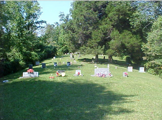
| Description | : | This cemetery is in good condition and is accessible by car/truck. Sits up on a hill way off the road is in not visible from the road. You have to enter through someones driveway and then follow an old driveway through the over grown field and then follow the road to the left which goes into the woods and up the hill. On a ridge of a point about one mile north of Flat Gap School on route 689. . The cemetery name may have derived from McCamant, one time owner of the land on which the cemetery is located. It is also referred to as... Read More |
frequently asked questions (FAQ):
-
Where is Camant Cemetery?
Camant Cemetery is located at Flat Gap, Johnson County ,Kentucky ,USA.
-
Camant Cemetery cemetery's updated grave count on graveviews.com?
3 memorials
-
Where are the coordinates of the Camant Cemetery?
Latitude: 37.9503480
Longitude: -82.8880580
Nearby Cemetories:
1. Lum Salyer Cemetery
Flat Gap, Johnson County, USA
Coordinate: 37.9383881, -82.9028611
2. Salyers Cemetery
Flat Gap, Johnson County, USA
Coordinate: 37.9192009, -82.8933029
3. Skaggstown Church Cemetery
Flat Gap, Johnson County, USA
Coordinate: 37.9612940, -82.9283080
4. Sparks Cemetery
Flat Gap, Johnson County, USA
Coordinate: 37.9185982, -82.8700027
5. Adams Cemetery
Fuget, Johnson County, USA
Coordinate: 37.9143870, -82.9193490
6. Buford Cantrell Cemetery
Flat Gap, Johnson County, USA
Coordinate: 37.9176960, -82.9305160
7. Davis Family Cemetery
Blaine, Lawrence County, USA
Coordinate: 37.9680800, -82.8331300
8. Cantrell-Hill Cemetery
Fuget, Johnson County, USA
Coordinate: 37.9093810, -82.9252870
9. Marvin Sparks Cemetery
Blaine, Lawrence County, USA
Coordinate: 37.9726000, -82.8306900
10. Henry Cantrell Cemetery
Flat Gap, Johnson County, USA
Coordinate: 37.9056060, -82.9297370
11. Rice Cemetery
Blaine, Lawrence County, USA
Coordinate: 38.0093994, -82.9096985
12. Chandlerville Cemetery
Chandlerville, Johnson County, USA
Coordinate: 37.9268990, -82.8142014
13. Bear Branch Cemetery
Blaine, Lawrence County, USA
Coordinate: 37.9940586, -82.8269238
14. Castle Cemetery
Blaine, Lawrence County, USA
Coordinate: 38.0026750, -82.8368200
15. Morton Sparks Cemetery
Blaine, Lawrence County, USA
Coordinate: 38.0127820, -82.9163160
16. Bishop Cemetery
Lawrence County, USA
Coordinate: 38.0175018, -82.8835983
17. Estep Cemetery
Johnson County, USA
Coordinate: 37.8871340, -82.9258910
18. Holbrook Cemetery
Elna, Johnson County, USA
Coordinate: 37.9278880, -82.9720850
19. Holbrook-John Cemetery
Elna, Johnson County, USA
Coordinate: 37.9150400, -82.9678820
20. Patty Flat Cemetery
Flat Gap, Johnson County, USA
Coordinate: 37.8891010, -82.9387040
21. Edwards Cemetery
Blaine, Lawrence County, USA
Coordinate: 38.0233002, -82.8728027
22. Old Path Baptist Church Cemetery
Blaine, Lawrence County, USA
Coordinate: 38.0221550, -82.8466950
23. Columbus Wheeler Cemetery
Blaine, Lawrence County, USA
Coordinate: 38.0221890, -82.8466740
24. Sparks Cemetery
Blaine, Lawrence County, USA
Coordinate: 38.0285988, -82.8572006