
| Memorials | : | 1 |
| Location | : | Blaine, Lawrence County, USA |
| Coordinate | : | 37.9940586, -82.8269238 |
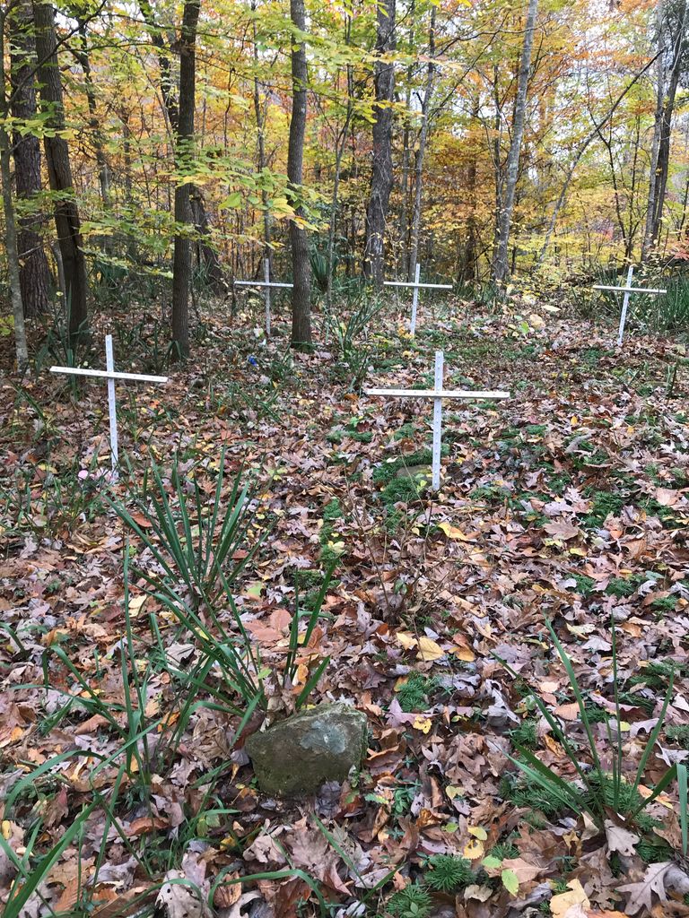
| Description | : | Almost to the end of Bear Branch Road, Cemetery is about 100 yards up the hill on the left, accessible via a footpath (that continues to a wellhead farther up the hill.) Cemetery is on the right of the footpath. Two marked graves (Shade Bowling and Perlina Bowling) and several "stones." |
frequently asked questions (FAQ):
-
Where is Bear Branch Cemetery?
Bear Branch Cemetery is located at Bear Branch Road Blaine, Lawrence County ,Kentucky , 41124USA.
-
Bear Branch Cemetery cemetery's updated grave count on graveviews.com?
1 memorials
-
Where are the coordinates of the Bear Branch Cemetery?
Latitude: 37.9940586
Longitude: -82.8269238
Nearby Cemetories:
1. Castle Cemetery
Blaine, Lawrence County, USA
Coordinate: 38.0026750, -82.8368200
2. Marvin Sparks Cemetery
Blaine, Lawrence County, USA
Coordinate: 37.9726000, -82.8306900
3. Davis Family Cemetery
Blaine, Lawrence County, USA
Coordinate: 37.9680800, -82.8331300
4. Old Path Baptist Church Cemetery
Blaine, Lawrence County, USA
Coordinate: 38.0221550, -82.8466950
5. Columbus Wheeler Cemetery
Blaine, Lawrence County, USA
Coordinate: 38.0221890, -82.8466740
6. H.J. Mollette Family Cemetery
Blaine, Lawrence County, USA
Coordinate: 38.0300017, -82.8477721
7. Cordle Cemetery
Blaine, Lawrence County, USA
Coordinate: 38.0144005, -82.7827988
8. Sparks Cemetery
Blaine, Lawrence County, USA
Coordinate: 38.0285988, -82.8572006
9. Curnutte Cemetery
Blaine, Lawrence County, USA
Coordinate: 38.0341988, -82.8099976
10. Swetnam Cemetery
Blaine, Lawrence County, USA
Coordinate: 38.0360985, -82.8486023
11. Edwards Cemetery
Blaine, Lawrence County, USA
Coordinate: 38.0233002, -82.8728027
12. Bishop Cemetery
Lawrence County, USA
Coordinate: 38.0175018, -82.8835983
13. Richard Cains Cemetery
Blaine, Lawrence County, USA
Coordinate: 38.0429220, -82.8715770
14. Camant Cemetery
Flat Gap, Johnson County, USA
Coordinate: 37.9503480, -82.8880580
15. Rice Cemetery
Blaine, Lawrence County, USA
Coordinate: 38.0093994, -82.9096985
16. Chandlerville Cemetery
Chandlerville, Johnson County, USA
Coordinate: 37.9268990, -82.8142014
17. Morton Sparks Cemetery
Blaine, Lawrence County, USA
Coordinate: 38.0127820, -82.9163160
18. Boggs Cemetery
Lawrence County, USA
Coordinate: 38.0588970, -82.8786130
19. Thompson Cemetery #5
Blaine, Lawrence County, USA
Coordinate: 38.0263470, -82.7334060
20. Lum Salyer Cemetery
Flat Gap, Johnson County, USA
Coordinate: 37.9383881, -82.9028611
21. Sparks Cemetery
Flat Gap, Johnson County, USA
Coordinate: 37.9185982, -82.8700027
22. Bazeal Hayes Pack Cemetery
Georges Creek, Lawrence County, USA
Coordinate: 37.9721200, -82.7256900
23. Mary United Baptist Church Cemetery
Georges Creek, Lawrence County, USA
Coordinate: 37.9709760, -82.7240330
24. Kelly Cemetery
Cherokee, Lawrence County, USA
Coordinate: 38.0780000, -82.8380000