
| Memorials | : | 0 |
| Location | : | Brownsville, Cameron County, USA |
| Coordinate | : | 25.9045200, -97.4948800 |
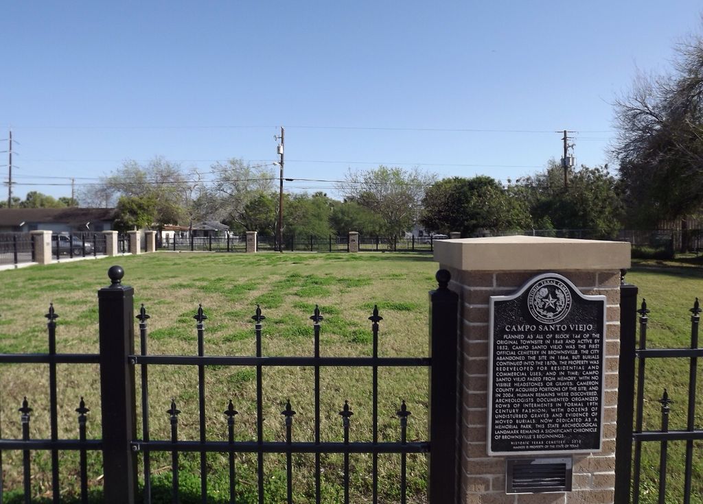
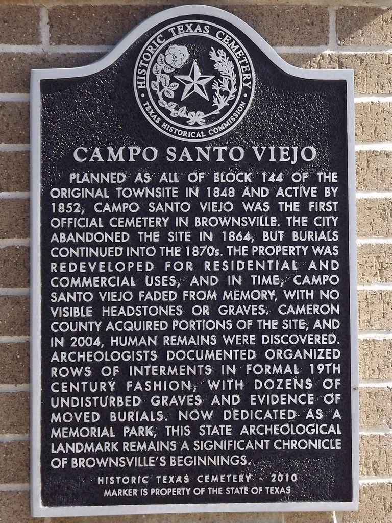
| Description | : | Campo Santo Viejo Cemetery is now a memorial park and State Archeological Landmark on the north side of East Munroe Street across from the County Courthouse in Brownsville There are no visible graves here but there are dozens of undisturbed graves and evidence of moved burials. ~ text from the Texas Historical Marker ~ Campo Santo Viejo Planned as all of block 144 of the original townsite in 1848 and active by 1852, Campo Santo Viejo was the first official cemetery in Brownsville. The city abandoned the site in 1864, but burials continued into the 1870s. The property was redeveloped for residential and commercial... Read More |
frequently asked questions (FAQ):
-
Where is Campo Santo Viejo Cemetery?
Campo Santo Viejo Cemetery is located at East Munroe Street Brownsville, Cameron County ,Texas ,USA.
-
Campo Santo Viejo Cemetery cemetery's updated grave count on graveviews.com?
0 memorials
-
Where are the coordinates of the Campo Santo Viejo Cemetery?
Latitude: 25.9045200
Longitude: -97.4948800
Nearby Cemetories:
1. Cathedral Church of the Immaculate Conception
Brownsville, Cameron County, USA
Coordinate: 25.9025300, -97.4955600
2. Old City Cemetery
Brownsville, Cameron County, USA
Coordinate: 25.9092007, -97.5006027
3. Hebrew Cemetery
Brownsville, Cameron County, USA
Coordinate: 25.9102600, -97.5022400
4. Buena Vista Burial Park
Brownsville, Cameron County, USA
Coordinate: 25.9160995, -97.4886017
5. Church of the Advent Columbarium
Brownsville, Cameron County, USA
Coordinate: 25.9104555, -97.5076436
6. Panteón Nuevo de Matamoros
Heroica Matamoros, Matamoros Municipality, Mexico
Coordinate: 25.8767010, -97.4894430
7. Panteón Antiguo de Matamoros
Heroica Matamoros, Matamoros Municipality, Mexico
Coordinate: 25.8760880, -97.5102200
8. Santa Rosalia Cemetery
Brownsville, Cameron County, USA
Coordinate: 25.8875008, -97.4606018
9. Cementerio del Ejido Las Rusias
Las Rusias, Matamoros Municipality, Mexico
Coordinate: 25.9132050, -97.5430650
10. Panteón La Campana
Matamoros Municipality, Mexico
Coordinate: 25.9255880, -97.5556090
11. Panteón Santa Cruz
Las Rusias, Matamoros Municipality, Mexico
Coordinate: 25.9169440, -97.5606000
12. Panteón Jardín
Heroica Matamoros, Matamoros Municipality, Mexico
Coordinate: 25.8399130, -97.5220300
13. Panteón de Lucio Blanco
Lucio Blanco, Matamoros Municipality, Mexico
Coordinate: 25.8459680, -97.4469570
14. Rose Lawn Memorial Gardens
Brownsville, Cameron County, USA
Coordinate: 25.9684800, -97.4515000
15. El Jardin Cemetery
Brownsville, Cameron County, USA
Coordinate: 25.9687000, -97.4516900
16. Villa Nueva Cemetery
Villa Nueva, Cameron County, USA
Coordinate: 25.9543700, -97.5590000
17. Panteón Ejido 20 de Noviembre
Heroica Matamoros, Matamoros Municipality, Mexico
Coordinate: 25.8288007, -97.5084854
18. La Palma Cemetery
Brownsville, Cameron County, USA
Coordinate: 25.9795800, -97.5134000
19. Panteón de Palmares
Heroica Matamoros, Matamoros Municipality, Mexico
Coordinate: 25.8424210, -97.5465880
20. Brulay Cemetery
Brownsville, Cameron County, USA
Coordinate: 25.8659550, -97.4078190
21. Panteón Francisco Rincón
Buenavista, Matamoros Municipality, Mexico
Coordinate: 25.8185340, -97.5280920
22. Panteón Jardines Del Recuerdo
Heroica Matamoros, Matamoros Municipality, Mexico
Coordinate: 25.8135258, -97.5021779
23. Guillen Community Cemetery
Brownsville, Cameron County, USA
Coordinate: 25.9205000, -97.3883000
24. Cabrera Family Cemetery
Brownsville, Cameron County, USA
Coordinate: 25.9659100, -97.5855600