
| Memorials | : | 5 |
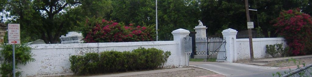
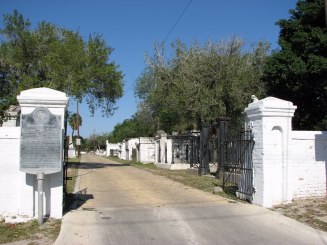
| Location | : | Brownsville, Cameron County, USA |
| Coordinate | : | 25.9092007, -97.5006027 |
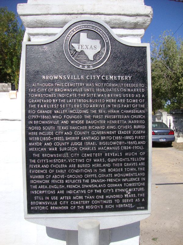
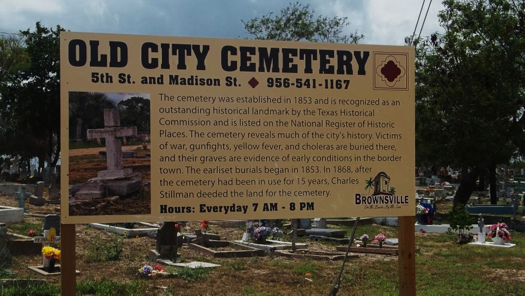
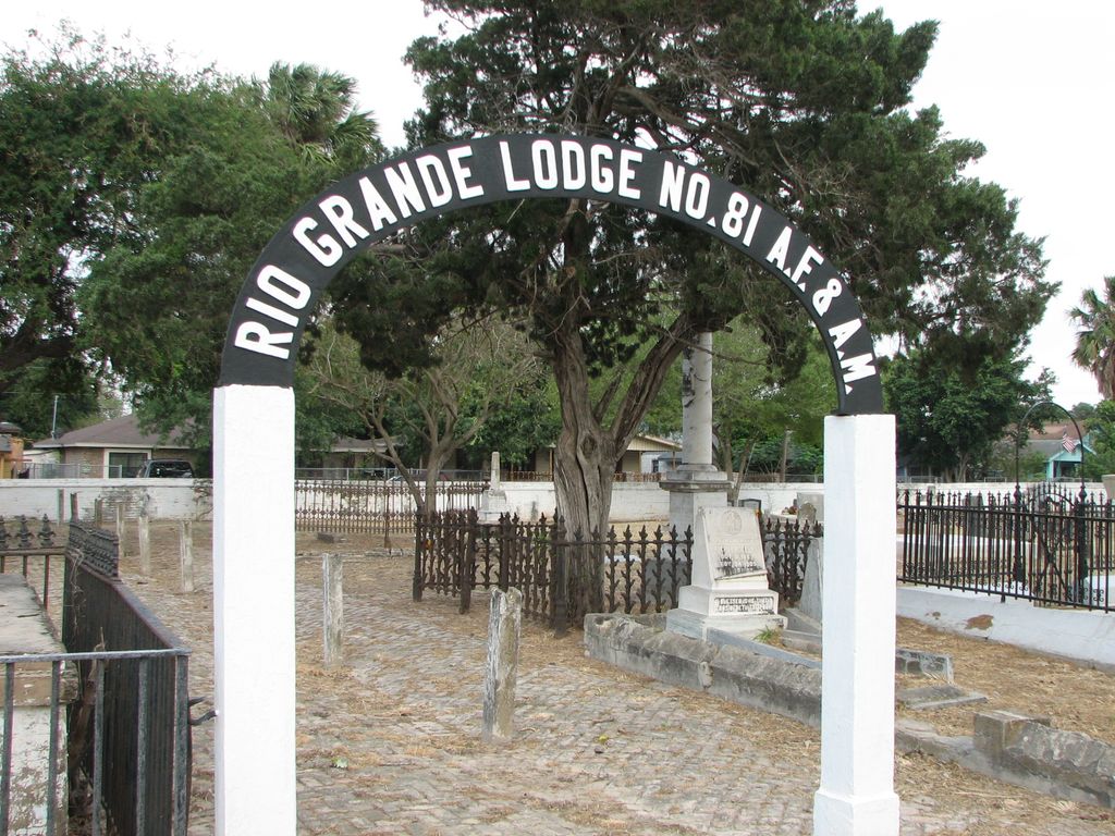
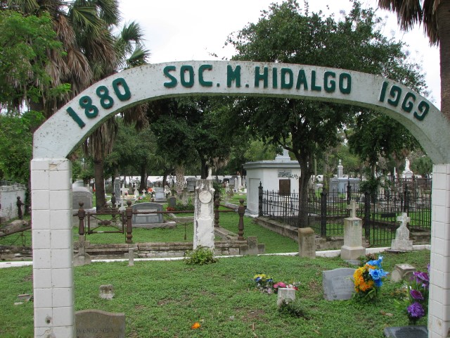
| Description | : | Brownsville City Cemetery - Although this cemetery was not formally deeded to the City of Brownsville until 1868, dates on marked tombstones indicate the site was being used as a graveyard by the late 1850s. Buried here are some of the earliest settlers to arrive in this part of the Rio Grande Valley, including The Rev. Hiram Chamberlain (1797-1866), who founded the First Presbyterian Church in Brownsville and whose daughter Henrietta married noted South Texas rancher Richard King. Others buried here include city and county government leader Joseph Webb (1850-1933), Sheriff Santiago Brito (1851-1892), first Mayor and County Judge Israel... Read More |
frequently asked questions (FAQ):
-
Where is Old City Cemetery?
Old City Cemetery is located at Brownsville, Cameron County ,Texas ,USA.
-
Old City Cemetery cemetery's updated grave count on graveviews.com?
5 memorials
-
Where are the coordinates of the Old City Cemetery?
Latitude: 25.9092007
Longitude: -97.5006027
Nearby Cemetories:
1. Hebrew Cemetery
Brownsville, Cameron County, USA
Coordinate: 25.9102600, -97.5022400
2. Church of the Advent Columbarium
Brownsville, Cameron County, USA
Coordinate: 25.9104555, -97.5076436
3. Campo Santo Viejo Cemetery
Brownsville, Cameron County, USA
Coordinate: 25.9045200, -97.4948800
4. Cathedral Church of the Immaculate Conception
Brownsville, Cameron County, USA
Coordinate: 25.9025300, -97.4955600
5. Buena Vista Burial Park
Brownsville, Cameron County, USA
Coordinate: 25.9160995, -97.4886017
6. Panteón Nuevo de Matamoros
Heroica Matamoros, Matamoros Municipality, Mexico
Coordinate: 25.8767010, -97.4894430
7. Panteón Antiguo de Matamoros
Heroica Matamoros, Matamoros Municipality, Mexico
Coordinate: 25.8760880, -97.5102200
8. Cementerio del Ejido Las Rusias
Las Rusias, Matamoros Municipality, Mexico
Coordinate: 25.9132050, -97.5430650
9. Santa Rosalia Cemetery
Brownsville, Cameron County, USA
Coordinate: 25.8875008, -97.4606018
10. Panteón La Campana
Matamoros Municipality, Mexico
Coordinate: 25.9255880, -97.5556090
11. Panteón Santa Cruz
Las Rusias, Matamoros Municipality, Mexico
Coordinate: 25.9169440, -97.5606000
12. Villa Nueva Cemetery
Villa Nueva, Cameron County, USA
Coordinate: 25.9543700, -97.5590000
13. La Palma Cemetery
Brownsville, Cameron County, USA
Coordinate: 25.9795800, -97.5134000
14. Panteón Jardín
Heroica Matamoros, Matamoros Municipality, Mexico
Coordinate: 25.8399130, -97.5220300
15. Rose Lawn Memorial Gardens
Brownsville, Cameron County, USA
Coordinate: 25.9684800, -97.4515000
16. El Jardin Cemetery
Brownsville, Cameron County, USA
Coordinate: 25.9687000, -97.4516900
17. Panteón de Palmares
Heroica Matamoros, Matamoros Municipality, Mexico
Coordinate: 25.8424210, -97.5465880
18. Panteón de Lucio Blanco
Lucio Blanco, Matamoros Municipality, Mexico
Coordinate: 25.8459680, -97.4469570
19. Panteón Ejido 20 de Noviembre
Heroica Matamoros, Matamoros Municipality, Mexico
Coordinate: 25.8288007, -97.5084854
20. Panteón Francisco Rincón
Buenavista, Matamoros Municipality, Mexico
Coordinate: 25.8185340, -97.5280920
21. Brulay Cemetery
Brownsville, Cameron County, USA
Coordinate: 25.8659550, -97.4078190
22. Cabrera Family Cemetery
Brownsville, Cameron County, USA
Coordinate: 25.9659100, -97.5855600
23. Panteón Jardines Del Recuerdo
Heroica Matamoros, Matamoros Municipality, Mexico
Coordinate: 25.8135258, -97.5021779
24. El Carmen Cemetery
Brownsville, Cameron County, USA
Coordinate: 25.9672200, -97.5879200