
| Memorials | : | 0 |
| Location | : | Port Orford, Curry County, USA |
| Coordinate | : | 42.8422012, -124.5413971 |
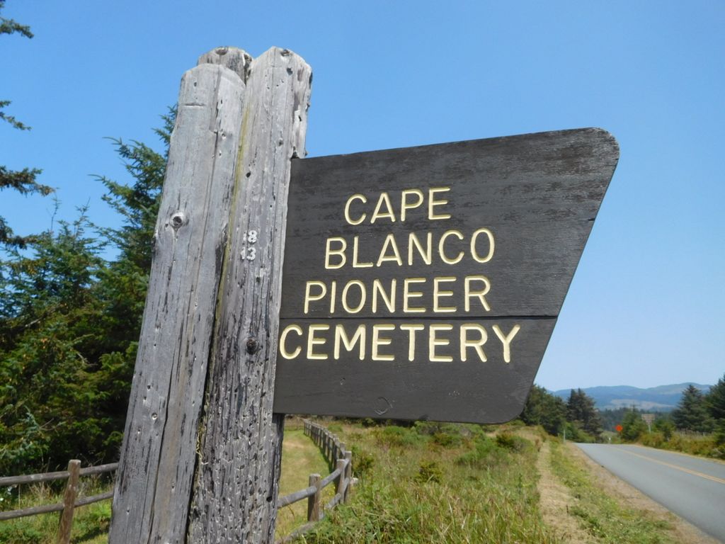
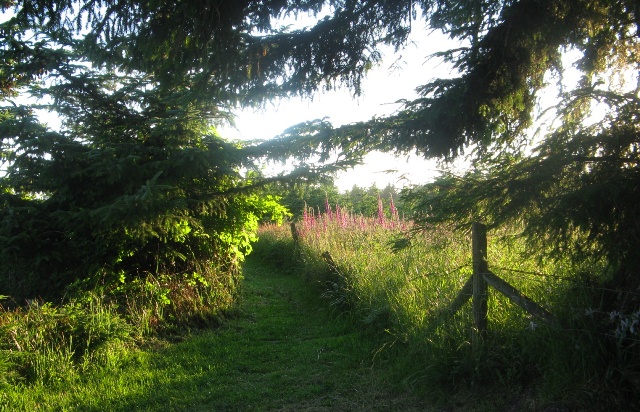
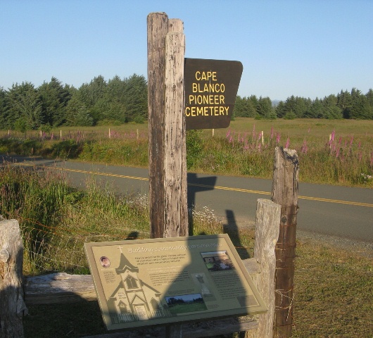
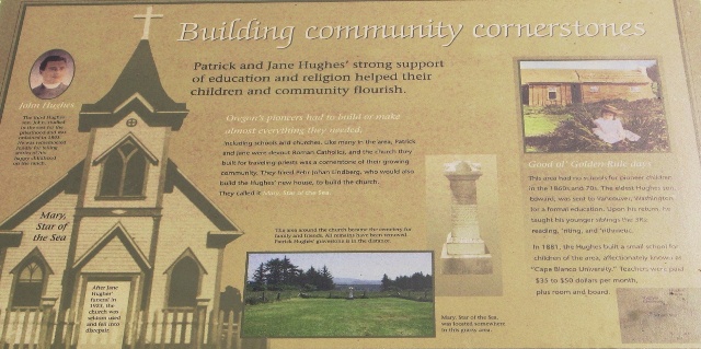
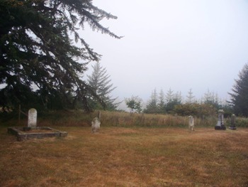
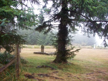
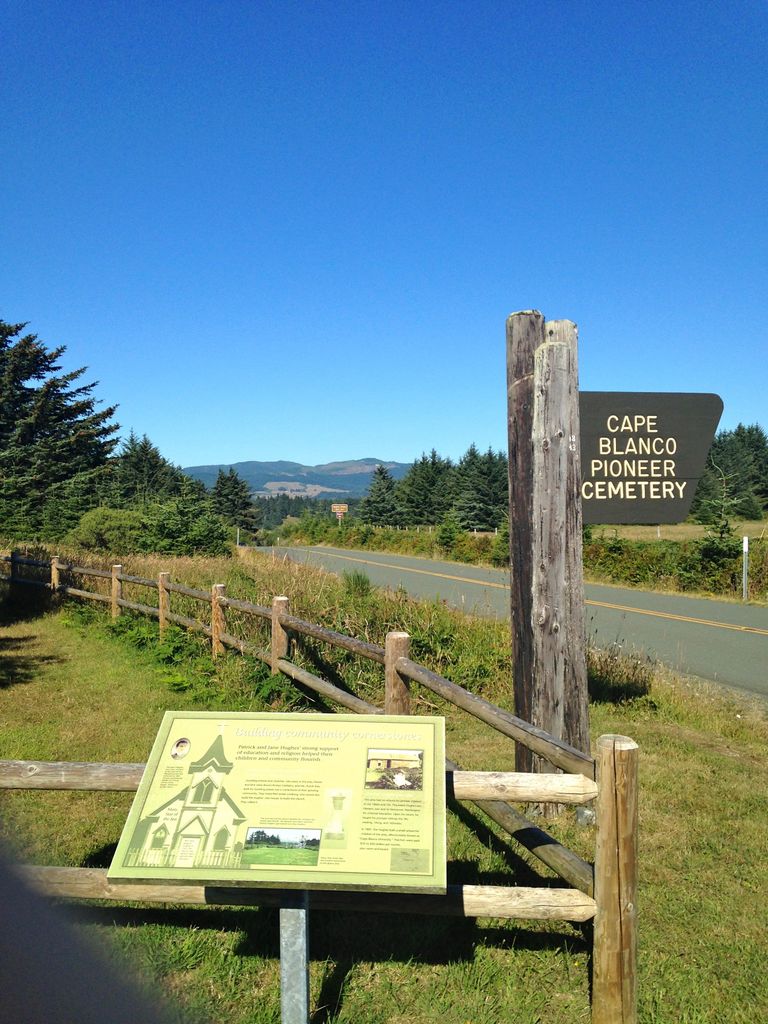
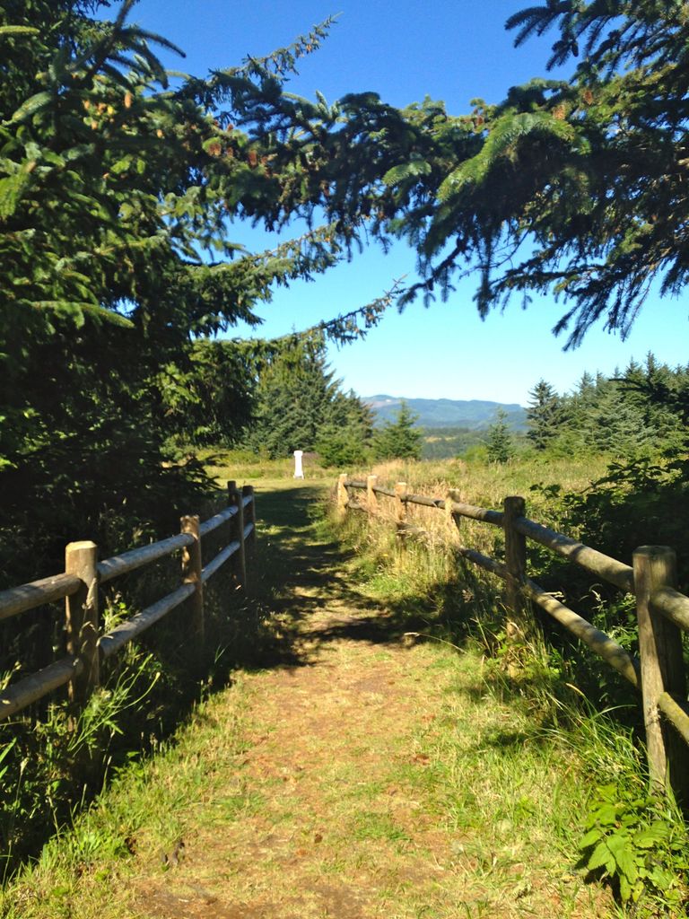
| Description | : | Cape Blanco Pioneer Cemetery, aka Hughes Family Cemetery, is located on a road into Cape Blanco State Park. The graveyard was built around the local church (Mary, Star of the Sea), and contained various members of the Hughes family and their mostly Irish immigrant neighbors. The church, now gone, was built by the first Hughes in the area, and is discussed in the interpretive sign here. Also nearby this site is the restored Victorian ranch house (open for tours) known as Hughes House, also built by the first Hughes here. The lighthouse (Cape Blanco Lighthouse) is very close by and... Read More |
frequently asked questions (FAQ):
-
Where is Cape Blanco Pioneer Cemetery?
Cape Blanco Pioneer Cemetery is located at Port Orford, Curry County ,Oregon ,USA.
-
Cape Blanco Pioneer Cemetery cemetery's updated grave count on graveviews.com?
0 memorials
-
Where are the coordinates of the Cape Blanco Pioneer Cemetery?
Latitude: 42.8422012
Longitude: -124.5413971


Nearby Cemetories:
1. Denmark Cemetery
Langlois, Curry County, USA
Coordinate: 42.8986015, -124.4677963
2. Tichenor Cemetery
Port Orford, Curry County, USA
Coordinate: 42.7444000, -124.5056000
3. Battle Rock Gravesites
Port Orford, Curry County, USA
Coordinate: 42.7424278, -124.4926071
4. Port Orford Cemetery
Port Orford, Curry County, USA
Coordinate: 42.7434350, -124.4825300
5. Ocean View Cemetery
Curry County, USA
Coordinate: 42.9486008, -124.3694000
6. West Grave
Langlois, Curry County, USA
Coordinate: 42.9109770, -124.3213170
7. Huckleberry Knoll Cemetery
Curry County, USA
Coordinate: 42.7785988, -124.2356033
8. Haines Cemetery
Eckley, Curry County, USA
Coordinate: 42.8417700, -124.1887100
9. Haines Cemetery
Curry County, USA
Coordinate: 42.8418999, -124.1875000
10. Gibbs Cemetery
Eckley, Curry County, USA
Coordinate: 42.8387200, -124.1845400
11. Catching Creek Cemetery
Coos County, USA
Coordinate: 43.0080986, -124.2130966
12. Grand Army of the Republic Cemetery
Bandon, Coos County, USA
Coordinate: 43.1191711, -124.4072189
13. Averill Pioneer Cemetery
Bandon, Coos County, USA
Coordinate: 43.1205720, -124.4052740
14. Holy Trinity Catholic Cemetery
Bandon, Coos County, USA
Coordinate: 43.1209360, -124.4050680
15. IOOF Cemetery
Bandon, Coos County, USA
Coordinate: 43.1190290, -124.3946220
16. Knights of Pythias Cemetery
Bandon, Coos County, USA
Coordinate: 43.1192017, -124.3893967
17. Fox Hill Cemetery
Curry County, USA
Coordinate: 42.5647011, -124.3861008
18. Bear Creek Cemetery
Coos County, USA
Coordinate: 43.1055984, -124.3319016
19. Dement Cemetery
Coos County, USA
Coordinate: 42.9832993, -124.1667023
20. Wise Cemetery
Coos County, USA
Coordinate: 42.9247017, -124.1164017
21. Warner Grave
Coos County, USA
Coordinate: 42.9333000, -124.1166992
22. Hermann Family Cemetery
Broadbent, Coos County, USA
Coordinate: 43.0046997, -124.1567001
23. Bullards Cemetery
Coos County, USA
Coordinate: 43.1549988, -124.3957977
24. Lampa Creek Cemetery
Coos County, USA
Coordinate: 43.1152992, -124.2861023