
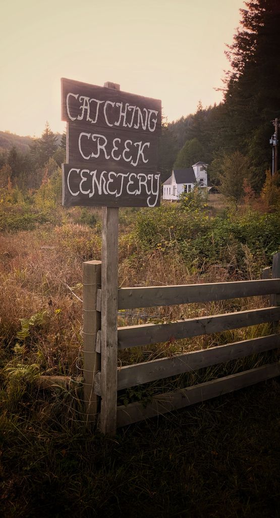
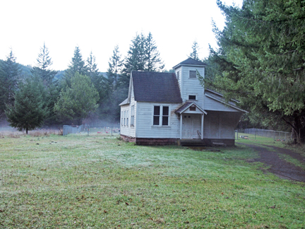
| Memorials | : | 2 |
| Location | : | Coos County, USA |
| Coordinate | : | 43.0080986, -124.2130966 |
| Description | : | 9 miles southwest of Myrtle Point on the Catching Creek Road |
frequently asked questions (FAQ):
-
Where is Catching Creek Cemetery?
Catching Creek Cemetery is located at Coos County ,Oregon ,USA.
-
Catching Creek Cemetery cemetery's updated grave count on graveviews.com?
2 memorials
-
Where are the coordinates of the Catching Creek Cemetery?
Latitude: 43.0080986
Longitude: -124.2130966


Nearby Cemetories:
1. Hermann Family Cemetery
Broadbent, Coos County, USA
Coordinate: 43.0046997, -124.1567001
2. Dement Cemetery
Coos County, USA
Coordinate: 42.9832993, -124.1667023
3. Whittington Cemetery
Myrtle Point, Coos County, USA
Coordinate: 43.0222783, -124.1486533
4. Miller Cemetery
Myrtle Point, Coos County, USA
Coordinate: 43.0104600, -124.1321500
5. Warner Cemetery
Coos County, USA
Coordinate: 43.0250015, -124.1280975
6. Smalley Cemetery
Myrtle Point, Coos County, USA
Coordinate: 43.0776900, -124.2176000
7. Hoffman Cemetery
Myrtle Point, Coos County, USA
Coordinate: 43.0402300, -124.1152400
8. Garrett Cemetery
Coos County, USA
Coordinate: 43.0405998, -124.1144028
9. Neal Cemetery
Gaylord, Coos County, USA
Coordinate: 42.9761009, -124.1138992
10. Rackleff Cemetery
Myrtle Point, Coos County, USA
Coordinate: 43.0808400, -124.1454200
11. Myrtle Point Cemetery
Myrtle Point, Coos County, USA
Coordinate: 43.0639000, -124.1196976
12. Brack Cemetery
Bridge, Coos County, USA
Coordinate: 43.0280991, -124.0877991
13. Breuer Cemetery
Coos County, USA
Coordinate: 43.0194016, -124.0792007
14. Upper Fish Trap Cemetery
Coos County, USA
Coordinate: 43.1074690, -124.2352010
15. Warner Grave
Coos County, USA
Coordinate: 42.9333000, -124.1166992
16. Norway Cemetery
Norway, Coos County, USA
Coordinate: 43.1035995, -124.1552963
17. Wise Cemetery
Coos County, USA
Coordinate: 42.9247017, -124.1164017
18. Robison-Lower Fishtrap Cemetery
Arago, Coos County, USA
Coordinate: 43.1232986, -124.2007980
19. Lampa Creek Cemetery
Coos County, USA
Coordinate: 43.1152992, -124.2861023
20. West Grave
Langlois, Curry County, USA
Coordinate: 42.9109770, -124.3213170
21. Ocean View Cemetery
Curry County, USA
Coordinate: 42.9486008, -124.3694000
22. Bear Creek Cemetery
Coos County, USA
Coordinate: 43.1055984, -124.3319016
23. Gravelford Pioneer Cemetery
Gravelford, Coos County, USA
Coordinate: 43.1087530, -124.0890310
24. Hansen-Culbertson Cemetery
Gravelford, Coos County, USA
Coordinate: 43.1105800, -124.0721900