
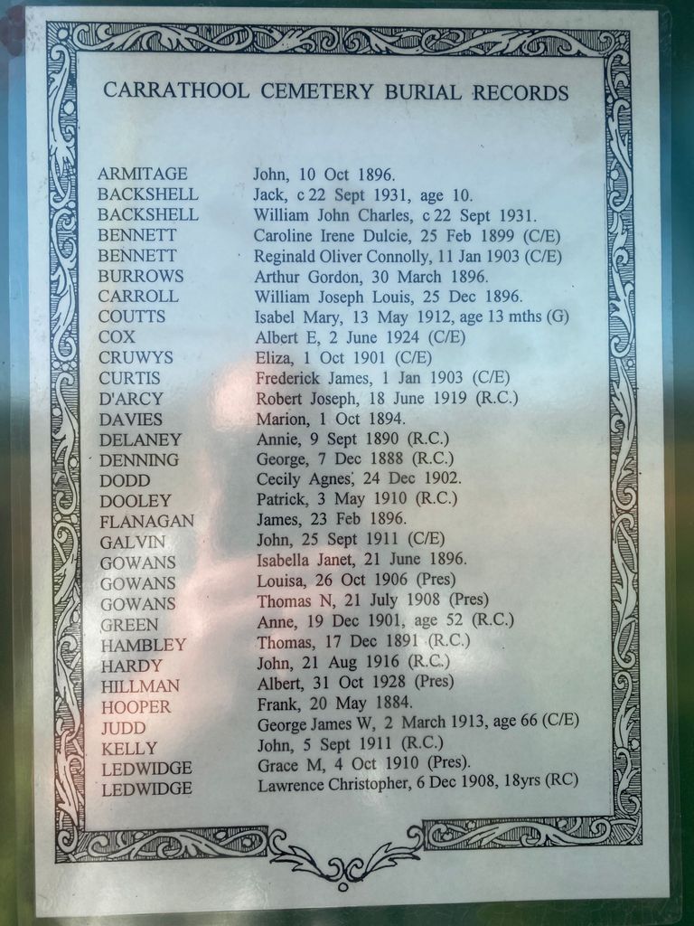
| Memorials | : | 65 |
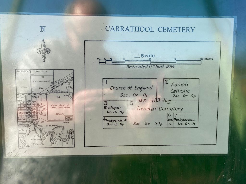
| Location | : | Carrathool, Carrathool Shire, Australia |
| Coordinate | : | -34.4451390, 145.4769990 |
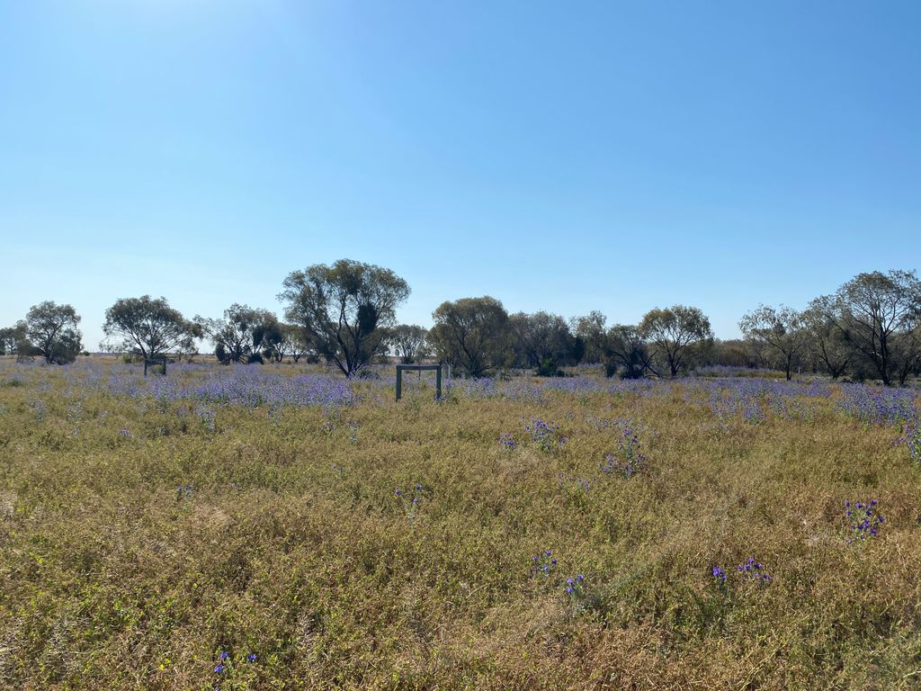
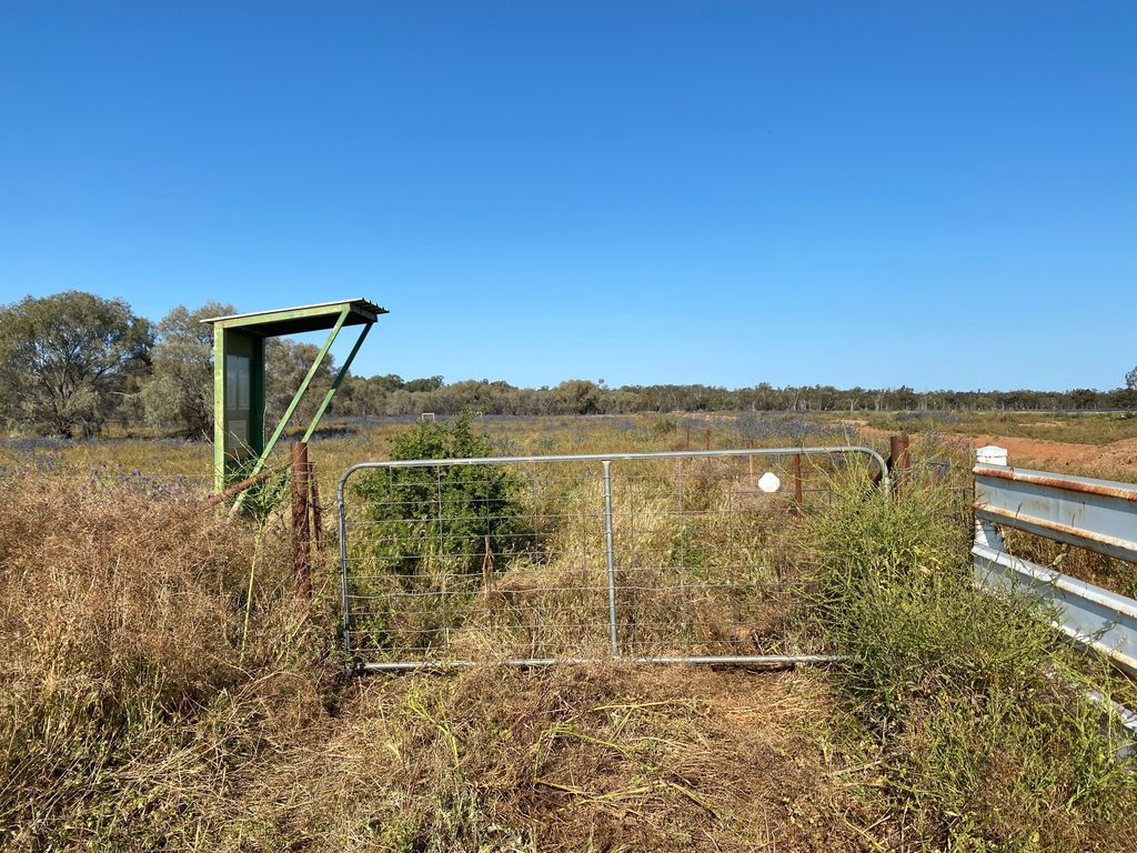
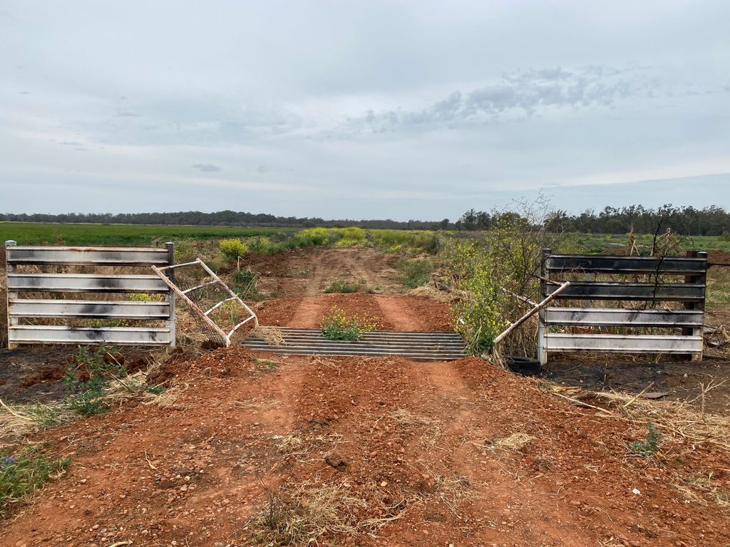
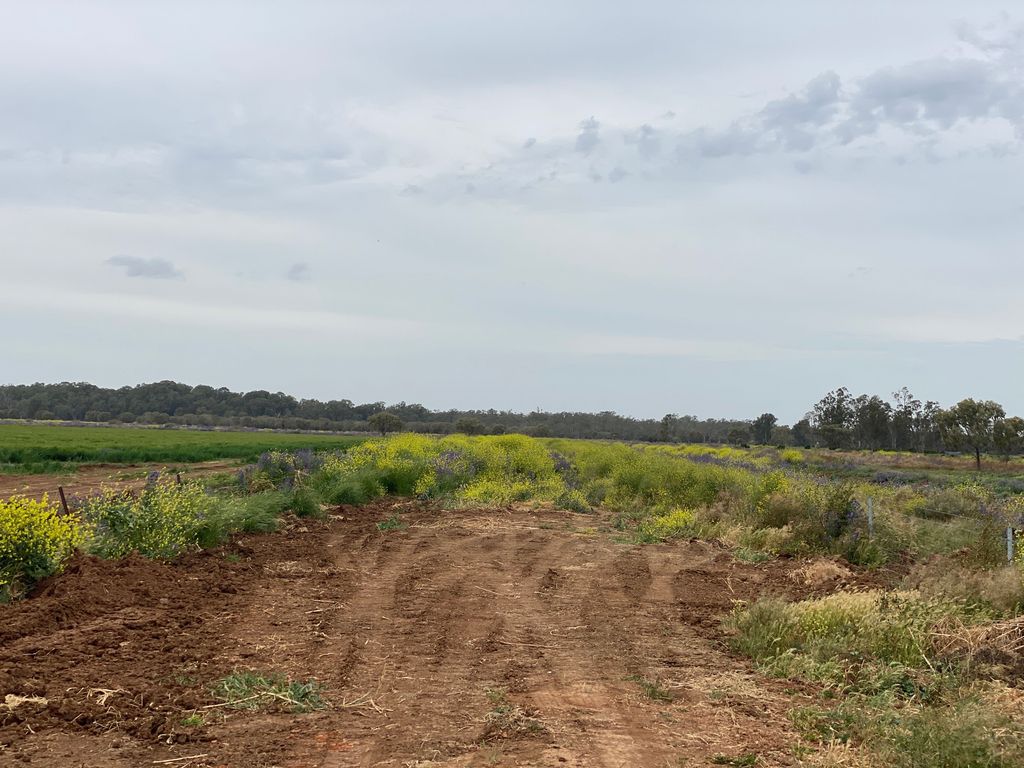
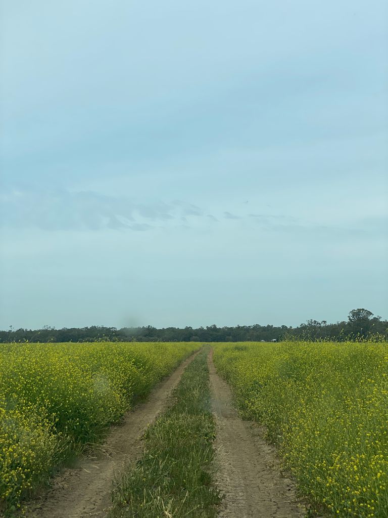
| Description | : | Road to cemetery is marked with a blue street sign saying "cemetery". Road is overgrown on both sides with weeds. After 600 m, road crosses a cattle grid and comes to an abrupt halt. The last 900 m metres of roadway to the cemetery (in September 2020) was not visible - completely covered by weeds. Uncertain of the condition of the cemetery itself. |
frequently asked questions (FAQ):
-
Where is Carrathool Cemetery?
Carrathool Cemetery is located at off Murrumbidgee River Road, Carrathool, New South Wales, Australia Carrathool, Carrathool Shire ,New South Wales , 2711Australia.
-
Carrathool Cemetery cemetery's updated grave count on graveviews.com?
65 memorials
-
Where are the coordinates of the Carrathool Cemetery?
Latitude: -34.4451390
Longitude: 145.4769990


Nearby Cemetories:
1. Rudds Point Station Cemetery
Carrathool Shire, Australia
Coordinate: -34.4682990, 145.4476200
2. Groongal Station
Carrathool, Carrathool Shire, Australia
Coordinate: -34.4397590, 145.5605470
3. Howlong Station Cemetery
Carrathool Shire, Australia
Coordinate: -34.4527050, 145.3780160
4. Uardry Station Cemetery
Carrathool Shire, Australia
Coordinate: -34.4646310, 145.3035570
5. Wyvern Station Cemetery
Carrathool Shire, Australia
Coordinate: -34.4631410, 145.6608490
6. Burrabogie Cemetery
Hay, Hay Shire, Australia
Coordinate: -34.5076000, 145.1901400
7. Benerembah Run Cemetery
Carrathool Shire, Australia
Coordinate: -34.5620060, 145.8464370
8. Gunbar Cemetery
Gunbar, Carrathool Shire, Australia
Coordinate: -34.0145240, 145.4078880
9. Sandy Valley Station Cemetery
Tabbita, Carrathool Shire, Australia
Coordinate: -34.1295560, 145.8606970
10. Darlington Point Cemetery
Darlington Point, Murrumbidgee Council, Australia
Coordinate: -34.5728920, 145.9977010
11. Warangesda Cemetery
Darlington Point, Murrumbidgee Council, Australia
Coordinate: -34.5860710, 146.0041480
12. Bagtown Cemetery
Hanwood, Griffith City, Australia
Coordinate: -34.3157900, 146.0471780
13. Goolgowi Cemetery
Goolgowi, Carrathool Shire, Australia
Coordinate: -33.9874263, 145.6984768
14. Coleambally Cemetery
Coleambally, Murrumbidgee Council, Australia
Coordinate: -34.8132800, 145.8762100
15. Hay General Cemetery
Hay, Hay Shire, Australia
Coordinate: -34.5135310, 144.8645800
16. Hay War Cemetery
Hay, Hay Shire, Australia
Coordinate: -34.5099144, 144.8611908
17. Griffith Cemetery
Griffith, Griffith City, Australia
Coordinate: -34.2860690, 146.0670780
18. Gunbar Station Cemetery
Gunbar, Carrathool Shire, Australia
Coordinate: -33.8812860, 145.3276280
19. Whitton Cemetery
Whitton, Leeton Shire, Australia
Coordinate: -34.4964100, 146.1814000
20. Merriwagga Cemetery
Merriwagga, Carrathool Shire, Australia
Coordinate: -33.8210900, 145.6078400
21. Yenda Cemetery
Yenda, Griffith City, Australia
Coordinate: -34.2395859, 146.2337537
22. Binya Cemetery
Binya, Narrandera Shire, Australia
Coordinate: -34.2062610, 146.3046460
23. Booligal Cemetery
Booligal, Hay Shire, Australia
Coordinate: -33.8320130, 144.9444820
24. Leeton Cemetery
Leeton, Leeton Shire, Australia
Coordinate: -34.5320150, 146.3980150