| Memorials | : | 0 |
| Location | : | Hay, Hay Shire, Australia |
| Coordinate | : | -34.5099144, 144.8611908 |
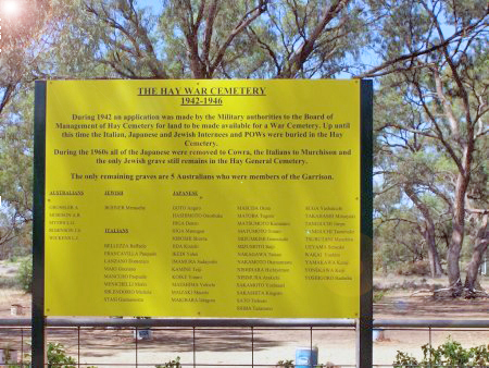
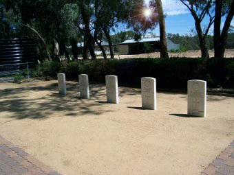
| Description | : | Hay War Cemetery is located in Wharf Street, Hay. From 1940 to 1946, Hay was the temporary residence for the 16th Garrison Battalion, AIF. They guarding almost 4,000 POWs and civilian detainees in three separate camps. Hay's isolated possision from the coast and major cities made it an ideal location. There are 5 graves of the 16th Garrison in the cemetery and there are also six war dead commemorated within the general cemetery. |
frequently asked questions (FAQ):
-
Where is Hay War Cemetery?
Hay War Cemetery is located at Hay, Hay Shire ,New South Wales ,Australia.
-
Hay War Cemetery cemetery's updated grave count on graveviews.com?
0 memorials
-
Where are the coordinates of the Hay War Cemetery?
Latitude: -34.5099144
Longitude: 144.8611908
Nearby Cemetories:
1. Hay General Cemetery
Hay, Hay Shire, Australia
Coordinate: -34.5135310, 144.8645800
2. Burrabogie Cemetery
Hay, Hay Shire, Australia
Coordinate: -34.5076000, 145.1901400
3. Uardry Station Cemetery
Carrathool Shire, Australia
Coordinate: -34.4646310, 145.3035570
4. Howlong Station Cemetery
Carrathool Shire, Australia
Coordinate: -34.4527050, 145.3780160
5. Maude Cemetery
Maude, Hay Shire, Australia
Coordinate: -34.4614820, 144.2908900
6. Rudds Point Station Cemetery
Carrathool Shire, Australia
Coordinate: -34.4682990, 145.4476200
7. Carrathool Cemetery
Carrathool, Carrathool Shire, Australia
Coordinate: -34.4451390, 145.4769990
8. Groongal Station
Carrathool, Carrathool Shire, Australia
Coordinate: -34.4397590, 145.5605470
9. Wyvern Station Cemetery
Carrathool Shire, Australia
Coordinate: -34.4631410, 145.6608490
10. Gunbar Cemetery
Gunbar, Carrathool Shire, Australia
Coordinate: -34.0145240, 145.4078880
11. Booligal Cemetery
Booligal, Hay Shire, Australia
Coordinate: -33.8320130, 144.9444820
12. Wanganella Pioneer Cemetery
Wanganella, Edward River Council, Australia
Coordinate: -35.2057090, 144.8005240
13. Gunbar Station Cemetery
Gunbar, Carrathool Shire, Australia
Coordinate: -33.8812860, 145.3276280
14. Benerembah Run Cemetery
Carrathool Shire, Australia
Coordinate: -34.5620060, 145.8464370
15. Goolgowi Cemetery
Goolgowi, Carrathool Shire, Australia
Coordinate: -33.9874263, 145.6984768
16. Moulamein Cemetery
Moulamein, Murray River Council, Australia
Coordinate: -35.0820470, 144.0542790
17. Coleambally Cemetery
Coleambally, Murrumbidgee Council, Australia
Coordinate: -34.8132800, 145.8762100
18. Moonahcullah Cemetery
Morago, Edward River Council, Australia
Coordinate: -35.3844590, 144.6458640
19. Sandy Valley Station Cemetery
Tabbita, Carrathool Shire, Australia
Coordinate: -34.1295560, 145.8606970
20. Merriwagga Cemetery
Merriwagga, Carrathool Shire, Australia
Coordinate: -33.8210900, 145.6078400
21. Duryea Family Cemetery
Balranald Shire, Australia
Coordinate: -34.1955342, 143.7919154
22. Darlington Point Cemetery
Darlington Point, Murrumbidgee Council, Australia
Coordinate: -34.5728920, 145.9977010
23. Warangesda Cemetery
Darlington Point, Murrumbidgee Council, Australia
Coordinate: -34.5860710, 146.0041480
24. Bagtown Cemetery
Hanwood, Griffith City, Australia
Coordinate: -34.3157900, 146.0471780


