
| Memorials | : | 136 |
| Location | : | Gunbar, Carrathool Shire, Australia |
| Coordinate | : | -34.0145240, 145.4078880 |
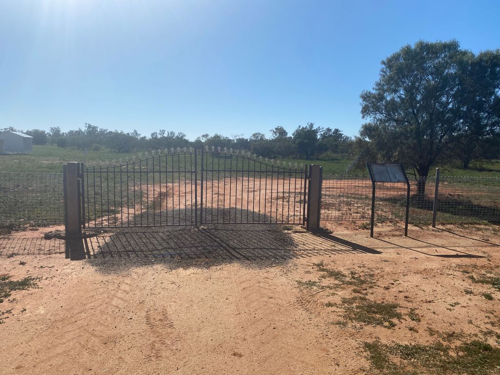
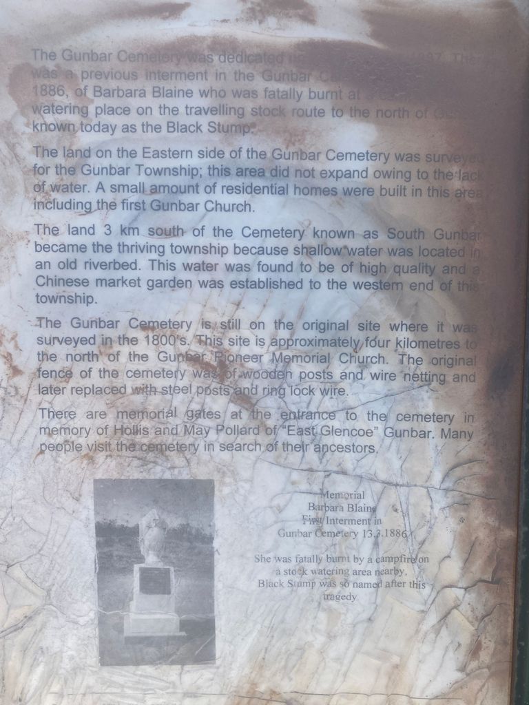
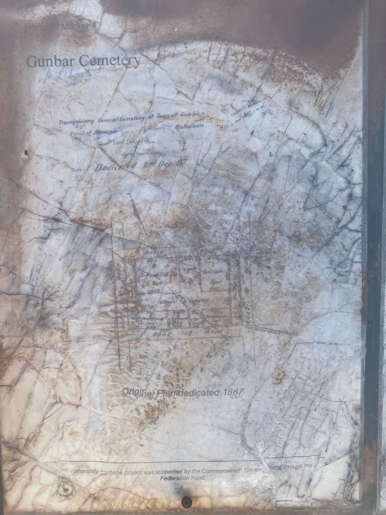
| Description | : | Gunbar cemetery was dedicated on (unreadable) 1887. There was a previous interment in the Gunbar Cemetery (unreadable) 1886, of Barbara Blaine who was fatally burnt at a (unreadable) watering place on the travelling stock route to the north of Gunbar, known today as the black stump. The land on the eastern side of the Gunbar Cemetery was surveyed for the Gunbar Township; this area did not expand owing to the lack of water. A small amount of residential homes were built in this area including the first Gunbar Church. The land 3 km south of the Cemetery known as South Gunbar became... Read More |
frequently asked questions (FAQ):
-
Where is Gunbar Cemetery?
Gunbar Cemetery is located at Gunbar Rd Gunbar, Carrathool Shire ,New South Wales , 2711Australia.
-
Gunbar Cemetery cemetery's updated grave count on graveviews.com?
136 memorials
-
Where are the coordinates of the Gunbar Cemetery?
Latitude: -34.0145240
Longitude: 145.4078880
Nearby Cemetories:
1. Gunbar Station Cemetery
Gunbar, Carrathool Shire, Australia
Coordinate: -33.8812860, 145.3276280
2. Goolgowi Cemetery
Goolgowi, Carrathool Shire, Australia
Coordinate: -33.9874263, 145.6984768
3. Merriwagga Cemetery
Merriwagga, Carrathool Shire, Australia
Coordinate: -33.8210900, 145.6078400
4. Sandy Valley Station Cemetery
Tabbita, Carrathool Shire, Australia
Coordinate: -34.1295560, 145.8606970
5. Booligal Cemetery
Booligal, Hay Shire, Australia
Coordinate: -33.8320130, 144.9444820
6. Carrathool Cemetery
Carrathool, Carrathool Shire, Australia
Coordinate: -34.4451390, 145.4769990
7. Howlong Station Cemetery
Carrathool Shire, Australia
Coordinate: -34.4527050, 145.3780160
8. Groongal Station
Carrathool, Carrathool Shire, Australia
Coordinate: -34.4397590, 145.5605470
9. Rudds Point Station Cemetery
Carrathool Shire, Australia
Coordinate: -34.4682990, 145.4476200
10. Uardry Station Cemetery
Carrathool Shire, Australia
Coordinate: -34.4646310, 145.3035570
11. Marfield Private
Hillston, Carrathool Shire, Australia
Coordinate: -33.5888420, 145.7117270
12. Wyvern Station Cemetery
Carrathool Shire, Australia
Coordinate: -34.4631410, 145.6608490
13. Burrabogie Cemetery
Hay, Hay Shire, Australia
Coordinate: -34.5076000, 145.1901400
14. Bagtown Cemetery
Hanwood, Griffith City, Australia
Coordinate: -34.3157900, 146.0471780
15. Griffith Cemetery
Griffith, Griffith City, Australia
Coordinate: -34.2860690, 146.0670780
16. Benerembah Run Cemetery
Carrathool Shire, Australia
Coordinate: -34.5620060, 145.8464370
17. Hay War Cemetery
Hay, Hay Shire, Australia
Coordinate: -34.5099144, 144.8611908
18. Hay General Cemetery
Hay, Hay Shire, Australia
Coordinate: -34.5135310, 144.8645800
19. Yenda Cemetery
Yenda, Griffith City, Australia
Coordinate: -34.2395859, 146.2337537
20. Darlington Point Cemetery
Darlington Point, Murrumbidgee Council, Australia
Coordinate: -34.5728920, 145.9977010
21. Warangesda Cemetery
Darlington Point, Murrumbidgee Council, Australia
Coordinate: -34.5860710, 146.0041480
22. Rankins Springs Cemetery
Rankins Springs, Carrathool Shire, Australia
Coordinate: -33.8255770, 146.2911550
23. Binya Cemetery
Binya, Narrandera Shire, Australia
Coordinate: -34.2062610, 146.3046460
24. Whitton Cemetery
Whitton, Leeton Shire, Australia
Coordinate: -34.4964100, 146.1814000