
| Memorials | : | 82 |
| Location | : | Greenwood County, USA |
| Phone | : | (706) 283-7238 |
| Coordinate | : | 34.0792400, -82.3025300 |
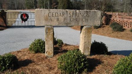
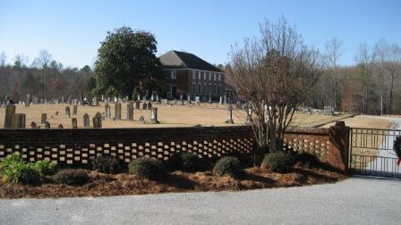
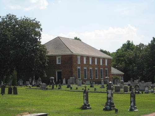
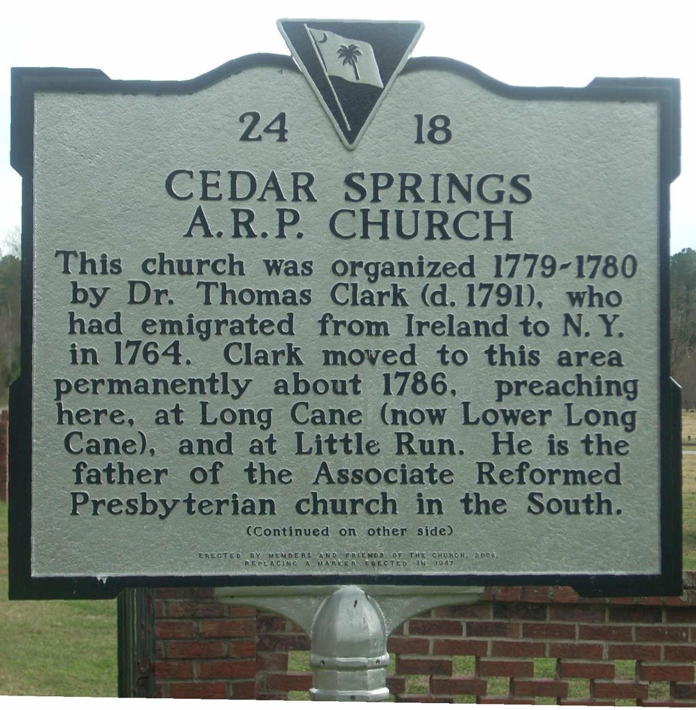
| Description | : | Historical Marker: [Front]: This church was organized 1779-1780 by Dr. Thomas Clark (d. 1791), who had emigrated from Ireland to N.Y. in 1764. Clark moved to this area permanently about 1786, preaching here, at Long Cane (now Lower Long Cane), and at Little Run. He is the father of the Associate Reformed Presbyterian church in the South. [Reverse]: The first church, then called Cedar Creek, was a log building 2 mi. SE. The congregation was renamed Cedar Springs in 1790. It moved here and built a frame church in 1791. The cemetery includes graves of several ministers, including Thomas Clark, and many early... Read More |
frequently asked questions (FAQ):
-
Where is Cedar Springs A.R.P. Church Cemetery?
Cedar Springs A.R.P. Church Cemetery is located at 2164 Cedar Springs Rd Greenwood County ,South Carolina , 29819USA.
-
Cedar Springs A.R.P. Church Cemetery cemetery's updated grave count on graveviews.com?
59 memorials
-
Where are the coordinates of the Cedar Springs A.R.P. Church Cemetery?
Latitude: 34.0792400
Longitude: -82.3025300


Nearby Cemetories:
1. Lyon-Lipford Cemetery
Bradley, Greenwood County, USA
Coordinate: 34.0889550, -82.2760960
2. Poplar Grove Baptist Church Cemetery
Abbeville County, USA
Coordinate: 34.0882100, -82.3312400
3. Creswell Family Cemetery
Greenwood County, USA
Coordinate: 34.0484220, -82.2869750
4. Campbell Cemetery
Troy, Greenwood County, USA
Coordinate: 34.0388720, -82.2995700
5. Lower Long Cane Cemetery
Abbeville, Abbeville County, USA
Coordinate: 34.1225000, -82.3207700
6. Millway Baptist Church Cemetery
Troy, Greenwood County, USA
Coordinate: 34.0310160, -82.2943070
7. Tittle Cemetery
Bradley Corner, McCormick County, USA
Coordinate: 34.0325400, -82.3258800
8. Cedar Grove Cemetery
Greenwood County, USA
Coordinate: 34.0555992, -82.2450027
9. Douglass Family Cemetery
Bradley, Greenwood County, USA
Coordinate: 34.0643200, -82.2375870
10. Mount Pleasant Cemetery
Greenwood County, USA
Coordinate: 34.0331001, -82.2611008
11. Chapel Cemetery
McCormick County, USA
Coordinate: 34.0388985, -82.3569031
12. Little Mountain African Methodist Episcopal Church
Abbeville, Abbeville County, USA
Coordinate: 34.0842820, -82.3758020
13. Mount Sinai Cemetery
Greenwood County, USA
Coordinate: 34.0224991, -82.2733002
14. Bethia Cemetery
Clatworthy Crossroads, Abbeville County, USA
Coordinate: 34.0617810, -82.3759150
15. Horeb Baptist Church Cemetery
Troy, Greenwood County, USA
Coordinate: 34.0217070, -82.2660290
16. Saint Mary A. M. E. Cemetery
Mount Carmel, McCormick County, USA
Coordinate: 34.0229400, -82.3424970
17. Glover Chapel Baptist Church Cemetery
McCormick County, USA
Coordinate: 34.0356080, -82.3615130
18. Chiles Family Cemetery
Bradley, Greenwood County, USA
Coordinate: 34.0430430, -82.2354500
19. Mount Sinai AME Church Cemetery
Troy, Greenwood County, USA
Coordinate: 34.0182430, -82.2654430
20. Lites Family Cemetery
Abbeville, Abbeville County, USA
Coordinate: 34.1446991, -82.2724991
21. Smyrna Presbyterian Church Cemetery
Promised Land, Greenwood County, USA
Coordinate: 34.1228440, -82.2339810
22. Mount Zion AME Church Cemetery
Promised Land, Greenwood County, USA
Coordinate: 34.1321430, -82.2428690
23. Crossroads Cemetery
Greenwood County, USA
Coordinate: 34.1258011, -82.2356033
24. Lower Long Cane Cemetery
McCormick County, USA
Coordinate: 34.0158005, -82.3491974