
| Memorials | : | 8 |
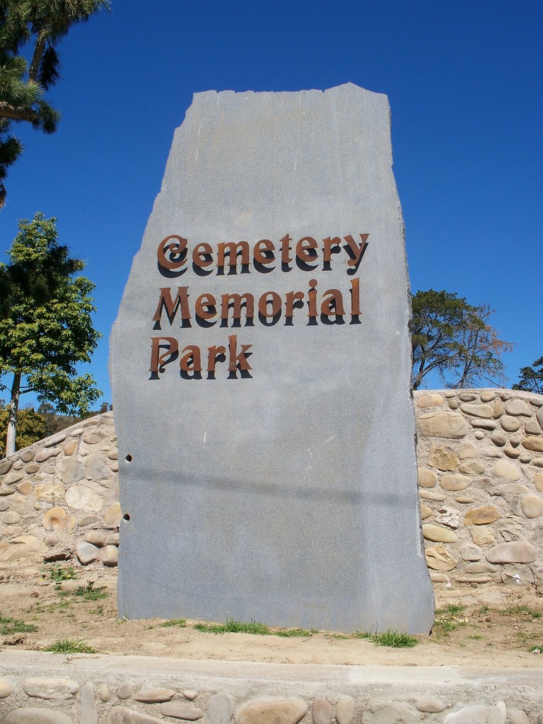
| Location | : | Ventura, Ventura County, USA |
| Website | : | restorestmarys.org/index.htm |
| Coordinate | : | 34.2811900, -119.2800700 |
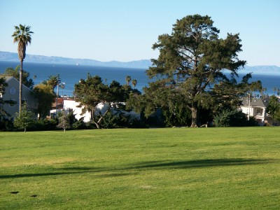
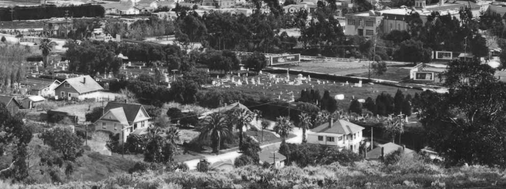
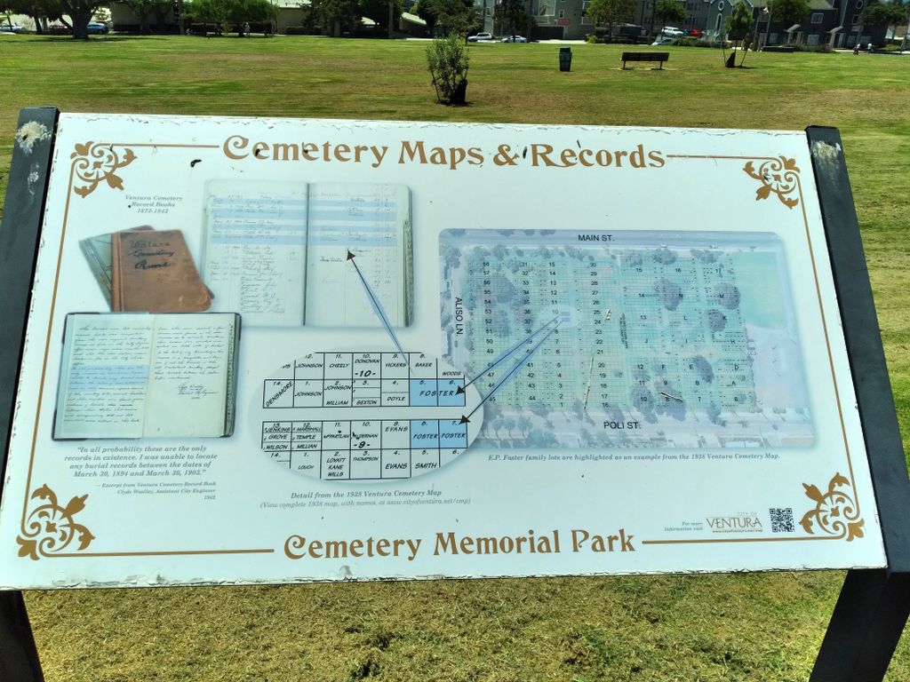
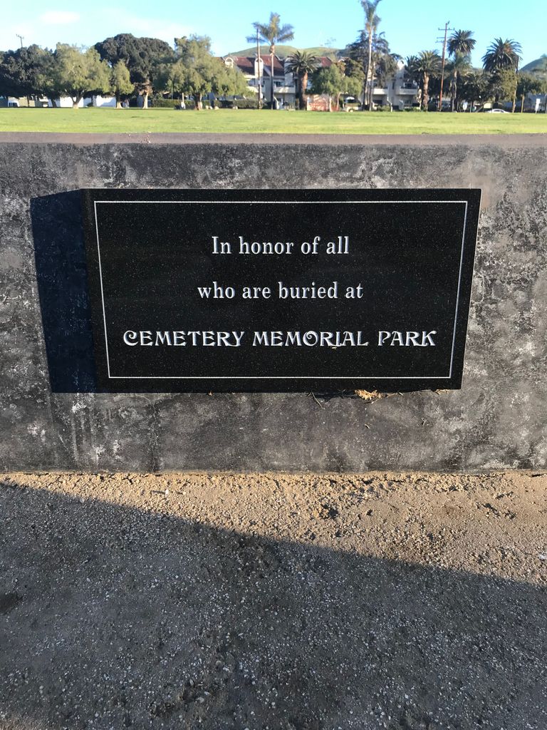
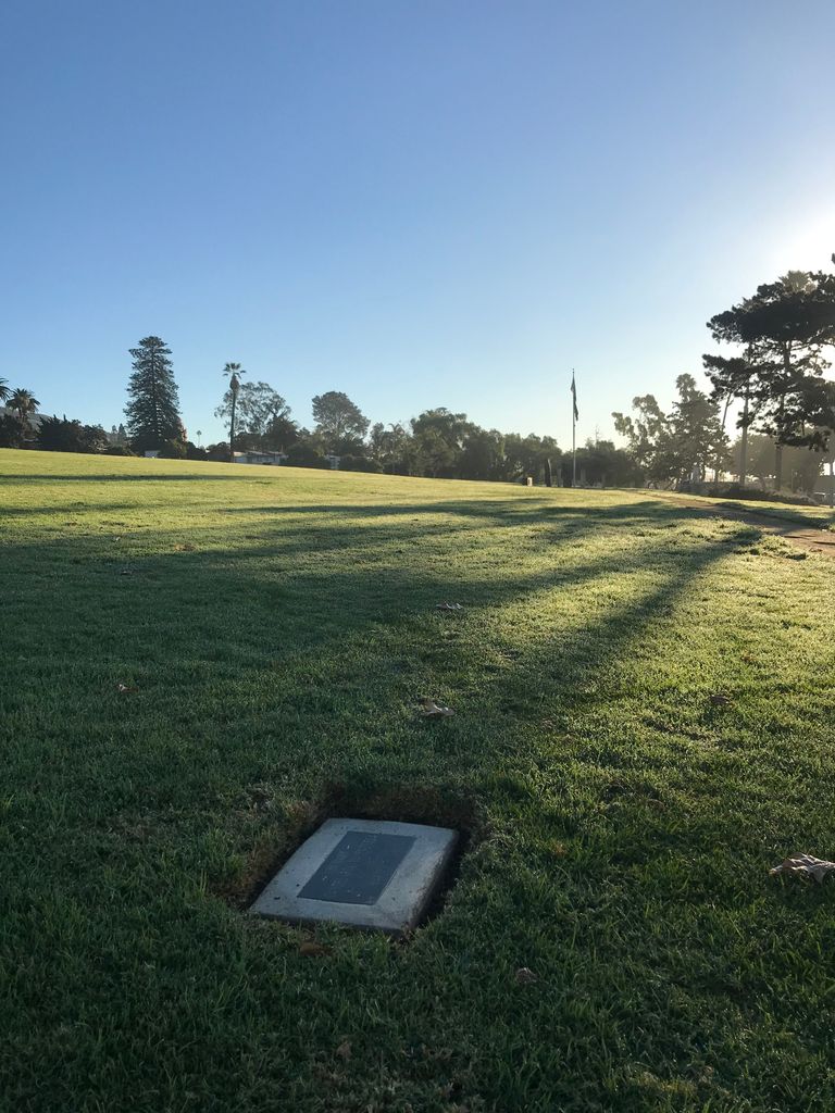
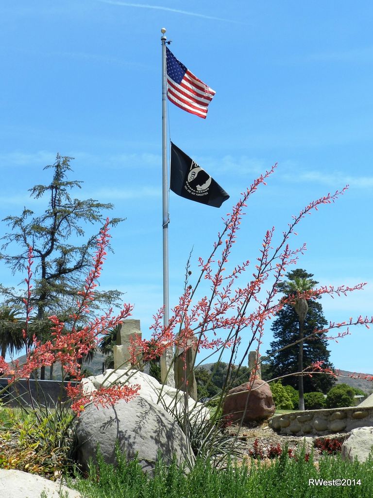
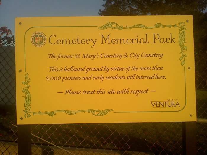
| Description | : | This cemetery was converted to a park in the 1960's, and no headstones remain. There have been no interments in this cemetery since 1943. Saint Mary's Cemetery on Poli Street in San Buenaventura is the resting place of 3000 Ventura County Pioneers. Their markers were removed by the City in 1964. Along with the names of the pioneers, the name of the cemetery was nearly forgotten. The future of Saint Mary's Cemetery is again at stake. The embarrassing mistake of 1964 was made, but now it is our opportunity to correct that wrong. We need to see that the mistake is... Read More |
frequently asked questions (FAQ):
-
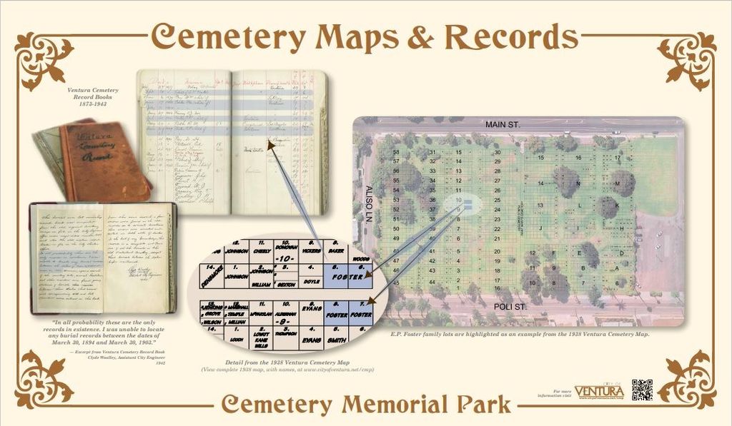
Where is Cemetery Memorial Park?
Cemetery Memorial Park is located at Poli Street Ventura, Ventura County ,California ,USA.
-
Cemetery Memorial Park cemetery's updated grave count on graveviews.com?
8 memorials
-
Where are the coordinates of the Cemetery Memorial Park?
Latitude: 34.2811900
Longitude: -119.2800700
Nearby Cemetories:
1. First United Methodist Church Ventura Columbarium
Ventura, Ventura County, USA
Coordinate: 34.2793589, -119.2819936
2. Mission San Buenaventura Cemetery
Ventura, Ventura County, USA
Coordinate: 34.2811890, -119.2982090
3. Saint Pauls Episcopal Church Memorial Garden
Ventura, Ventura County, USA
Coordinate: 34.2759070, -119.2522820
4. Trinity Lutheran Church Columbarium
Ventura, Ventura County, USA
Coordinate: 34.2772220, -119.2394440
5. Ivy Lawn Memorial Park
Ventura, Ventura County, USA
Coordinate: 34.2518997, -119.2153015
6. Santa Clara Cemetery
Oxnard, Ventura County, USA
Coordinate: 34.2305984, -119.1821976
7. In The Shadow Of The Cross Memorial Garden
Oxnard, Ventura County, USA
Coordinate: 34.2158818, -119.1807445
8. Saint Paul United Methodist Church Memorial Garden
Oxnard, Ventura County, USA
Coordinate: 34.1815060, -119.1806660
9. Bard Memorial
Port Hueneme, Ventura County, USA
Coordinate: 34.1565180, -119.1955080
10. Saint Thomas Aquinas Cemetery
Ojai, Ventura County, USA
Coordinate: 34.4301250, -119.2650250
11. Japanese Cemetery
Port Hueneme, Ventura County, USA
Coordinate: 34.1618996, -119.1496964
12. Masonic Cemetery
Port Hueneme, Ventura County, USA
Coordinate: 34.1622009, -119.1477966
13. Ojai United Methodist Memorial Garden
Ojai, Ventura County, USA
Coordinate: 34.4437040, -119.2665540
14. Nordhoff Cemetery
Ojai, Ventura County, USA
Coordinate: 34.4446600, -119.2604400
15. Saint Andrews Episcopal Church Columbarium
Ojai, Ventura County, USA
Coordinate: 34.4454300, -119.2513700
16. Ojai Presbyterian Church Columbarium
Ojai, Ventura County, USA
Coordinate: 34.4494250, -119.2530420
17. Pierce Brothers Santa Paula Cemetery
Santa Paula, Ventura County, USA
Coordinate: 34.3535995, -119.0785980
18. Saint Columbas Episcopal Church Columbarium
Camarillo, Ventura County, USA
Coordinate: 34.2331850, -119.0554690
19. Ferrer Family Ranch Grounds
Carpinteria, Santa Barbara County, USA
Coordinate: 34.3821940, -119.4812560
20. Richardson Family Cemetery
Santa Paula, Ventura County, USA
Coordinate: 34.3437350, -119.0463940
21. Pleasant Valley Cemetery
Camarillo, Ventura County, USA
Coordinate: 34.2158480, -119.0373060
22. Camarillo Family Mausoleum
Camarillo, Ventura County, USA
Coordinate: 34.2151690, -119.0361310
23. Conejo Mountain Memorial Park
Camarillo, Ventura County, USA
Coordinate: 34.1805970, -119.0034930
24. Carpinteria Cemetery
Carpinteria, Santa Barbara County, USA
Coordinate: 34.4118996, -119.5385971