
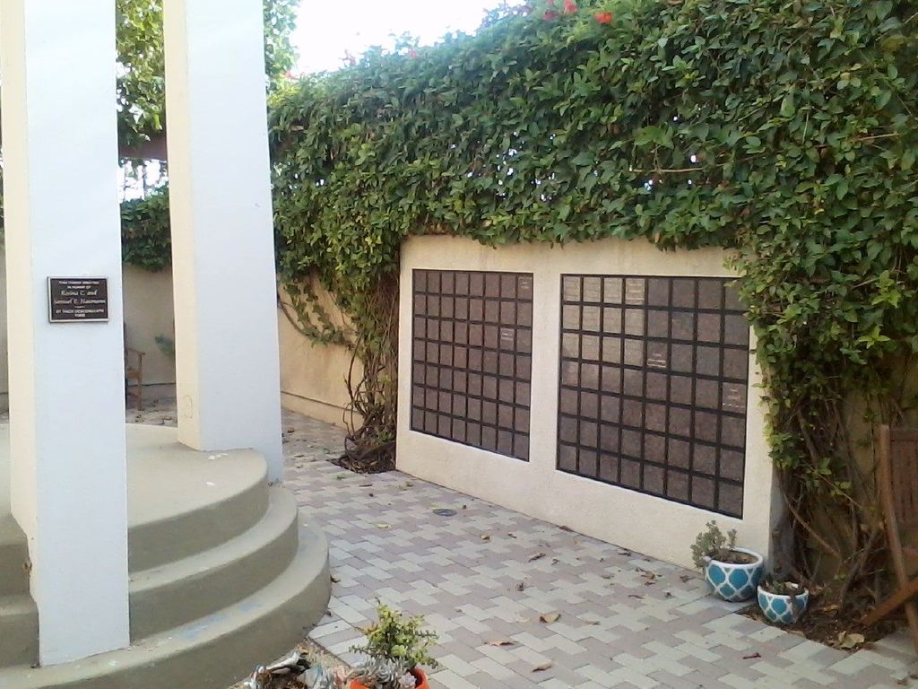
| Memorials | : | 2 |
| Location | : | Oxnard, Ventura County, USA |
| Phone | : | (805) 983-2171 |
| Website | : | stjohnsoxnard.com |
| Coordinate | : | 34.2158818, -119.1807445 |
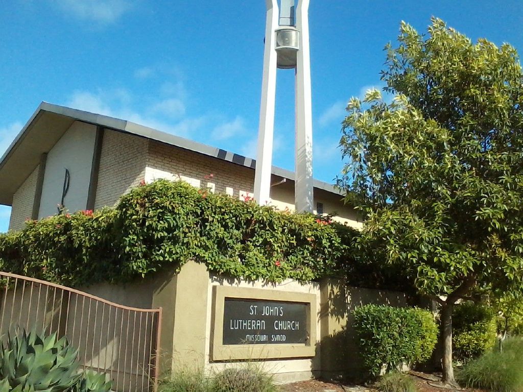
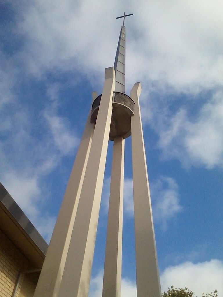
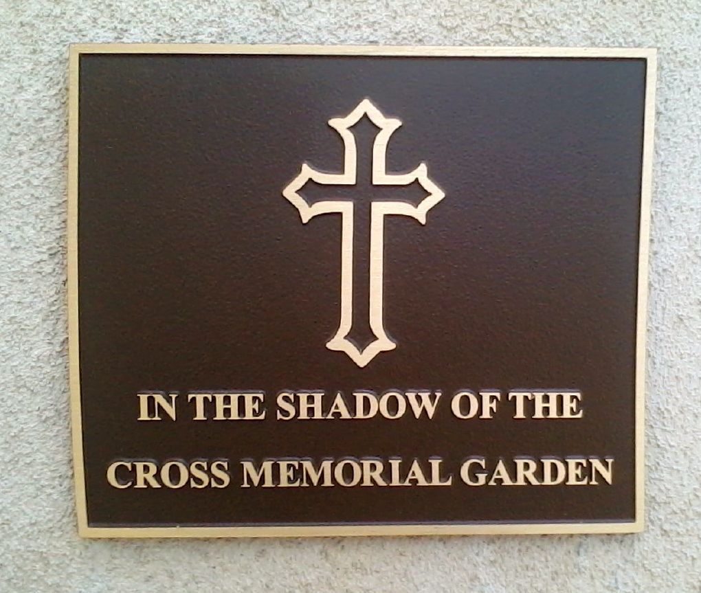
| Description | : | Memorial garden and columbarium on campus of St. John's Lutheran Church |
frequently asked questions (FAQ):
-
Where is In The Shadow Of The Cross Memorial Garden?
In The Shadow Of The Cross Memorial Garden is located at 1500 North C St Oxnard, Ventura County ,California , 93030USA.
-
In The Shadow Of The Cross Memorial Garden cemetery's updated grave count on graveviews.com?
2 memorials
-
Where are the coordinates of the In The Shadow Of The Cross Memorial Garden?
Latitude: 34.2158818
Longitude: -119.1807445
Nearby Cemetories:
1. Santa Clara Cemetery
Oxnard, Ventura County, USA
Coordinate: 34.2305984, -119.1821976
2. Saint Paul United Methodist Church Memorial Garden
Oxnard, Ventura County, USA
Coordinate: 34.1815060, -119.1806660
3. Ivy Lawn Memorial Park
Ventura, Ventura County, USA
Coordinate: 34.2518997, -119.2153015
4. Japanese Cemetery
Port Hueneme, Ventura County, USA
Coordinate: 34.1618996, -119.1496964
5. Masonic Cemetery
Port Hueneme, Ventura County, USA
Coordinate: 34.1622009, -119.1477966
6. Bard Memorial
Port Hueneme, Ventura County, USA
Coordinate: 34.1565180, -119.1955080
7. Trinity Lutheran Church Columbarium
Ventura, Ventura County, USA
Coordinate: 34.2772220, -119.2394440
8. Saint Pauls Episcopal Church Memorial Garden
Ventura, Ventura County, USA
Coordinate: 34.2759070, -119.2522820
9. Cemetery Memorial Park
Ventura, Ventura County, USA
Coordinate: 34.2811900, -119.2800700
10. Saint Columbas Episcopal Church Columbarium
Camarillo, Ventura County, USA
Coordinate: 34.2331850, -119.0554690
11. First United Methodist Church Ventura Columbarium
Ventura, Ventura County, USA
Coordinate: 34.2793589, -119.2819936
12. Mission San Buenaventura Cemetery
Ventura, Ventura County, USA
Coordinate: 34.2811890, -119.2982090
13. Pleasant Valley Cemetery
Camarillo, Ventura County, USA
Coordinate: 34.2158480, -119.0373060
14. Camarillo Family Mausoleum
Camarillo, Ventura County, USA
Coordinate: 34.2151690, -119.0361310
15. Conejo Mountain Memorial Park
Camarillo, Ventura County, USA
Coordinate: 34.1805970, -119.0034930
16. Pierce Brothers Santa Paula Cemetery
Santa Paula, Ventura County, USA
Coordinate: 34.3535995, -119.0785980
17. Richardson Family Cemetery
Santa Paula, Ventura County, USA
Coordinate: 34.3437350, -119.0463940
18. Saint Thomas Aquinas Cemetery
Ojai, Ventura County, USA
Coordinate: 34.4301250, -119.2650250
19. Saint Andrews Episcopal Church Columbarium
Ojai, Ventura County, USA
Coordinate: 34.4454300, -119.2513700
20. Nordhoff Cemetery
Ojai, Ventura County, USA
Coordinate: 34.4446600, -119.2604400
21. Ojai United Methodist Memorial Garden
Ojai, Ventura County, USA
Coordinate: 34.4437040, -119.2665540
22. Ojai Presbyterian Church Columbarium
Ojai, Ventura County, USA
Coordinate: 34.4494250, -119.2530420
23. Bardsdale Cemetery
Fillmore, Ventura County, USA
Coordinate: 34.3610992, -118.9403000
24. Olson Family Cemetery
Ventura County, USA
Coordinate: 34.2263300, -118.8688700