
| Memorials | : | 0 |
| Location | : | Jackson, Madison County, USA |
| Coordinate | : | 35.6584250, -88.6898400 |
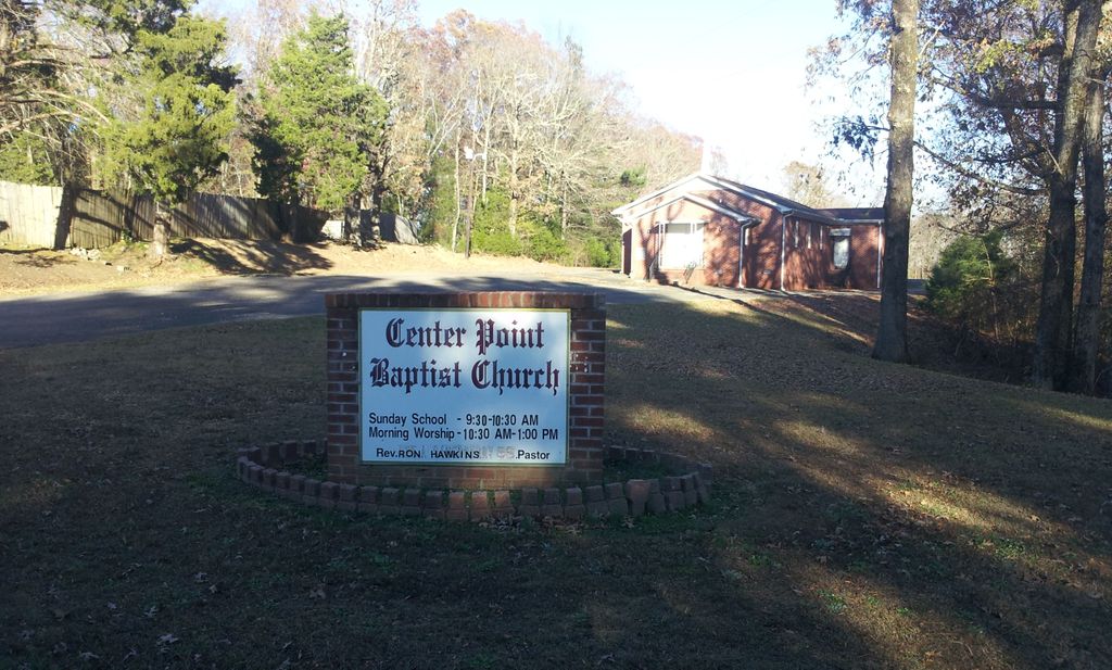
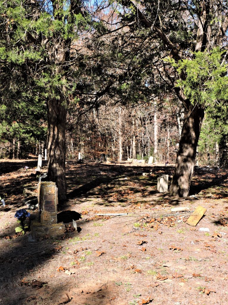
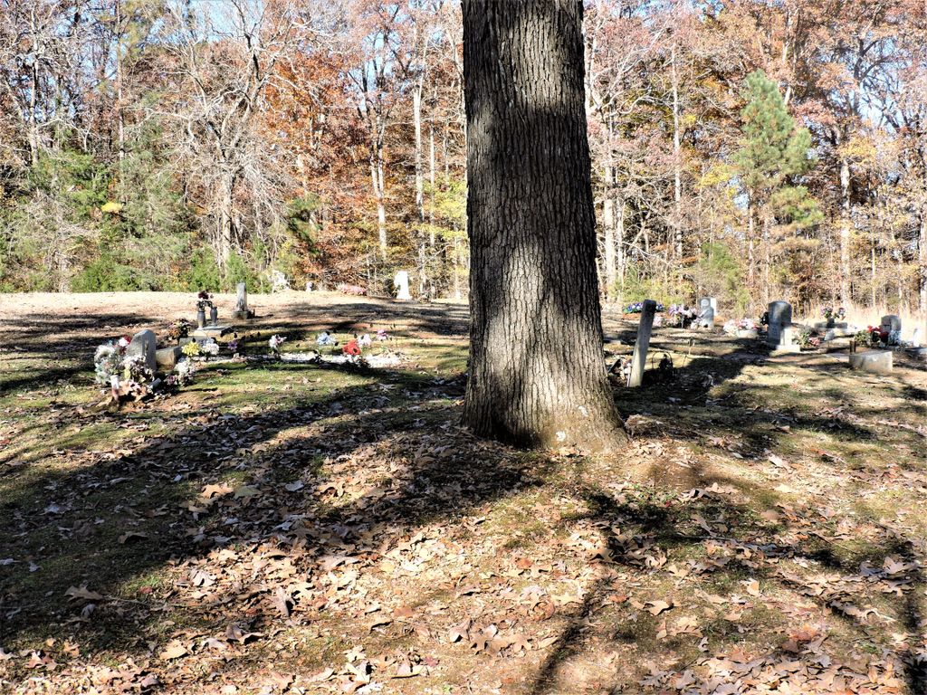
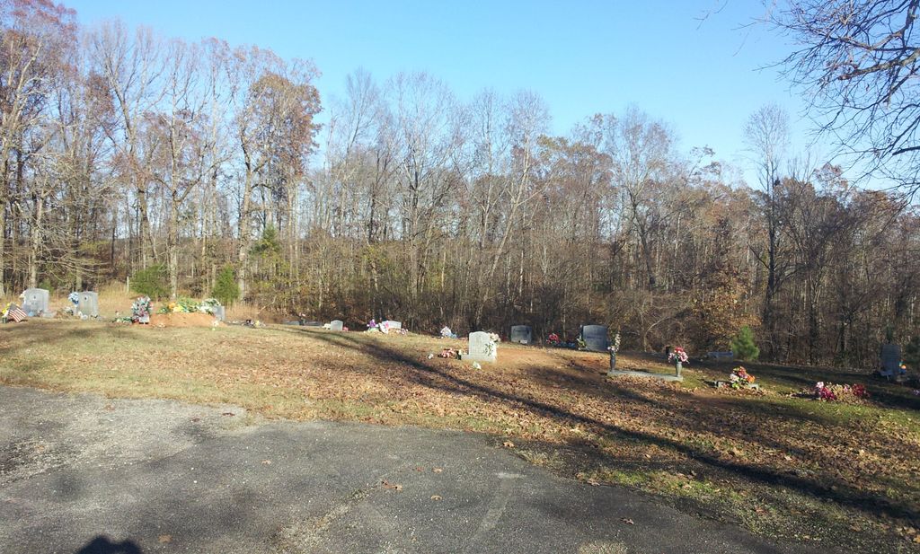
| Description | : | From the intersection of Potts Chapel Rd. & Cotton Grove Rd., east of Jackson, travel southeast on Potts Chapel Rd. for 0.6 mi., turning north (left) into the parking lot of the Center Point Baptist Church & to the cemetery to the rear of the church. These cemeteries are located on Potts Chapel Road in eastern Madison County, Tennessee. The newer of the cemeteries is located behind the Center Point Baptist Church building. The older cemetery is located beside Potts Chapel Road about 0.2 mile south of the church (GPS: 35.6570, -88.6907). Both cemeteries were recorded on July... Read More |
frequently asked questions (FAQ):
-
Where is Center Point Church Cemetery?
Center Point Church Cemetery is located at 786 Potts Chapel Road Jackson, Madison County ,Tennessee ,USA.
-
Center Point Church Cemetery cemetery's updated grave count on graveviews.com?
0 memorials
-
Where are the coordinates of the Center Point Church Cemetery?
Latitude: 35.6584250
Longitude: -88.6898400
Nearby Cemetories:
1. Cotton Grove Cemetery
Cotton Grove, Madison County, USA
Coordinate: 35.6718580, -88.6854410
2. Browns Church Cemetery
Jackson, Madison County, USA
Coordinate: 35.6782250, -88.7110860
3. Union Hill C.M.E. Church Cemetery
Jackson, Madison County, USA
Coordinate: 35.6792730, -88.7117900
4. Fenner Cemetery
Jackson, Madison County, USA
Coordinate: 35.6679800, -88.7289100
5. Liberty Church Cemetery
Beech Bluff, Madison County, USA
Coordinate: 35.6606680, -88.6486600
6. Isaiah Chapel Cemetery
Madison County, USA
Coordinate: 35.6225900, -88.6879580
7. Isaiah Chapel Church Cemeteryʌ
Jackson, Madison County, USA
Coordinate: 35.6225850, -88.6880130
8. Jonas Clark Family Cemetery
Jackson, Madison County, USA
Coordinate: 35.6946270, -88.6758830
9. McCoy Cemetery
Jackson, Madison County, USA
Coordinate: 35.6176610, -88.6914250
10. House of Israel Cemetery
Jackson, Madison County, USA
Coordinate: 35.6256910, -88.7286210
11. Hurts Chapel Cemetery
Jackson, Madison County, USA
Coordinate: 35.6211940, -88.7282080
12. Key Cemetery
Spring Creek, Madison County, USA
Coordinate: 35.7036680, -88.6538450
13. Gaskins Cemetery
Claybrook, Madison County, USA
Coordinate: 35.7176590, -88.6917720
14. Pearson Family Graveyard
Claybrook, Madison County, USA
Coordinate: 35.7083100, -88.6441600
15. Pleasant Hill Church Cemetery
Beech Bluff, Madison County, USA
Coordinate: 35.6113250, -88.6374810
16. May Family Cemetery
Spring Creek, Madison County, USA
Coordinate: 35.7216000, -88.6985000
17. Rose Hill Cemetery
Jackson, Madison County, USA
Coordinate: 35.6095730, -88.7443370
18. Old Salem Cemetery
Jackson, Madison County, USA
Coordinate: 35.6293060, -88.7663500
19. Maple Springs Cemetery
Henderson County, USA
Coordinate: 35.6559460, -88.6050000
20. Browns Chapel Church Cemetery
Jackson, Madison County, USA
Coordinate: 35.6272700, -88.7673730
21. Union Grove Church Cemetery
Henderson County, USA
Coordinate: 35.6731520, -88.6040190
22. Claybrook-Berry Zion Cemetery
Beech Bluff, Madison County, USA
Coordinate: 35.7072720, -88.6249050
23. Beech Bluff Cemetery
Beech Bluff, Madison County, USA
Coordinate: 35.5995930, -88.6380390
24. Parkway Memorial Gardens
Jackson, Madison County, USA
Coordinate: 35.6232860, -88.7679750