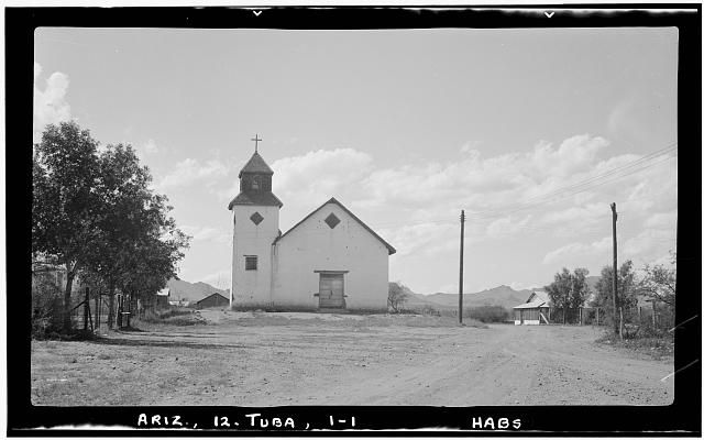
| Memorials | : | 0 |
| Location | : | Tubac, Santa Cruz County, USA |
| Website | : | www.tubacarizona.com/tubac_history.htm |
| Description | : | Juan Bautista de Anza, the commander of the garrison of Tubac, is hailed today as the most important person to ever live in Tubac. He lived there for sixteen years in total, settling in 1760 and then leaving the village in 1776. While he was there, he built the famous Santa Gertrudis chapel. This chapel eventually became unused after the Jesuits were expelled, and for several years, Catholics who wanted to worship would have to travel as far as Sonora in Mexico to worship together. While the chapel of Santa Gertrudis no longer stands in Tubac, the foundations of it... Read More |
frequently asked questions (FAQ):
-
Where is Chapel of Santa Gertrudis?
Chapel of Santa Gertrudis is located at No GPS information available Add GPS11 Calle Iglesia Tubac, Santa Cruz County ,Arizona , 85646USA.
-
Chapel of Santa Gertrudis cemetery's updated grave count on graveviews.com?
0 memorials
Nearby Cemetories:
1. Tellos-Ramos-Espinosa-Lopez Burial Site
Calabasas, Santa Cruz County, USA
2. Gatlin Jones Cemetery
Patagonia, Santa Cruz County, USA
Coordinate: 31.5557995, -110.5457993
3. Parker Canyon Cemetery
Patagonia, Santa Cruz County, USA
Coordinate: 31.5309000, -111.0288000
4. Patagonia Cemetery
Patagonia, Santa Cruz County, USA
Coordinate: 31.5655500, -111.0375900
5. Alto Cemetery
Alto, Santa Cruz County, USA
Coordinate: 31.5688000, -111.0509000
6. Duquesne Cemetery
Duquesne, Santa Cruz County, USA
Coordinate: 31.4277992, -111.2767029
7. Mission Los Santos Angeles de Guevavi
Santa Cruz County, USA
8. Mowry Cemetery
Santa Cruz County, USA
Coordinate: 31.6698740, -110.5624240
9. California Gulch Cemetery
Old Glory, Santa Cruz County, USA
Coordinate: 31.3341000, -110.6250000
10. Ruby Cemetery
Ruby, Santa Cruz County, USA
Coordinate: 31.7348000, -110.8823700
11. Scribner Cemetery
Ruby, Santa Cruz County, USA
Coordinate: 31.7401562, -110.8862305
12. Oro Blanco Cemetery
Oro Blanco, Santa Cruz County, USA
13. Bartell Canelo Ranch Cemetery
Canelo, Santa Cruz County, USA
14. Black Oak Cemetery
Canelo, Santa Cruz County, USA
Coordinate: 31.5557995, -110.5457993
15. Otero Cemetery
Otero, Santa Cruz County, USA
Coordinate: 31.5309000, -111.0288000
16. Saint Josephs Cemetery
Tumacacori, Santa Cruz County, USA
Coordinate: 31.5655500, -111.0375900
17. Tumacacori Mission Cemetery
Tumacacori, Santa Cruz County, USA
Coordinate: 31.5688000, -111.0509000
18. El Oro Cemetery
Santa Cruz County, USA
Coordinate: 31.4277992, -111.2767029
19. Elgin Cemetery
Elgin, Santa Cruz County, USA
20. Fruitland Cemetery
Elgin, Santa Cruz County, USA
Coordinate: 31.6698740, -110.5624240
21. Lochiel Cemetery
Santa Cruz County, USA
Coordinate: 31.3341000, -110.6250000
22. Madera Canyon Gravesite
Madera Canyon, Santa Cruz County, USA
Coordinate: 31.7348000, -110.8823700
23. Whitehouse Gravesite
Madera Canyon, Santa Cruz County, USA
Coordinate: 31.7401562, -110.8862305
24. Phelps Gravesite
Santa Cruz County, USA

