
| Memorials | : | 0 |
| Location | : | Douglasville, Douglas County, USA |
| Coordinate | : | 33.6707740, -84.7208230 |
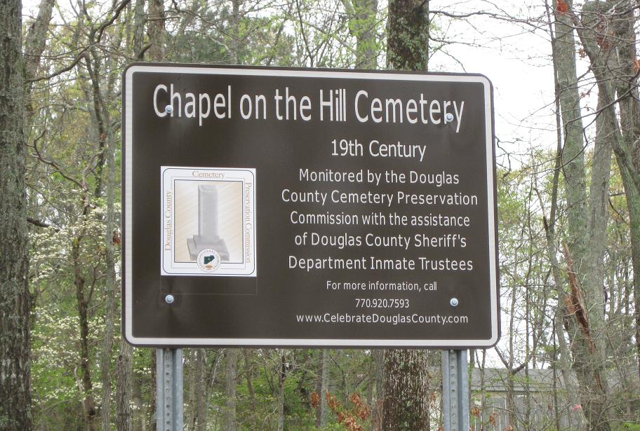
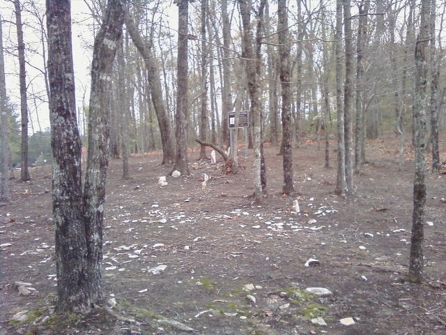
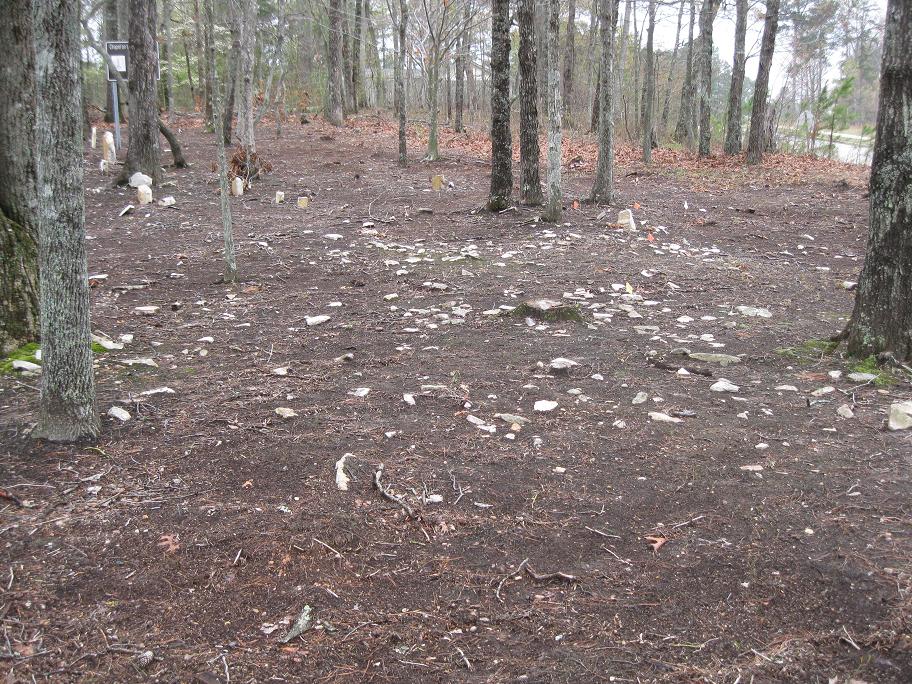
| Description | : | A 19th century cemetery, that was the burial ground of Native American converts. The church was said to be in the Holly Springs/Chapel Hill area. The church name was in a Native American language and meant the equivalent of "Chapel on the Hill". Stones are scattered throughout the burial ground and it would be difficult to estimate the amount of people buried here. |
frequently asked questions (FAQ):
-
Where is Chapel on the Hill Cemetery?
Chapel on the Hill Cemetery is located at Douglasville, Douglas County ,Georgia ,USA.
-
Chapel on the Hill Cemetery cemetery's updated grave count on graveviews.com?
0 memorials
-
Where are the coordinates of the Chapel on the Hill Cemetery?
Latitude: 33.6707740
Longitude: -84.7208230
Nearby Cemetories:
1. Holly Springs Cemetery
Douglasville, Douglas County, USA
Coordinate: 33.6657982, -84.7268982
2. Chapel Hill Cemetery
Douglasville, Douglas County, USA
Coordinate: 33.6852600, -84.7165000
3. Tranquil AME Church Cemetery
Douglasville, Douglas County, USA
Coordinate: 33.6860950, -84.7221060
4. Brock Family Cemetery
Douglasville, Douglas County, USA
Coordinate: 33.6877190, -84.7160050
5. McKoy Cemetery
Douglas County, USA
Coordinate: 33.6571999, -84.7022018
6. Abercrombie Family Cemetery
Fulton County, USA
Coordinate: 33.6408670, -84.6998290
7. Brock Cemetery
Fulton County, USA
Coordinate: 33.6421240, -84.6924100
8. Smith-Collins Family Cemetery
Chapel Hill, Douglas County, USA
Coordinate: 33.6342910, -84.7352740
9. Edenfield Family Cemetery
Douglas County, USA
Coordinate: 33.6758990, -84.6734880
10. Campbellton Baptist Church Cemetery
Fairburn, Fulton County, USA
Coordinate: 33.6530100, -84.6716300
11. Campbellton United Methodist Church Cemetery
Fairburn, Fulton County, USA
Coordinate: 33.6505500, -84.6723800
12. Moss Cemetery
Hilderbrand, Douglas County, USA
Coordinate: 33.6806710, -84.6672750
13. Saint Julians Memorial Garden
Douglasville, Douglas County, USA
Coordinate: 33.7089388, -84.7516909
14. Friendship Baptist Church Cemetery
Campbellton, Fulton County, USA
Coordinate: 33.6519700, -84.6694300
15. Old Campbellton Baptist Church Cemetery
Campbellton, Fulton County, USA
Coordinate: 33.6525300, -84.6686100
16. Central Baptist Church Memorial Garden
Douglasville, Douglas County, USA
Coordinate: 33.7029700, -84.7645500
17. Boyd Slave Cemetery
Hilderbrand, Douglas County, USA
Coordinate: 33.6939590, -84.6661810
18. Victory Baptist Church Cemetery
Douglasville, Douglas County, USA
Coordinate: 33.6849340, -84.6616050
19. Holdbrook Family Cemetery
Douglasville, Douglas County, USA
Coordinate: 33.6970230, -84.7814060
20. Bearden Church of Christ Cemetery
Douglasville, Douglas County, USA
Coordinate: 33.6962020, -84.7831580
21. Believers Church Cemetery
Douglasville, Douglas County, USA
Coordinate: 33.7240261, -84.6921704
22. Smith Family Cemetery
Douglasville, Douglas County, USA
Coordinate: 33.7111590, -84.7745630
23. Pleasant Grove Baptist Church Cemetery
Douglas County, USA
Coordinate: 33.7063751, -84.6582870
24. New River Community Church Cemetery
Douglasville, Douglas County, USA
Coordinate: 33.7109030, -84.6618760