
| Memorials | : | 0 |
| Location | : | Piney Woods, Cleburne County, USA |
| Coordinate | : | 33.8165900, -85.4423000 |
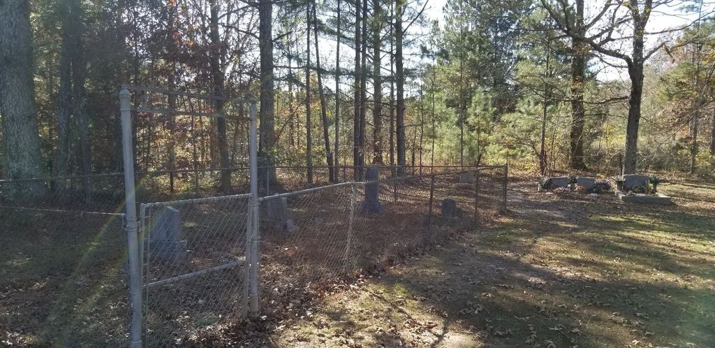
| Description | : | A small Cemetery on the edge of the road with Headstones in a fenced area and some outside the fence. Only one has two slate rocks for a stone placement. It's in the Piney Woods area of Cleburne County Alabama. It has no sign stating it's name. All the stones are photographed as of this date except 2, 1 with the stone rocks and one that's listed in there but cannot be found at all, "Mills" |
frequently asked questions (FAQ):
-
Where is Cherry Grove Cemetery?
Cherry Grove Cemetery is located at SR 88 Piney Woods, Cleburne County ,Alabama ,USA.
-
Cherry Grove Cemetery cemetery's updated grave count on graveviews.com?
0 memorials
-
Where are the coordinates of the Cherry Grove Cemetery?
Latitude: 33.8165900
Longitude: -85.4423000

Nearby Cemetories:
1. Camp Creek Baptist Church Cemetery
Oak Level, Cleburne County, USA
Coordinate: 33.8286018, -85.4518967
2. Mount Perry Cemetery
Cleburne County, USA
Coordinate: 33.8205986, -85.4253006
3. Mount Paran Baptist Church Cemetery
Piney Woods, Cleburne County, USA
Coordinate: 33.8209880, -85.4243660
4. Buttram Cemetery
Oak Level, Cleburne County, USA
Coordinate: 33.8333970, -85.4205750
5. Saint Michaels Lutheran Church Cemetery
Piney Woods, Cleburne County, USA
Coordinate: 33.8149986, -85.4075012
6. Living Word Family Church Cemetery
Muscadine, Cleburne County, USA
Coordinate: 33.7849890, -85.4255980
7. Mars Hill Cemetery
Cleburne County, USA
Coordinate: 33.8394012, -85.4021988
8. Hendon Cemetery
Oak Level, Cleburne County, USA
Coordinate: 33.8499985, -85.4779968
9. Oak Level Methodist Church Cemetery
Oak Level, Cleburne County, USA
Coordinate: 33.8503418, -85.4796219
10. Pilgrim's Rest Baptist Church Cemetery
Fruithurst, Cleburne County, USA
Coordinate: 33.7875300, -85.4866650
11. Bethel Cemetery
Cleburne County, USA
Coordinate: 33.7991982, -85.3891983
12. Camp Ground United Methodist Church Cemetery
Muscadine, Cleburne County, USA
Coordinate: 33.7700005, -85.4131012
13. Mount Olive Church of God Cemetery
Fruithurst, Cleburne County, USA
Coordinate: 33.7589660, -85.4612970
14. Hooper Cemetery
Fruithurst, Cleburne County, USA
Coordinate: 33.7571983, -85.4170990
15. Steed Cemetery
Oak Level, Cleburne County, USA
Coordinate: 33.8572006, -85.5030975
16. Roe Cemetery
Cleburne County, USA
Coordinate: 33.8689003, -85.3918991
17. McAlpin Family Cemetery #2
Haralson County, USA
Coordinate: 33.8063240, -85.3552060
18. Mountain Creek Baptist Church Cemetery
Borden Wheeler Springs, Cleburne County, USA
Coordinate: 33.8810997, -85.3983002
19. McAlpin Family Cemetery #1
Haralson County, USA
Coordinate: 33.7898930, -85.3529670
20. Fruithurst City Cemetery
Fruithurst, Cleburne County, USA
Coordinate: 33.7342730, -85.4415170
21. Pleasant Hill Baptist Church Cemetery
Tallapoosa, Haralson County, USA
Coordinate: 33.7918000, -85.3422100
22. Upper Cane Creek Cemetery
Fruithurst, Cleburne County, USA
Coordinate: 33.7338982, -85.4777985
23. Muscadine Memory Garden
Muscadine, Cleburne County, USA
Coordinate: 33.7405014, -85.3878021
24. Unidentified Cemetery
Tallapoosa, Haralson County, USA
Coordinate: 33.7832028, -85.3414889