
| Memorials | : | 0 |
| Location | : | Oak Level, Cleburne County, USA |
| Coordinate | : | 33.8503418, -85.4796219 |
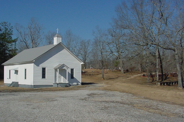
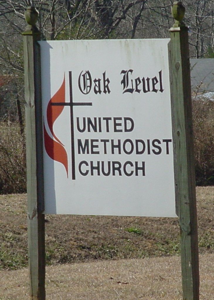
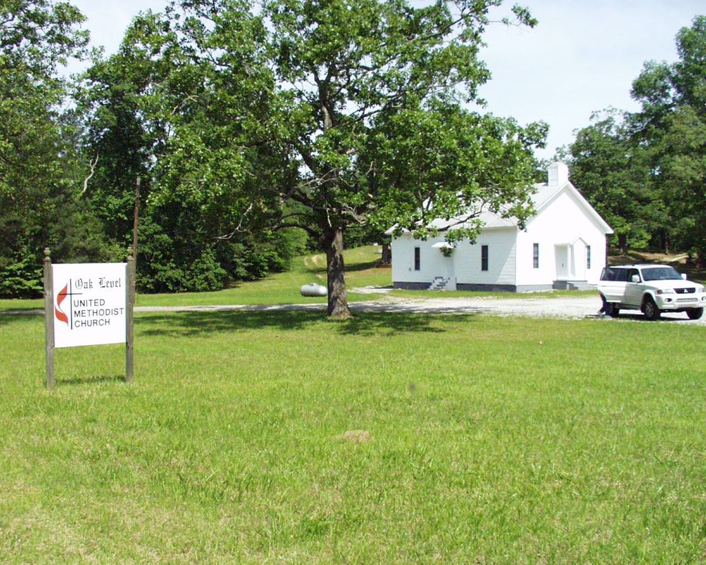
| Description | : | Cemetery is located behind the Oak Level United Methodist Church at the intersection of Cleburne County, AL CR49 & CR55. It is approximately 20 miles north of I-20 not far from the Georgia state line. |
frequently asked questions (FAQ):
-
Where is Oak Level Methodist Church Cemetery?
Oak Level Methodist Church Cemetery is located at Oak Level, Cleburne County ,Alabama ,USA.
-
Oak Level Methodist Church Cemetery cemetery's updated grave count on graveviews.com?
0 memorials
-
Where are the coordinates of the Oak Level Methodist Church Cemetery?
Latitude: 33.8503418
Longitude: -85.4796219

Nearby Cemetories:
1. Hendon Cemetery
Oak Level, Cleburne County, USA
Coordinate: 33.8499985, -85.4779968
2. Steed Cemetery
Oak Level, Cleburne County, USA
Coordinate: 33.8572006, -85.5030975
3. Camp Creek Baptist Church Cemetery
Oak Level, Cleburne County, USA
Coordinate: 33.8286018, -85.4518967
4. Cherry Grove Cemetery
Piney Woods, Cleburne County, USA
Coordinate: 33.8165900, -85.4423000
5. Buttram Cemetery
Oak Level, Cleburne County, USA
Coordinate: 33.8333970, -85.4205750
6. Mount Perry Cemetery
Cleburne County, USA
Coordinate: 33.8205986, -85.4253006
7. Mount Paran Baptist Church Cemetery
Piney Woods, Cleburne County, USA
Coordinate: 33.8209880, -85.4243660
8. Grimes Cemetery
Cleburne County, USA
Coordinate: 33.8572006, -85.5457993
9. Pilgrim's Rest Baptist Church Cemetery
Fruithurst, Cleburne County, USA
Coordinate: 33.7875300, -85.4866650
10. Mars Hill Cemetery
Cleburne County, USA
Coordinate: 33.8394012, -85.4021988
11. Saint Michaels Lutheran Church Cemetery
Piney Woods, Cleburne County, USA
Coordinate: 33.8149986, -85.4075012
12. John Borden Cemetery
Calhoun County, USA
Coordinate: 33.9214000, -85.4800000
13. Church of Christ Cemetery
Borden Springs, Cleburne County, USA
Coordinate: 33.9218740, -85.4745850
14. Mountain Creek Baptist Church Cemetery
Borden Wheeler Springs, Cleburne County, USA
Coordinate: 33.8810997, -85.3983002
15. Roe Cemetery
Cleburne County, USA
Coordinate: 33.8689003, -85.3918991
16. Living Word Family Church Cemetery
Muscadine, Cleburne County, USA
Coordinate: 33.7849890, -85.4255980
17. Wilson Family Cemetery
Vigo, Calhoun County, USA
Coordinate: 33.9130030, -85.5489440
18. J T Kerr Family Cemetery
Piedmont, Calhoun County, USA
Coordinate: 33.9056400, -85.5655900
19. Bethel Cemetery
Cleburne County, USA
Coordinate: 33.7991982, -85.3891983
20. Mount Olive Church of God Cemetery
Fruithurst, Cleburne County, USA
Coordinate: 33.7589660, -85.4612970
21. Dunn Cemetery
Cleburne County, USA
Coordinate: 33.8464012, -85.5958023
22. Camp Ground United Methodist Church Cemetery
Muscadine, Cleburne County, USA
Coordinate: 33.7700005, -85.4131012
23. McFry Cemetery
Piedmont, Calhoun County, USA
Coordinate: 33.9109690, -85.5753790
24. Hanks Cemetery
Piedmont, Calhoun County, USA
Coordinate: 33.9124985, -85.5764008