
| Memorials | : | 0 |
| Location | : | Hermitage Springs, Clay County, USA |
| Coordinate | : | 36.6138200, -85.7849000 |
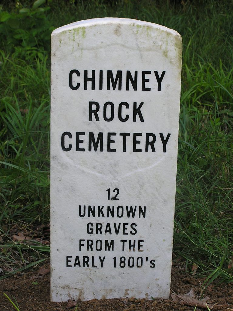
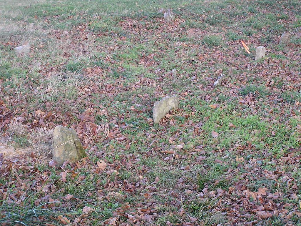
| Description | : | Comer - Chimney Rock Cemetery is a private cemetery located on the bluff just above the famous Chimney Rock hole on Line Creek. It is located on the Chad Comer farm, on the Harlin Comer Road, in the northwestern corner of Clay County, TN at the KY-TN state line. It is a very old cemetery dating to the early 1800s. There are at least 12 old graves in the cemetery none of which have names or dates, and one modern burial. Just plain field rocks as headstones. They are unknown but to God. |
frequently asked questions (FAQ):
-
Where is Chimney Rock Cemetery?
Chimney Rock Cemetery is located at Harlin Comer Road Hermitage Springs, Clay County ,Tennessee , 37150USA.
-
Chimney Rock Cemetery cemetery's updated grave count on graveviews.com?
0 memorials
-
Where are the coordinates of the Chimney Rock Cemetery?
Latitude: 36.6138200
Longitude: -85.7849000
Nearby Cemetories:
1. Biles Cemetery
Hermitage Springs, Clay County, USA
Coordinate: 36.6039009, -85.7919006
2. Compton Cemetery
Gamaliel, Monroe County, USA
Coordinate: 36.6262040, -85.7680120
3. Gamaliel Cemetery
Gamaliel, Monroe County, USA
Coordinate: 36.6422000, -85.7989000
4. Hermitage Springs Cemetery
Hermitage Springs, Clay County, USA
Coordinate: 36.5823500, -85.7750900
5. Reeves Cemetery
Hermitage Springs, Clay County, USA
Coordinate: 36.5760994, -85.7977982
6. Pedigo Cemetery
Clay County, USA
Coordinate: 36.5744019, -85.7863998
7. Beautiful Home Cemetery
Tompkinsville, Monroe County, USA
Coordinate: 36.6392000, -85.7371000
8. Samuel Harlan Family Cemetery
Gamaliel, Monroe County, USA
Coordinate: 36.6669730, -85.7835670
9. Old Bowman Cemetery
Gamaliel, Monroe County, USA
Coordinate: 36.6289830, -85.7204190
10. Clementsville Cemetery
Clementsville, Clay County, USA
Coordinate: 36.6132300, -85.7146410
11. Old Union Church Cemetery
Gamaliel, Monroe County, USA
Coordinate: 36.6578500, -85.8294440
12. Browning Cemetery
Clay County, USA
Coordinate: 36.5578003, -85.7602997
13. Cherry Cemetery #3
Oak Grove, Clay County, USA
Coordinate: 36.6015000, -85.7100300
14. Freetown Church Cemetery
Gamaliel, Monroe County, USA
Coordinate: 36.6747000, -85.7989000
15. Community Park Cemetery
Gamaliel, Monroe County, USA
Coordinate: 36.6785400, -85.8013600
16. Carnahan Cemetery
Harlan Crossroads, Monroe County, USA
Coordinate: 36.6592700, -85.7224900
17. Hale Cemetery
Tompkinsville, Monroe County, USA
Coordinate: 36.6753950, -85.7417460
18. Ebenezer Cemetery
Tompkinsville, Monroe County, USA
Coordinate: 36.6810800, -85.7503670
19. Bethany Cemetery
Macon County, USA
Coordinate: 36.5691986, -85.8574982
20. Harlan's Crossroads Cemetery
Harlan Crossroads, Monroe County, USA
Coordinate: 36.6518500, -85.7064700
21. Corinth Gardens
Macon County, USA
Coordinate: 36.6188889, -85.8797222
22. Pitcock Cemetery
Clay County, USA
Coordinate: 36.5992012, -85.6911011
23. Hinson Cemetery
Moss, Clay County, USA
Coordinate: 36.5756750, -85.7020010
24. Creek Family Cemetery
Bugtussle, Monroe County, USA
Coordinate: 36.6319938, -85.8780112