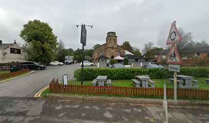
| Memorials | : | 392 |
| Location | : | Adlington, Chorley Borough, England |
| Coordinate | : | 53.6136590, -2.6042260 |
| Description | : | Founded in 1839, designed by Edward Welch, listed Grade II building, closed in 1975. Declared redundant 1 Nov 1980, and approved for use as an office or shopping 7 Apr 1982. Source: Wikipedia Sold to the Sharju Restaurant in 1980 (conflicting dates). "A notice about the gravestones was pinned to the church door inviting people to claim them if they belonged to the family. Many of the headstones were not claimed and they were broken up and dumped in the sea at Morecambe Bay." [how could this be allowed?] Source: Genuki |
frequently asked questions (FAQ):
-
Where is Christ Church Churchyard?
Christ Church Churchyard is located at Adlington, Chorley Borough ,Lancashire ,England.
-
Christ Church Churchyard cemetery's updated grave count on graveviews.com?
389 memorials
-
Where are the coordinates of the Christ Church Churchyard?
Latitude: 53.6136590
Longitude: -2.6042260
Nearby Cemetories:
1. Adlington Cemetery
Adlington, Chorley Borough, England
Coordinate: 53.6100510, -2.6089100
2. St. Joseph's Churchyard, Anderton
Adlington, Chorley Borough, England
Coordinate: 53.6165600, -2.5953600
3. St Katharine Churchyard
Blackrod, Metropolitan Borough of Bolton, England
Coordinate: 53.5946930, -2.5860040
4. Rivington Churchyard
Rivington, Chorley Borough, England
Coordinate: 53.6251690, -2.5684490
5. Unitarian Chapelyard
Rivington, Chorley Borough, England
Coordinate: 53.6254549, -2.5660662
6. St Gregory Weld Bank Church Cemetery
Chorley, Chorley Borough, England
Coordinate: 53.6390300, -2.6307480
7. Coppull Parish Churchyard
Coppull, Chorley Borough, England
Coordinate: 53.6168000, -2.6549710
8. Coppull Parish Churchyard Extension
Coppull, Chorley Borough, England
Coordinate: 53.6170200, -2.6555420
9. Lee Lane United Reformed Churchyard
Horwich, Metropolitan Borough of Bolton, England
Coordinate: 53.6016464, -2.5499649
10. St David Churchyard
Haigh, Metropolitan Borough of Wigan, England
Coordinate: 53.5758550, -2.5960800
11. St Oswald’s Churchyard
Coppull, Chorley Borough, England
Coordinate: 53.6217176, -2.6714738
12. St George's Churchyard
Chorley, Chorley Borough, England
Coordinate: 53.6521460, -2.6295520
13. Holy Trinity Churchyard
Horwich, Metropolitan Borough of Bolton, England
Coordinate: 53.5992280, -2.5383300
14. St Wilfrid Churchyard
Standish, Metropolitan Borough of Wigan, England
Coordinate: 53.5868240, -2.6616530
15. St Laurence's Church
Chorley, Chorley Borough, England
Coordinate: 53.6546880, -2.6327020
16. Ridgmont Cemetery
Horwich, Metropolitan Borough of Bolton, England
Coordinate: 53.5985630, -2.5323480
17. Chorley Cemetery
Chorley, Chorley Borough, England
Coordinate: 53.6549770, -2.6447530
18. St Peters Churchyard
Chorley, Chorley Borough, England
Coordinate: 53.6607430, -2.6232100
19. St Marie Churchyard
Standish, Metropolitan Borough of Wigan, England
Coordinate: 53.5844610, -2.6704070
20. Christ Church
Charnock Richard, Chorley Borough, England
Coordinate: 53.6367200, -2.6773400
21. Gidlow Cemetery
Standish, Metropolitan Borough of Wigan, England
Coordinate: 53.5681220, -2.6437140
22. St. Elizabeth Churchyard
Aspull, Metropolitan Borough of Wigan, England
Coordinate: 53.5633940, -2.5749240
23. Charnock Richard Crematorium
Chorley, Chorley Borough, England
Coordinate: 53.6518550, -2.6763080
24. St. Joseph's Roman Catholic Church Cemetery
Wrightington, West Lancashire District, England
Coordinate: 53.5923300, -2.7010200

