
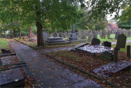
| Memorials | : | 507 |
| Location | : | Standish, Metropolitan Borough of Wigan, England |
| Coordinate | : | 53.5868240, -2.6616530 |
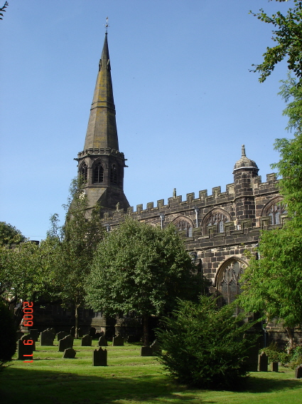
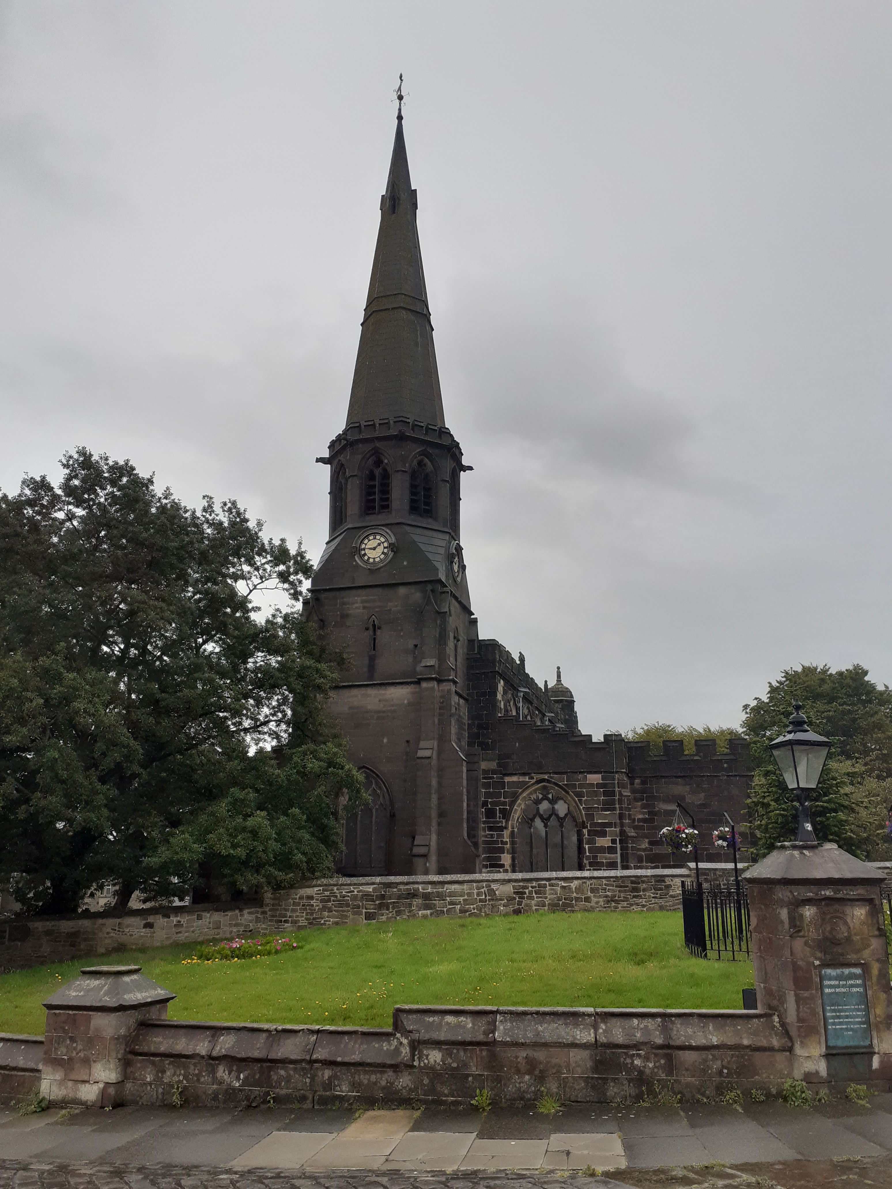
| Description | : | Church of St Wilfrid is a church in Standish, within the Metropolitan Borough of Wigan, Greater Manchester, England, and is located on Market Place (SD561102). It is part of the Church of England and Anglican Diocese of Blackburn. It is a Grade I listed building.[1] The church is believed to have been constructed between 1582 and 1584 and designed by L. Shipway. It is in a blended Gothic and Renaissance style. The church is first mentioned in 1205 but the vast extent of the ancient parish with its eleven townships (Adlington, Anderton, Charnock Richard, Coppull, Duxbury, Heath Charnock, Langtree, Shevington, Standish, Welch... Read More |
frequently asked questions (FAQ):
-
Where is St Wilfrid Churchyard?
St Wilfrid Churchyard is located at Market Place Standish, Metropolitan Borough of Wigan ,Greater Manchester , WN6 0JTEngland.
-
St Wilfrid Churchyard cemetery's updated grave count on graveviews.com?
507 memorials
-
Where are the coordinates of the St Wilfrid Churchyard?
Latitude: 53.5868240
Longitude: -2.6616530
Nearby Cemetories:
1. St Marie Churchyard
Standish, Metropolitan Borough of Wigan, England
Coordinate: 53.5844610, -2.6704070
2. Gidlow Cemetery
Standish, Metropolitan Borough of Wigan, England
Coordinate: 53.5681220, -2.6437140
3. St. Joseph's Roman Catholic Church Cemetery
Wrightington, West Lancashire District, England
Coordinate: 53.5923300, -2.7010200
4. Coppull Parish Churchyard
Coppull, Chorley Borough, England
Coordinate: 53.6168000, -2.6549710
5. Coppull Parish Churchyard Extension
Coppull, Chorley Borough, England
Coordinate: 53.6170200, -2.6555420
6. St Oswald’s Churchyard
Coppull, Chorley Borough, England
Coordinate: 53.6217176, -2.6714738
7. Adlington Cemetery
Adlington, Chorley Borough, England
Coordinate: 53.6100510, -2.6089100
8. St David Churchyard
Haigh, Metropolitan Borough of Wigan, England
Coordinate: 53.5758550, -2.5960800
9. Christ Church Churchyard
Adlington, Chorley Borough, England
Coordinate: 53.6136590, -2.6042260
10. All Saints Churchyard
Wigan, Metropolitan Borough of Wigan, England
Coordinate: 53.5458134, -2.6334023
11. St. James the Great Churchyard
Wrightington, West Lancashire District, England
Coordinate: 53.6168220, -2.7175670
12. St Katharine Churchyard
Blackrod, Metropolitan Borough of Bolton, England
Coordinate: 53.5946930, -2.5860040
13. St Catharine Churchyard
Wigan, Metropolitan Borough of Wigan, England
Coordinate: 53.5461800, -2.6168400
14. St. Joseph's Churchyard, Anderton
Adlington, Chorley Borough, England
Coordinate: 53.6165600, -2.5953600
15. Christ Church
Charnock Richard, Chorley Borough, England
Coordinate: 53.6367200, -2.6773400
16. St John the Divine Churchyard
Pemberton, Metropolitan Borough of Wigan, England
Coordinate: 53.5373860, -2.6823840
17. St. Joseph's College
Up Holland, West Lancashire District, England
Coordinate: 53.5525740, -2.7307890
18. Christ Church Churchyard
Parbold, West Lancashire District, England
Coordinate: 53.5908500, -2.7531900
19. St Gregory Weld Bank Church Cemetery
Chorley, Chorley Borough, England
Coordinate: 53.6390300, -2.6307480
20. St. Elizabeth Churchyard
Aspull, Metropolitan Borough of Wigan, England
Coordinate: 53.5633940, -2.5749240
21. St Thomas the Martyr Churchyard
Up Holland, West Lancashire District, England
Coordinate: 53.5402980, -2.7195920
22. St. Matthew Churchyard
Pemberton, Metropolitan Borough of Wigan, England
Coordinate: 53.5290100, -2.6721300
23. St. Paul's Church of England Churchyard
Wigan, Metropolitan Borough of Wigan, England
Coordinate: 53.5278761, -2.6536048
24. Lower Ince Cemetery
Ince in Makerfield, Metropolitan Borough of Wigan, England
Coordinate: 53.5315670, -2.6209900