
| Memorials | : | 408 |
| Location | : | Charnock Richard, Chorley Borough, England |
| Coordinate | : | 53.6367200, -2.6773400 |
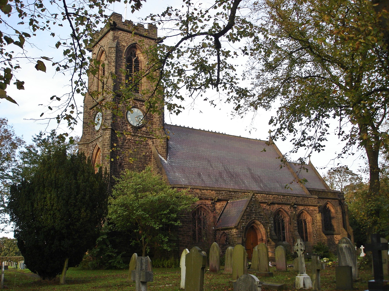
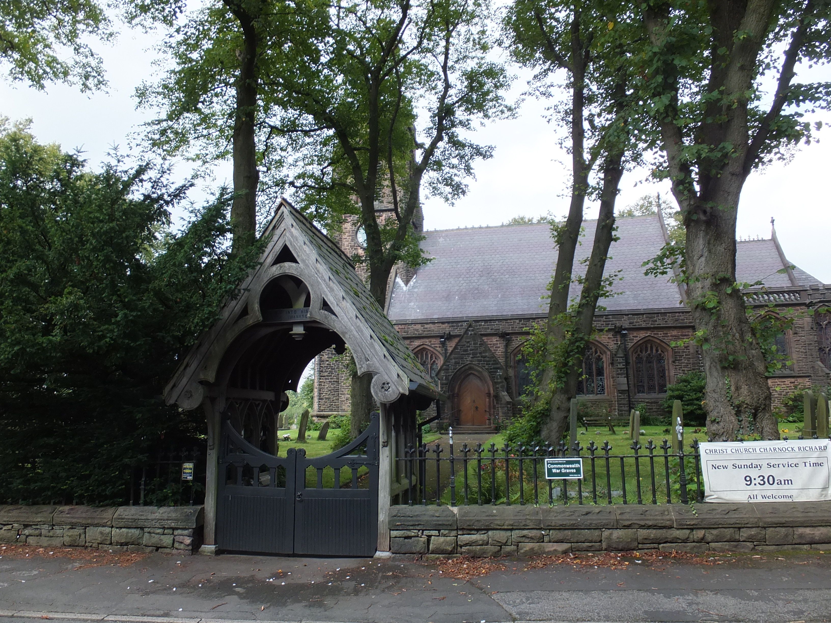
| Description | : | The Church of England, Parish of Christ Church, Charnock Richard was founded in 1860. A beautiful country church containing historic tile work and a superb marble memorial to Frances Darlington, wife of the original benefactor. Our church is a busy hub of the village, and every year in September we host the Scarecrow Festival. |
frequently asked questions (FAQ):
-
Where is Christ Church?
Christ Church is located at 134 Church Lane Charnock Richard, Chorley Borough ,Lancashire , PR7 5LREngland.
-
Christ Church cemetery's updated grave count on graveviews.com?
408 memorials
-
Where are the coordinates of the Christ Church?
Latitude: 53.6367200
Longitude: -2.6773400
Nearby Cemetories:
1. Charnock Richard Crematorium
Chorley, Chorley Borough, England
Coordinate: 53.6518550, -2.6763080
2. St Oswald’s Churchyard
Coppull, Chorley Borough, England
Coordinate: 53.6217176, -2.6714738
3. Coppull Parish Churchyard Extension
Coppull, Chorley Borough, England
Coordinate: 53.6170200, -2.6555420
4. Coppull Parish Churchyard
Coppull, Chorley Borough, England
Coordinate: 53.6168000, -2.6549710
5. Chorley Cemetery
Chorley, Chorley Borough, England
Coordinate: 53.6549770, -2.6447530
6. St Gregory Weld Bank Church Cemetery
Chorley, Chorley Borough, England
Coordinate: 53.6390300, -2.6307480
7. Euxton Parish Churchyard
Euxton, Chorley Borough, England
Coordinate: 53.6650950, -2.6743630
8. St. Mary's Churchyard
Euxton, Chorley Borough, England
Coordinate: 53.6669580, -2.6768350
9. St. James the Great Churchyard
Wrightington, West Lancashire District, England
Coordinate: 53.6168220, -2.7175670
10. St Laurence's Church
Chorley, Chorley Borough, England
Coordinate: 53.6546880, -2.6327020
11. St George's Churchyard
Chorley, Chorley Borough, England
Coordinate: 53.6521460, -2.6295520
12. St Mary the Virgin Churchyard
Eccleston, Chorley Borough, England
Coordinate: 53.6528800, -2.7331920
13. St Peters Churchyard
Chorley, Chorley Borough, England
Coordinate: 53.6607430, -2.6232100
14. St. Peter and St. Paul Churchyard
Mawdesley, Chorley Borough, England
Coordinate: 53.6266580, -2.7451420
15. St. Joseph's Roman Catholic Church Cemetery
Wrightington, West Lancashire District, England
Coordinate: 53.5923300, -2.7010200
16. Adlington Cemetery
Adlington, Chorley Borough, England
Coordinate: 53.6100510, -2.6089100
17. Christ Church Churchyard
Adlington, Chorley Borough, England
Coordinate: 53.6136590, -2.6042260
18. St Wilfrid Churchyard
Standish, Metropolitan Borough of Wigan, England
Coordinate: 53.5868240, -2.6616530
19. St Marie Churchyard
Standish, Metropolitan Borough of Wigan, England
Coordinate: 53.5844610, -2.6704070
20. Saint Andrews Churchyard
Leyland, South Ribble Borough, England
Coordinate: 53.6881270, -2.6957880
21. St. Joseph's Churchyard, Anderton
Adlington, Chorley Borough, England
Coordinate: 53.6165600, -2.5953600
22. St Mary's Roman Catholic Churchyard
Leyland, South Ribble Borough, England
Coordinate: 53.6880510, -2.6983240
23. St John the Evangelist Churchyard
Whittle-le-Woods, Chorley Borough, England
Coordinate: 53.6883280, -2.6400320
24. St. Peter's Churchyard
Mawdesley, Chorley Borough, England
Coordinate: 53.6237600, -2.7734100