
| Memorials | : | 0 |
| Location | : | Brampton Bierlow, Metropolitan Borough of Rotherham, England |
| Coordinate | : | 53.5031100, -1.3657400 |
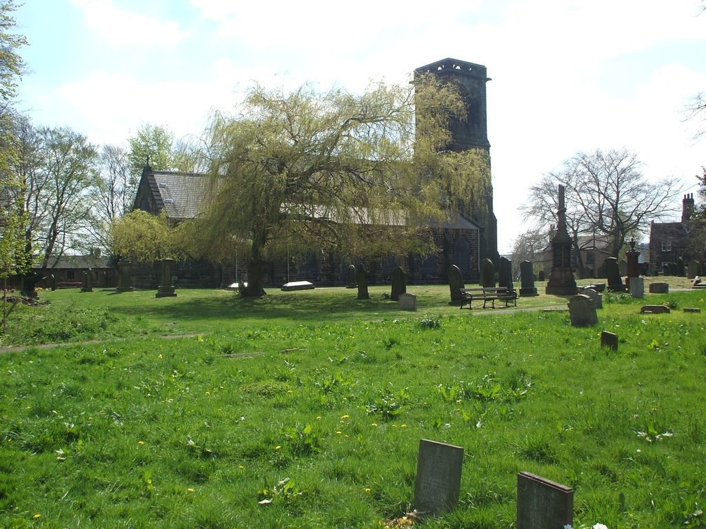
| Description | : | The churchyard and church date from 1855 and was built due to the increase in the local population. Church is built from local stone on land given by the 5th Earl Fitzwilliam and is GradeII Listed. First burial was in September 1855. In 1901 the Fitzwilliam family donated more land. This increased the churchyard which is now very large and looked after by volunteers. Near to the church is a freestanding white Christian Cross which seems to date from the the time when the church was built. Nearby to the cross is a plot where ashes are laid to rest. There are... Read More |
frequently asked questions (FAQ):
-
Where is Christ Church Churchyard?
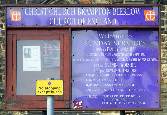
Christ Church Churchyard is located at Melton High Street Brampton Bierlow, Metropolitan Borough of Rotherham ,South Yorkshire , S63 6ANEngland.
-
Christ Church Churchyard cemetery's updated grave count on graveviews.com?
0 memorials
-
Where are the coordinates of the Christ Church Churchyard?
Latitude: 53.5031100
Longitude: -1.3657400
Nearby Cemetories:
1. All Saints Churchyard
Wath-upon-Dearne, Metropolitan Borough of Rotherham, England
Coordinate: 53.5028716, -1.3494516
2. Wath-Upon-Dearne Cemetery
Wath-upon-Dearne, Metropolitan Borough of Rotherham, England
Coordinate: 53.4979410, -1.3505370
3. Wombwell Cemetery
Wombwell, Metropolitan Borough of Barnsley, England
Coordinate: 53.5233070, -1.4035730
4. St Margaret Churchyard
Swinton, Metropolitan Borough of Rotherham, England
Coordinate: 53.4890470, -1.3202140
5. All Saints Churchyard
Darfield, Metropolitan Borough of Barnsley, England
Coordinate: 53.5336800, -1.3702400
6. Holy Trinity Churchyard
Elsecar, Metropolitan Borough of Barnsley, England
Coordinate: 53.4971310, -1.4181020
7. Elsecar Cemetery
Elsecar, Metropolitan Borough of Barnsley, England
Coordinate: 53.4981300, -1.4196000
8. Hemingfield & Jump Cemetery
Hemingfield, Metropolitan Borough of Barnsley, England
Coordinate: 53.5070400, -1.4218400
9. Bolton Cemetery
Bolton upon Dearne, Metropolitan Borough of Barnsley, England
Coordinate: 53.5209050, -1.3172860
10. Butterfields Memorial Garden
Swinton, Metropolitan Borough of Rotherham, England
Coordinate: 53.4876084, -1.3080726
11. Darfield Cemetery
Darfield, Metropolitan Borough of Barnsley, England
Coordinate: 53.5412700, -1.3783500
12. Rawmarsh Cemetery
Rawmarsh, Metropolitan Borough of Rotherham, England
Coordinate: 53.4658310, -1.3460880
13. Holy Trinity Old Churchyard
Wentworth, Metropolitan Borough of Rotherham, England
Coordinate: 53.4799721, -1.4230417
14. Holy Trinity Churchyard
Wentworth, Metropolitan Borough of Rotherham, England
Coordinate: 53.4790700, -1.4229200
15. Greasbrough Lane Cemetery
Rawmarsh, Metropolitan Borough of Rotherham, England
Coordinate: 53.4620370, -1.3462330
16. St. John the Baptist Churchyard
Adwick-on-Dearne, Metropolitan Borough of Doncaster, England
Coordinate: 53.5080520, -1.2924120
17. Mexborough Cemetery
Mexborough, Metropolitan Borough of Doncaster, England
Coordinate: 53.4995220, -1.2886400
18. High Street Cemetery
Rawmarsh, Metropolitan Borough of Rotherham, England
Coordinate: 53.4587900, -1.3448100
19. Thurnscoe Cemetery
Thurnscoe, Metropolitan Borough of Barnsley, England
Coordinate: 53.5423000, -1.3248700
20. St. Thomas' Churchyard Extension
Kilnhurst, Metropolitan Borough of Rotherham, England
Coordinate: 53.4723700, -1.3072300
21. St Mary
Greasbrough, Metropolitan Borough of Rotherham, England
Coordinate: 53.4562120, -1.3717680
22. Rawmarsh War Memorial
Rawmarsh, Metropolitan Borough of Rotherham, England
Coordinate: 53.4576880, -1.3450730
23. St. Helen's R.C. Burial Ground
Hoyland, Metropolitan Borough of Barnsley, England
Coordinate: 53.4999500, -1.4447800
24. Greasbrough Cemetery
Rawmarsh, Metropolitan Borough of Rotherham, England
Coordinate: 53.4561300, -1.3849900