
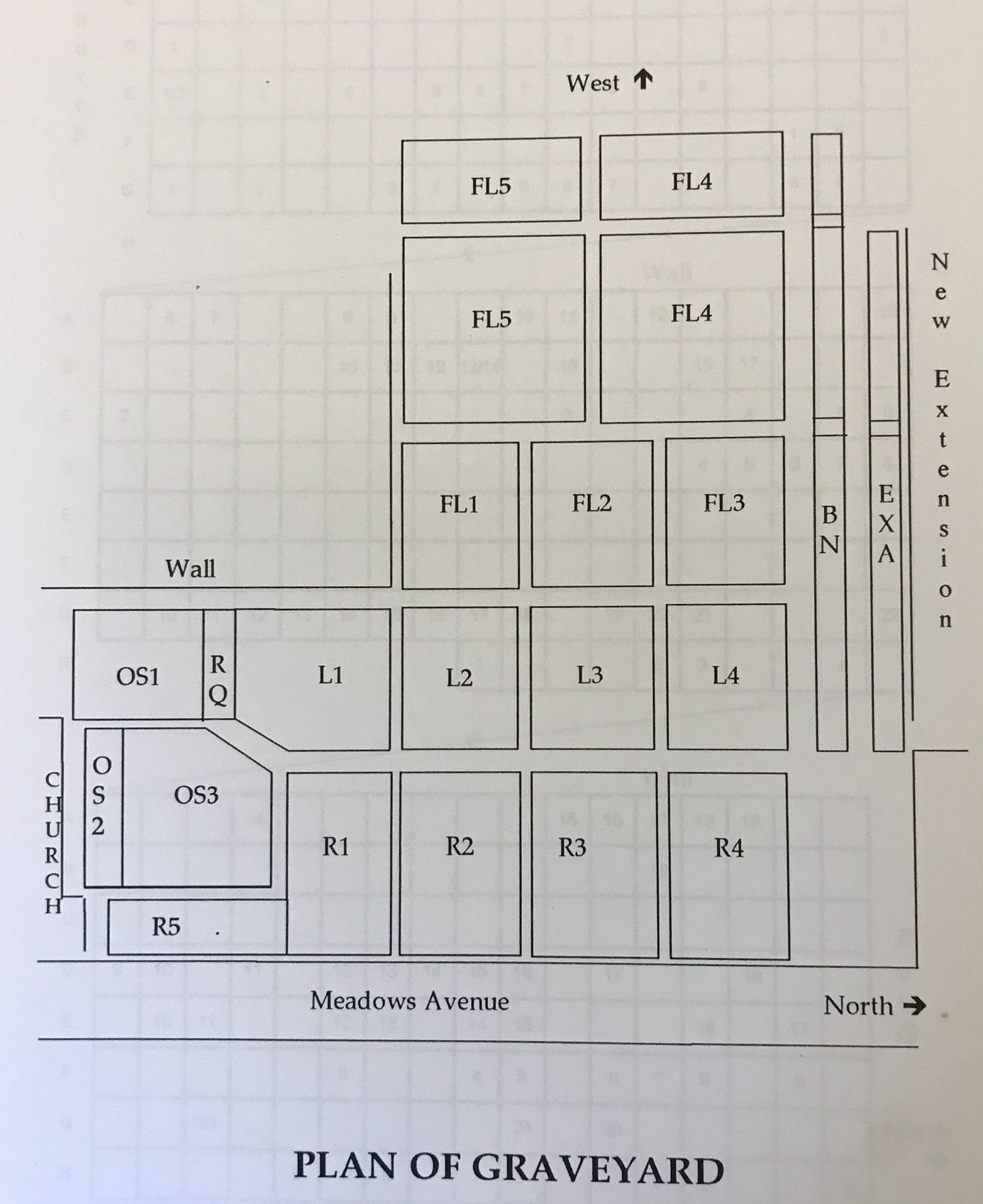
| Memorials | : | 94 |
| Location | : | Thornton-Cleveleys, Wyre Borough, England |
| Website | : | www.christchurchthornton.org/welcome.htm |
| Coordinate | : | 53.8772800, -3.0221100 |
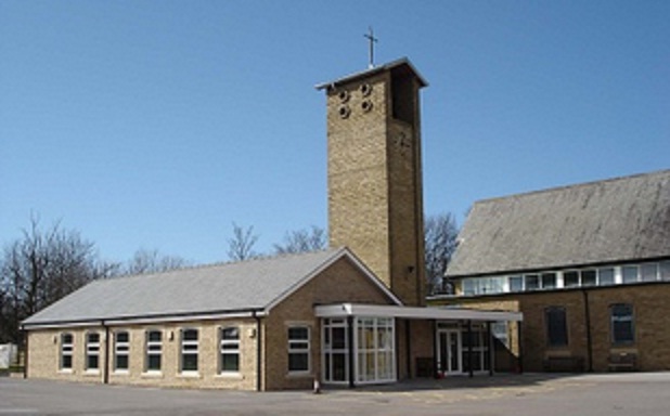
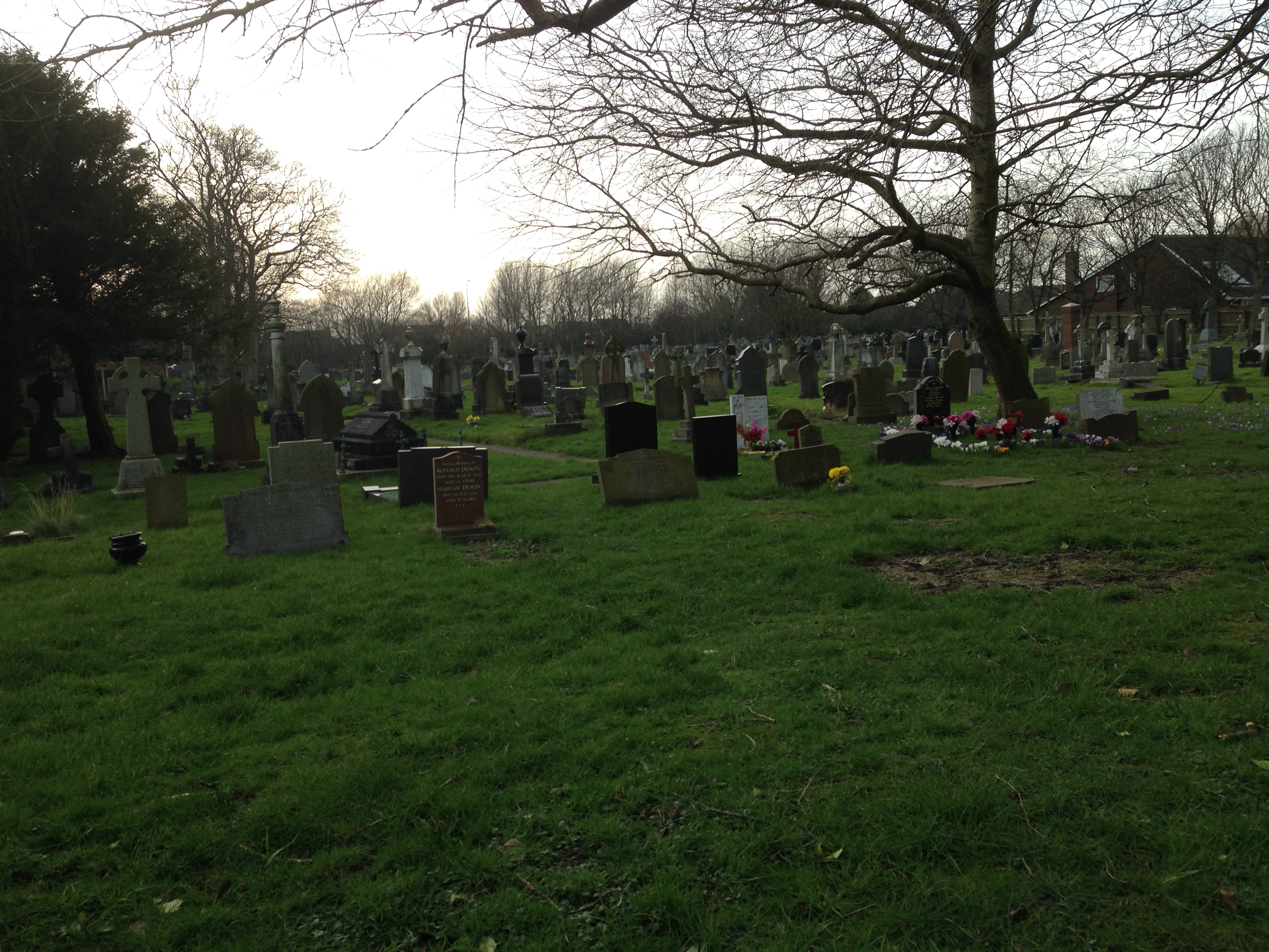
| Description | : | Originally, Thornton Parish Church (as it was known) served what is now Fleetwood, Cleveleys and Little Thornton. The Churchyard, which has served the whole District since 1835, is still the one and only burial ground in the area. It serves as a public cemetery and is used by all denominations. The first Church, built in 1835, was a simple box-like construction. Later a tower was added. This Church and Tower stood between the Font and Chancel steps, between the present pillars of the Nave. The remains of this Church are in fact buried beneath the present Church. |
frequently asked questions (FAQ):
-
Where is Christ Church Thornton Churchyard?
Christ Church Thornton Churchyard is located at Meadows Avenue Thornton-Cleveleys, Wyre Borough ,Lancashire , FY5 2TWEngland.
-
Christ Church Thornton Churchyard cemetery's updated grave count on graveviews.com?
94 memorials
-
Where are the coordinates of the Christ Church Thornton Churchyard?
Latitude: 53.8772800
Longitude: -3.0221100
Nearby Cemetories:
1. All Hallow's Churchyard
Bispham, Blackpool Unitary Authority, England
Coordinate: 53.8567580, -3.0372160
2. Blackpool Cemetery and Crematorium
Poulton-le-Fylde, Wyre Borough, England
Coordinate: 53.8465680, -3.0196600
3. St Johns Roman Catholic Church Cemetery
Poulton-le-Fylde, Wyre Borough, England
Coordinate: 53.8520854, -2.9873511
4. Saint Chad Churchyard
Poulton-le-Fylde, Wyre Borough, England
Coordinate: 53.8471992, -2.9925005
5. St Stephen On-the-Cliffs Churchyard
Blackpool, Blackpool Unitary Authority, England
Coordinate: 53.8407230, -3.0515610
6. Poulton-Le-Fylde Old Cemetery
Poulton-le-Fylde, Wyre Borough, England
Coordinate: 53.8458145, -2.9713324
7. Poulton New Cemetery
Poulton-le-Fylde, Wyre Borough, England
Coordinate: 53.8461240, -2.9689560
8. Preesall Cemetery
Preesall, Wyre Borough, England
Coordinate: 53.9075410, -2.9635410
9. Fleetwood Cemetery
Fleetwood, Wyre Borough, England
Coordinate: 53.9223440, -3.0370570
10. St. Peter and St. David Churchyard
Fleetwood, Wyre Borough, England
Coordinate: 53.9238123, -3.0116212
11. St James Churchyard
Stalmine, Wyre Borough, England
Coordinate: 53.9020510, -2.9533720
12. Blackpool Jewish Cemetery
Blackpool, Blackpool Unitary Authority, England
Coordinate: 53.8287397, -3.0311753
13. Layton Cemetery
Blackpool, Blackpool Unitary Authority, England
Coordinate: 53.8273740, -3.0328240
14. St Paul's Church & Medical Centre
Blackpool Unitary Authority, England
Coordinate: 53.8291540, -3.0533490
15. St John the Evangelist Churchyard
Blackpool, Blackpool Unitary Authority, England
Coordinate: 53.8182303, -3.0508197
16. St. Anne's Churchyard
Blackburn, Blackburn with Darwen Unitary Authority, England
Coordinate: 53.8381160, -2.9362870
17. St Anne Churchyard
Singleton, Fylde Borough, England
Coordinate: 53.8379280, -2.9359890
18. Carlton Cemetery& Crematorium
Blackpool, Blackpool Unitary Authority, England
Coordinate: 53.8095921, -3.0364920
19. Saint Paul Churchyard
Great Marton, Blackpool Unitary Authority, England
Coordinate: 53.8053220, -3.0268330
20. St. John’s Churchyard
Out Rawcliffe, Wyre Borough, England
Coordinate: 53.8741650, -2.8959310
21. Marton Burial Ground
Great Marton, Blackpool Unitary Authority, England
Coordinate: 53.8030870, -3.0108350
22. Holy Trinity Churchyard
Blackpool, Blackpool Unitary Authority, England
Coordinate: 53.7962949, -3.0536214
23. St John the Baptist's Church
Pilling, Wyre Borough, England
Coordinate: 53.9289910, -2.9114540
24. St Anne Churchyard
Great Eccleston, Wyre Borough, England
Coordinate: 53.8481413, -2.8835925