
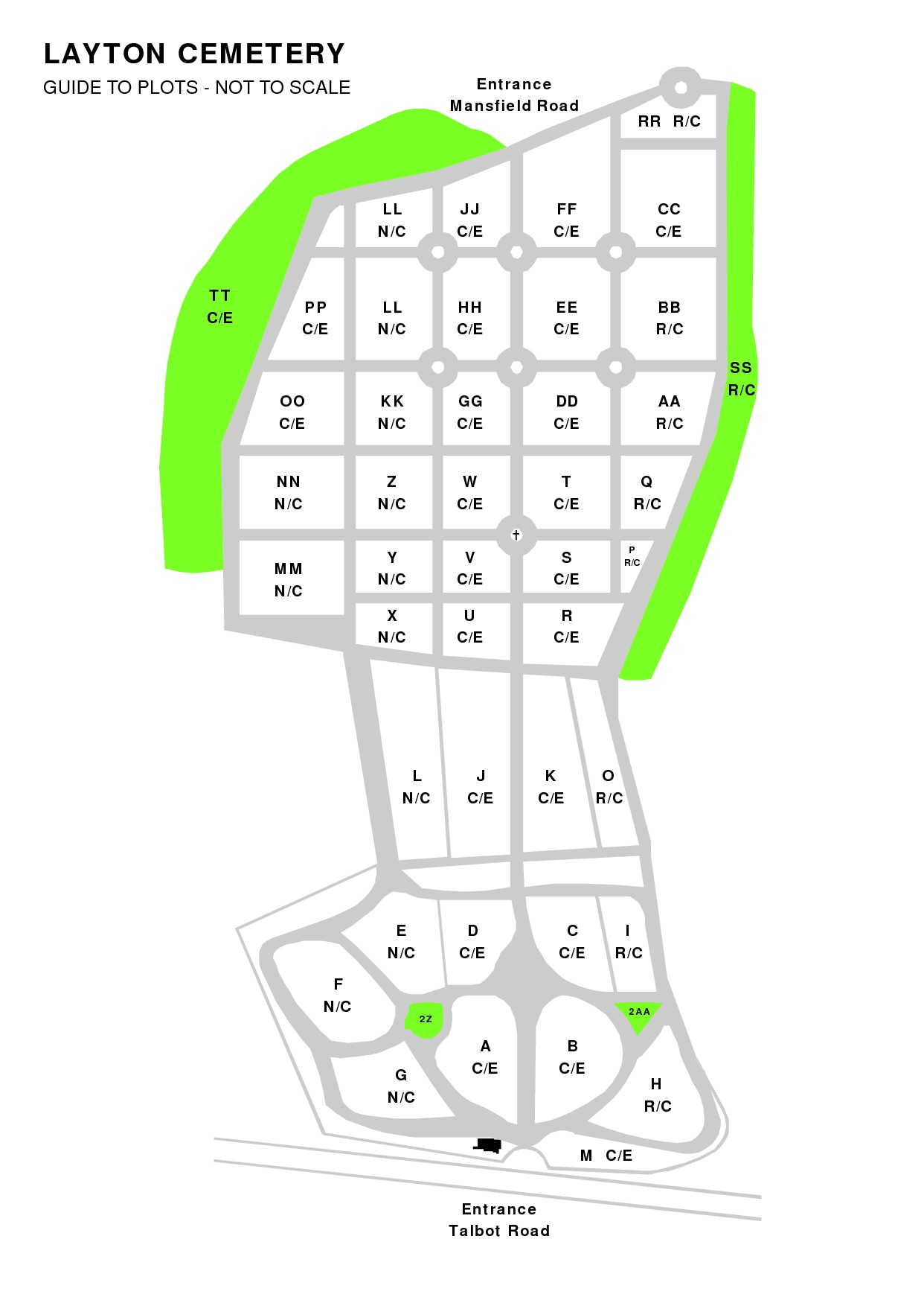
| Memorials | : | 835 |
| Location | : | Blackpool, Blackpool Unitary Authority, England |
| Coordinate | : | 53.8273740, -3.0328240 |
frequently asked questions (FAQ):
-
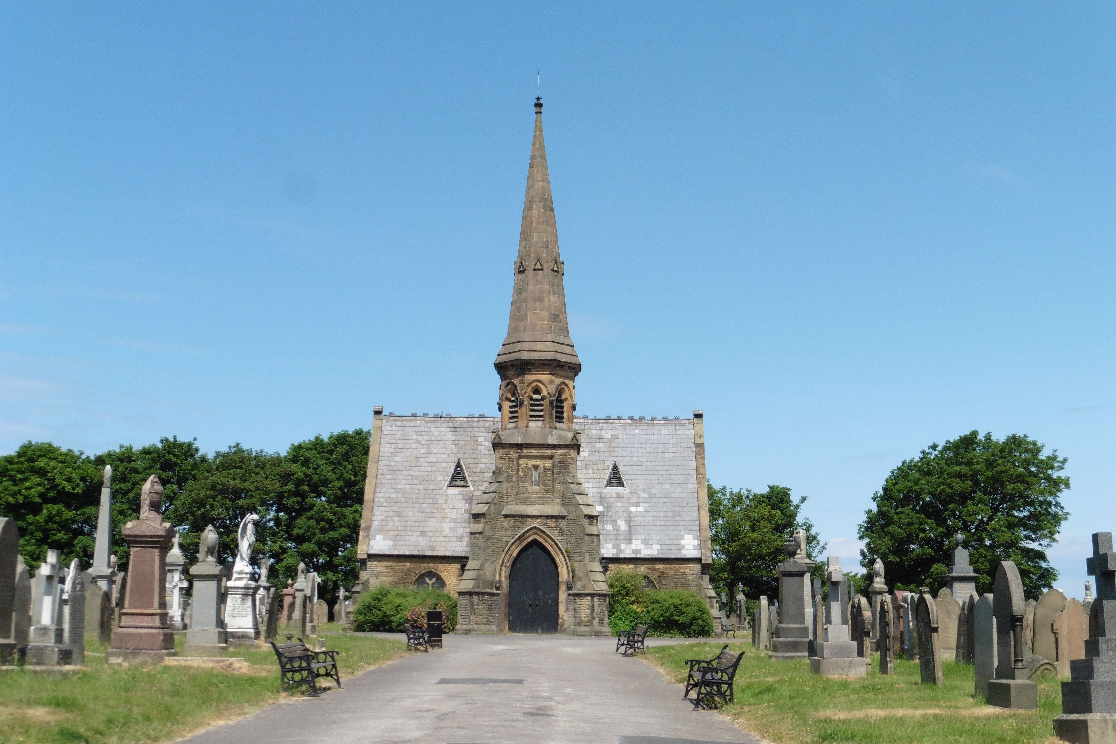
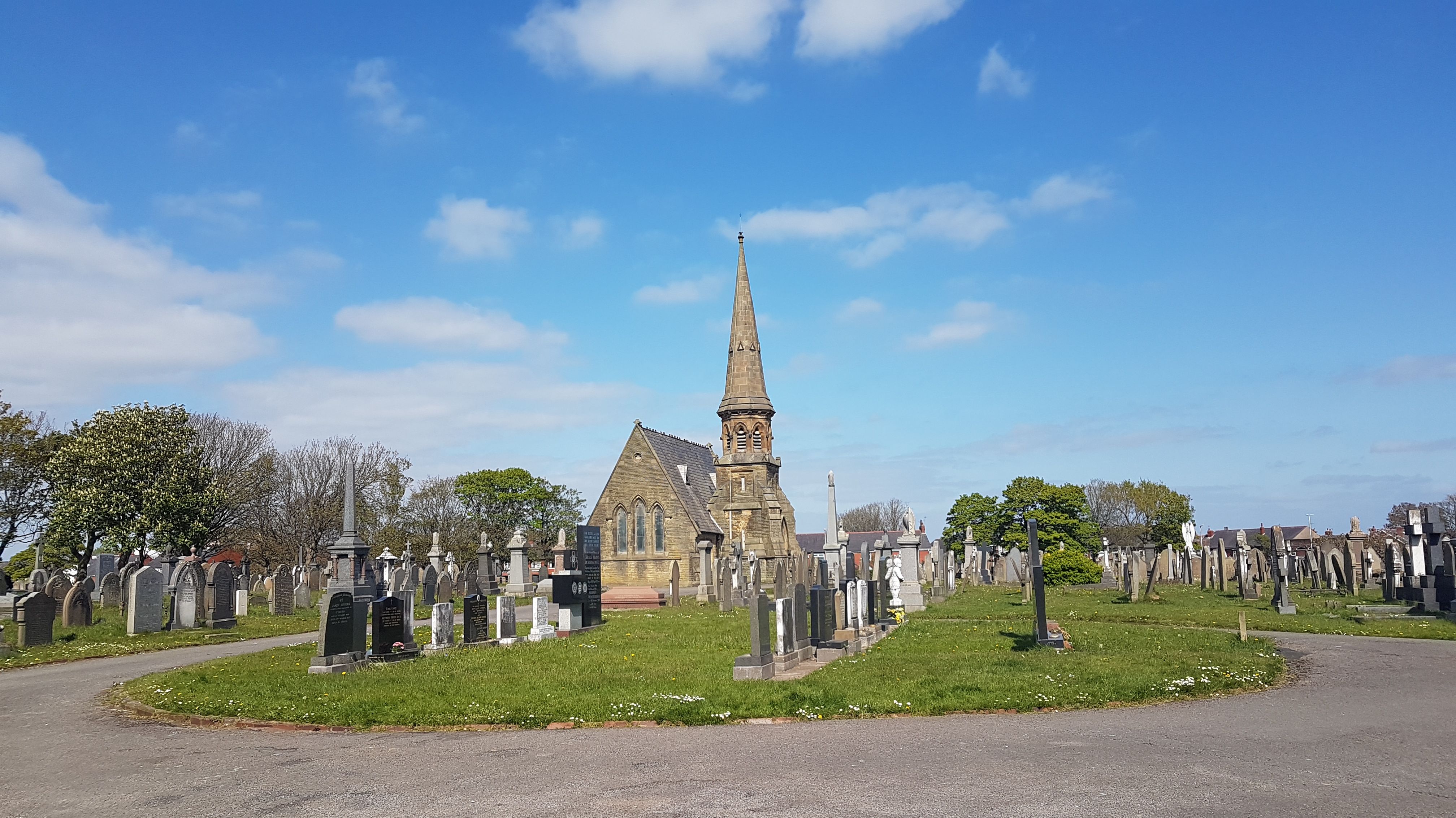
Where is Layton Cemetery?
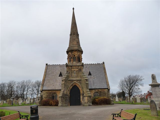
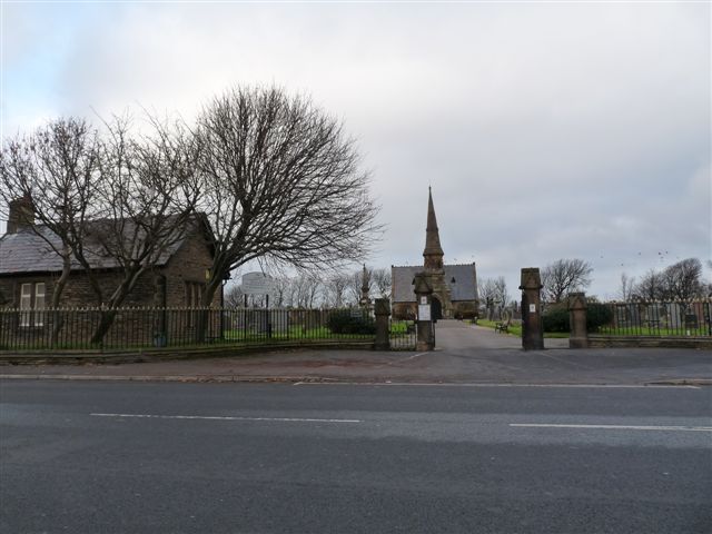
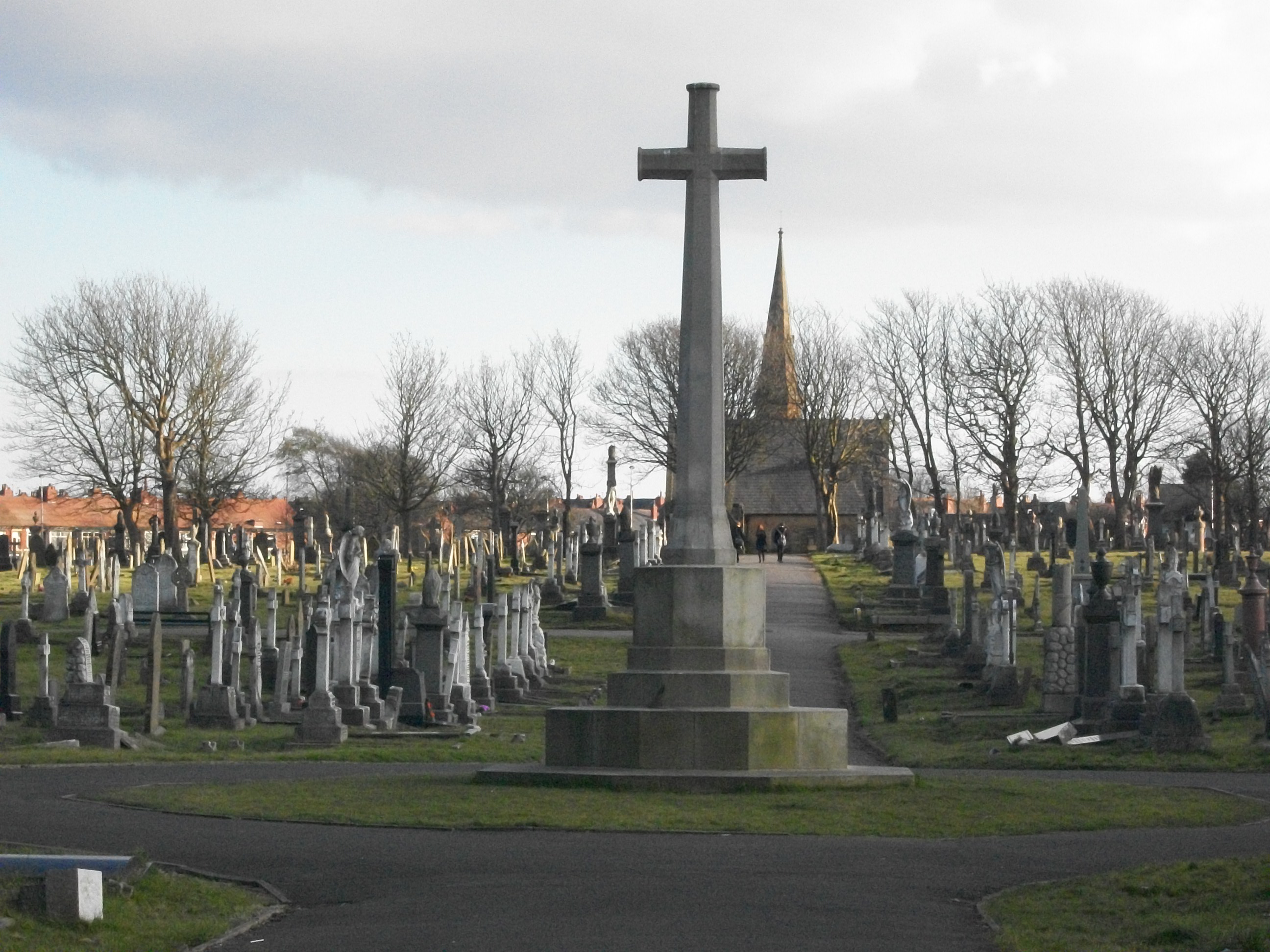
Layton Cemetery is located at Talbot Road Blackpool, Blackpool Unitary Authority ,Lancashire , FY3 7BDEngland.
-
Layton Cemetery cemetery's updated grave count on graveviews.com?
833 memorials
-
Where are the coordinates of the Layton Cemetery?
Latitude: 53.8273740
Longitude: -3.0328240
Nearby Cemetories:
1. Blackpool Jewish Cemetery
Blackpool, Blackpool Unitary Authority, England
Coordinate: 53.8287397, -3.0311753
2. St Paul's Church & Medical Centre
Blackpool Unitary Authority, England
Coordinate: 53.8291540, -3.0533490
3. St John the Evangelist Churchyard
Blackpool, Blackpool Unitary Authority, England
Coordinate: 53.8182303, -3.0508197
4. St Stephen On-the-Cliffs Churchyard
Blackpool, Blackpool Unitary Authority, England
Coordinate: 53.8407230, -3.0515610
5. Carlton Cemetery& Crematorium
Blackpool, Blackpool Unitary Authority, England
Coordinate: 53.8095921, -3.0364920
6. Blackpool Cemetery and Crematorium
Poulton-le-Fylde, Wyre Borough, England
Coordinate: 53.8465680, -3.0196600
7. Saint Paul Churchyard
Great Marton, Blackpool Unitary Authority, England
Coordinate: 53.8053220, -3.0268330
8. Marton Burial Ground
Great Marton, Blackpool Unitary Authority, England
Coordinate: 53.8030870, -3.0108350
9. All Hallow's Churchyard
Bispham, Blackpool Unitary Authority, England
Coordinate: 53.8567580, -3.0372160
10. Saint Chad Churchyard
Poulton-le-Fylde, Wyre Borough, England
Coordinate: 53.8471992, -2.9925005
11. Holy Trinity Churchyard
Blackpool, Blackpool Unitary Authority, England
Coordinate: 53.7962949, -3.0536214
12. St Johns Roman Catholic Church Cemetery
Poulton-le-Fylde, Wyre Borough, England
Coordinate: 53.8520854, -2.9873511
13. Poulton-Le-Fylde Old Cemetery
Poulton-le-Fylde, Wyre Borough, England
Coordinate: 53.8458145, -2.9713324
14. Poulton New Cemetery
Poulton-le-Fylde, Wyre Borough, England
Coordinate: 53.8461240, -2.9689560
15. Christ Church Thornton Churchyard
Thornton-Cleveleys, Wyre Borough, England
Coordinate: 53.8772800, -3.0221100
16. St. Anne's Churchyard
Blackburn, Blackburn with Darwen Unitary Authority, England
Coordinate: 53.8381160, -2.9362870
17. St Anne Churchyard
Singleton, Fylde Borough, England
Coordinate: 53.8379280, -2.9359890
18. St Michael Churchyard
Weeton, Fylde Borough, England
Coordinate: 53.7995380, -2.9358020
19. St Anne's Parish Church
St Annes, Fylde Borough, England
Coordinate: 53.7565230, -3.0227100
20. St. Anne's Roman Catholic Churchyard
Westby, Fylde Borough, England
Coordinate: 53.7876590, -2.9247000
21. Lytham Park Cemetery and Crematorium
Lytham Saint Annes, Fylde Borough, England
Coordinate: 53.7534410, -2.9825790
22. St Nicholas Churchyard
Wrea Green, Fylde Borough, England
Coordinate: 53.7772420, -2.9156380
23. St James Churchyard
Stalmine, Wyre Borough, England
Coordinate: 53.9020510, -2.9533720
24. Preesall Cemetery
Preesall, Wyre Borough, England
Coordinate: 53.9075410, -2.9635410