
| Memorials | : | 63 |
| Location | : | Blackpool, Blackpool Unitary Authority, England |
| Coordinate | : | 53.8182303, -3.0508197 |
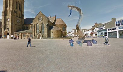
| Description | : | St John the Evangelist was the first church to be built for Blackpool, and was consecrated in 1821. The original building was replaced in the 1870s, and the new church was consecrated in 1878. |
frequently asked questions (FAQ):
-
Where is St John the Evangelist Churchyard?
St John the Evangelist Churchyard is located at Church Street Blackpool, Blackpool Unitary Authority ,Lancashire , FY1 1BP England.
-
St John the Evangelist Churchyard cemetery's updated grave count on graveviews.com?
63 memorials
-
Where are the coordinates of the St John the Evangelist Churchyard?
Latitude: 53.8182303
Longitude: -3.0508197
Nearby Cemetories:
1. St Paul's Church & Medical Centre
Blackpool Unitary Authority, England
Coordinate: 53.8291540, -3.0533490
2. Carlton Cemetery& Crematorium
Blackpool, Blackpool Unitary Authority, England
Coordinate: 53.8095921, -3.0364920
3. Layton Cemetery
Blackpool, Blackpool Unitary Authority, England
Coordinate: 53.8273740, -3.0328240
4. Blackpool Jewish Cemetery
Blackpool, Blackpool Unitary Authority, England
Coordinate: 53.8287397, -3.0311753
5. Saint Paul Churchyard
Great Marton, Blackpool Unitary Authority, England
Coordinate: 53.8053220, -3.0268330
6. Holy Trinity Churchyard
Blackpool, Blackpool Unitary Authority, England
Coordinate: 53.7962949, -3.0536214
7. St Stephen On-the-Cliffs Churchyard
Blackpool, Blackpool Unitary Authority, England
Coordinate: 53.8407230, -3.0515610
8. Marton Burial Ground
Great Marton, Blackpool Unitary Authority, England
Coordinate: 53.8030870, -3.0108350
9. Blackpool Cemetery and Crematorium
Poulton-le-Fylde, Wyre Borough, England
Coordinate: 53.8465680, -3.0196600
10. All Hallow's Churchyard
Bispham, Blackpool Unitary Authority, England
Coordinate: 53.8567580, -3.0372160
11. Saint Chad Churchyard
Poulton-le-Fylde, Wyre Borough, England
Coordinate: 53.8471992, -2.9925005
12. St Johns Roman Catholic Church Cemetery
Poulton-le-Fylde, Wyre Borough, England
Coordinate: 53.8520854, -2.9873511
13. Poulton-Le-Fylde Old Cemetery
Poulton-le-Fylde, Wyre Borough, England
Coordinate: 53.8458145, -2.9713324
14. Poulton New Cemetery
Poulton-le-Fylde, Wyre Borough, England
Coordinate: 53.8461240, -2.9689560
15. Christ Church Thornton Churchyard
Thornton-Cleveleys, Wyre Borough, England
Coordinate: 53.8772800, -3.0221100
16. St Anne's Parish Church
St Annes, Fylde Borough, England
Coordinate: 53.7565230, -3.0227100
17. St Michael Churchyard
Weeton, Fylde Borough, England
Coordinate: 53.7995380, -2.9358020
18. St. Anne's Churchyard
Blackburn, Blackburn with Darwen Unitary Authority, England
Coordinate: 53.8381160, -2.9362870
19. St Anne Churchyard
Singleton, Fylde Borough, England
Coordinate: 53.8379280, -2.9359890
20. Lytham Park Cemetery and Crematorium
Lytham Saint Annes, Fylde Borough, England
Coordinate: 53.7534410, -2.9825790
21. St. Anne's Roman Catholic Churchyard
Westby, Fylde Borough, England
Coordinate: 53.7876590, -2.9247000
22. St Nicholas Churchyard
Wrea Green, Fylde Borough, England
Coordinate: 53.7772420, -2.9156380
23. St. Cuthbert Churchyard
Lytham Saint Annes, Fylde Borough, England
Coordinate: 53.7376560, -2.9761270
24. Saltcoates Roman Catholic Cemetery
Lytham Saint Annes, Fylde Borough, England
Coordinate: 53.7463000, -2.9448940