| Memorials | : | 0 |
| Location | : | Chudleigh, Meander Valley Council, Australia |
| Coordinate | : | -41.5632480, 146.4863430 |
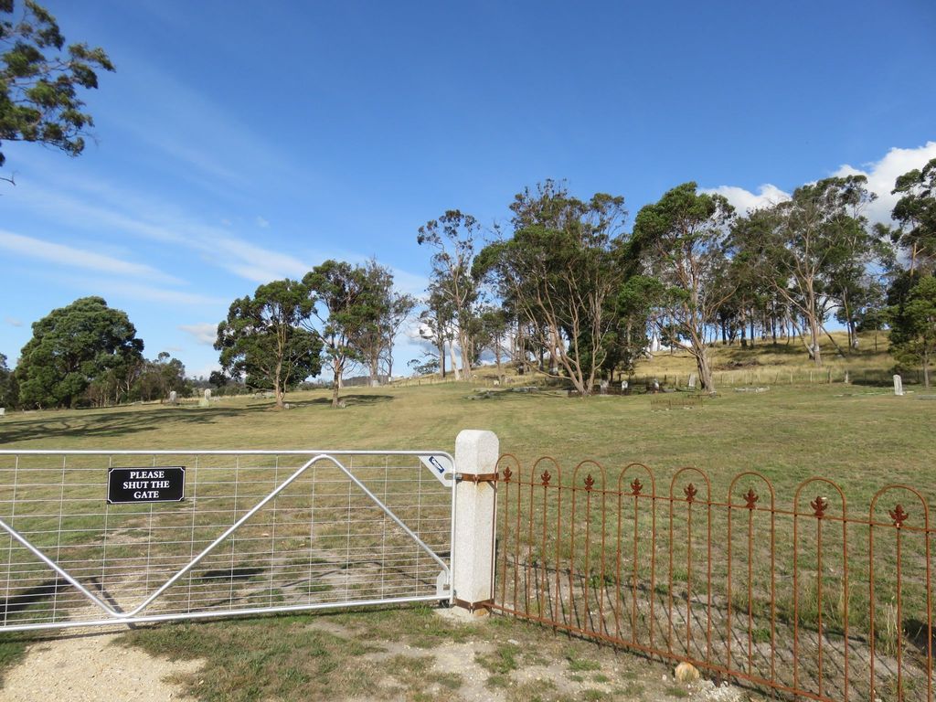
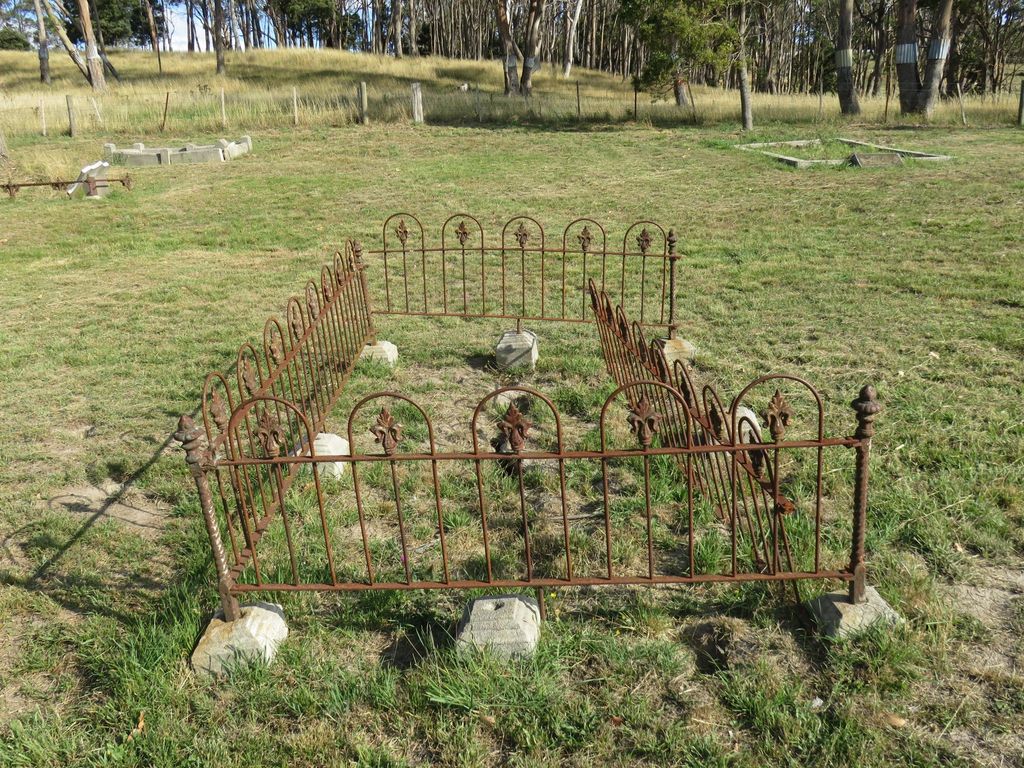
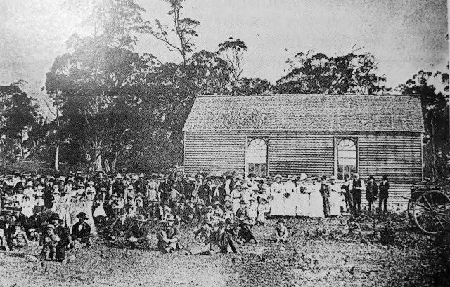
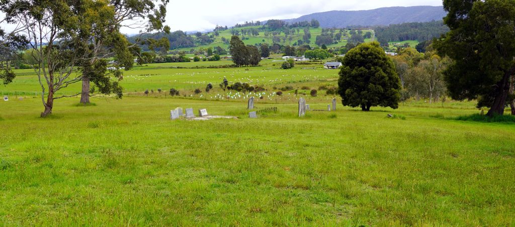
| Description | : | Chudleigh Presbyterian Cemetery was established with the Presbyterian Church in 1858 on land off Burnett Street, Chudleigh. The church subsequently fell into disrepair and was removed. The land on which the cemetery resides is now privately owned. As a cemetery it consists of widely spaced small groups of headstones and anonymous graves. |
frequently asked questions (FAQ):
-
Where is Chudleigh Presbyterian Cemetery?
Chudleigh Presbyterian Cemetery is located at Burnett Street Chudleigh, Meander Valley Council ,Tasmania , 7304Australia.
-
Chudleigh Presbyterian Cemetery cemetery's updated grave count on graveviews.com?
0 memorials
-
Where are the coordinates of the Chudleigh Presbyterian Cemetery?
Latitude: -41.5632480
Longitude: 146.4863430
Nearby Cemetories:
1. Chudleigh Cemetery
Chudleigh, Meander Valley Council, Australia
Coordinate: -41.5532600, 146.4788000
2. Mole Creek General and Lawn Cemetery
Mole Creek, Meander Valley Council, Australia
Coordinate: -41.5703200, 146.4055750
3. Western Creek Cemetery
Meander Valley Council, Australia
Coordinate: -41.6394750, 146.4960280
4. Deloraine General Cemetery
Deloraine, Meander Valley Council, Australia
Coordinate: -41.5077836, 146.6302915
5. Meander Cemetery
Meander, Meander Valley Council, Australia
Coordinate: -41.6493140, 146.6173550
6. Saint Mark's Anglican Cemetery
Deloraine, Meander Valley Council, Australia
Coordinate: -41.5250850, 146.6600750
7. St. Michael and All Angels Anglican Cemetery
Kimberley, Meander Valley Council, Australia
Coordinate: -41.4032830, 146.4960360
8. Claude Road Cemetery
Claude Road, Kentish Council, Australia
Coordinate: -41.4322840, 146.2871020
9. St. James Roman Catholic Cemetery
Railton, Kentish Council, Australia
Coordinate: -41.3569000, 146.4103680
10. Railton Roman Catholic Cemetery
Railton, Kentish Council, Australia
Coordinate: -41.3542310, 146.4160170
11. Railton Methodist Cemetery
Railton, Kentish Council, Australia
Coordinate: -41.3517810, 146.4169420
12. St John’s Anglican Church Cemetery
Railton, Kentish Council, Australia
Coordinate: -41.3521240, 146.4130000
13. Sheffield Cemetery
Sheffield, Kentish Council, Australia
Coordinate: -41.3726558, 146.3055161
14. Westbury General Cemetery
Westbury, Meander Valley Council, Australia
Coordinate: -41.5319850, 146.8259020
15. Westbury Uniting Church Cemetery
Westbury, Meander Valley Council, Australia
Coordinate: -41.5316580, 146.8318780
16. Culzean Cemetery
Westbury, Meander Valley Council, Australia
Coordinate: -41.5212380, 146.8339060
17. Lorinna Cemetery
Lorinna, Kentish Council, Australia
Coordinate: -41.5477800, 146.1345900
18. Westbury Pioneer Catholic Cemetery
Westbury, Meander Valley Council, Australia
Coordinate: -41.5333340, 146.8393990
19. Methodist Cemetery
Barrington, Kentish Council, Australia
Coordinate: -41.3382370, 146.2801480
20. Sassafras Baptist Church Cemetery
Sassafras East, Latrobe Council, Australia
Coordinate: -41.2892740, 146.5059210
21. Sassafras Uniting Church Cemetery
Sassafras, Latrobe Council, Australia
Coordinate: -41.2841730, 146.5071220
22. Wilmot Cemetery
Wilmot, Kentish Council, Australia
Coordinate: -41.3837350, 146.1871690
23. Hagley Methodist-Uniting Cemetery
Hagley, Meander Valley Council, Australia
Coordinate: -41.5258094, 146.8881433
24. Hagley Presbyterian Cemetery
Hagley, Meander Valley Council, Australia
Coordinate: -41.5255610, 146.8975560


