
| Memorials | : | 442 |
| Location | : | Mole Creek, Meander Valley Council, Australia |
| Coordinate | : | -41.5703200, 146.4055750 |
frequently asked questions (FAQ):
-
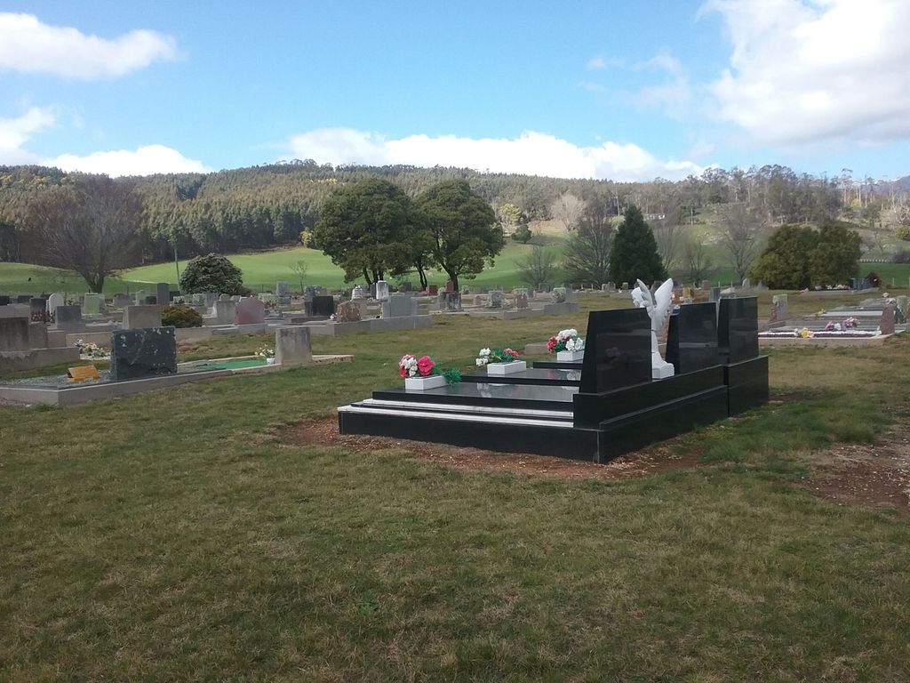
Where is Mole Creek General and Lawn Cemetery?
Mole Creek General and Lawn Cemetery is located at 149 Caveside Road Mole Creek, Meander Valley Council ,Tasmania , 7304Australia.
-
Mole Creek General and Lawn Cemetery cemetery's updated grave count on graveviews.com?
442 memorials
-
Where are the coordinates of the Mole Creek General and Lawn Cemetery?
Latitude: -41.5703200
Longitude: 146.4055750


Nearby Cemetories:
1. Chudleigh Cemetery
Chudleigh, Meander Valley Council, Australia
Coordinate: -41.5532600, 146.4788000
2. Chudleigh Presbyterian Cemetery
Chudleigh, Meander Valley Council, Australia
Coordinate: -41.5632480, 146.4863430
3. Western Creek Cemetery
Meander Valley Council, Australia
Coordinate: -41.6394750, 146.4960280
4. Claude Road Cemetery
Claude Road, Kentish Council, Australia
Coordinate: -41.4322840, 146.2871020
5. Meander Cemetery
Meander, Meander Valley Council, Australia
Coordinate: -41.6493140, 146.6173550
6. Deloraine General Cemetery
Deloraine, Meander Valley Council, Australia
Coordinate: -41.5077836, 146.6302915
7. St. Michael and All Angels Anglican Cemetery
Kimberley, Meander Valley Council, Australia
Coordinate: -41.4032830, 146.4960360
8. Saint Mark's Anglican Cemetery
Deloraine, Meander Valley Council, Australia
Coordinate: -41.5250850, 146.6600750
9. Lorinna Cemetery
Lorinna, Kentish Council, Australia
Coordinate: -41.5477800, 146.1345900
10. Sheffield Cemetery
Sheffield, Kentish Council, Australia
Coordinate: -41.3726558, 146.3055161
11. St. James Roman Catholic Cemetery
Railton, Kentish Council, Australia
Coordinate: -41.3569000, 146.4103680
12. Railton Roman Catholic Cemetery
Railton, Kentish Council, Australia
Coordinate: -41.3542310, 146.4160170
13. St John’s Anglican Church Cemetery
Railton, Kentish Council, Australia
Coordinate: -41.3521240, 146.4130000
14. Railton Methodist Cemetery
Railton, Kentish Council, Australia
Coordinate: -41.3517810, 146.4169420
15. Wilmot Cemetery
Wilmot, Kentish Council, Australia
Coordinate: -41.3837350, 146.1871690
16. Methodist Cemetery
Barrington, Kentish Council, Australia
Coordinate: -41.3382370, 146.2801480
17. Sassafras Baptist Church Cemetery
Sassafras East, Latrobe Council, Australia
Coordinate: -41.2892740, 146.5059210
18. Sassafras Uniting Church Cemetery
Sassafras, Latrobe Council, Australia
Coordinate: -41.2841730, 146.5071220
19. Westbury General Cemetery
Westbury, Meander Valley Council, Australia
Coordinate: -41.5319850, 146.8259020
20. Westbury Uniting Church Cemetery
Westbury, Meander Valley Council, Australia
Coordinate: -41.5316580, 146.8318780
21. Culzean Cemetery
Westbury, Meander Valley Council, Australia
Coordinate: -41.5212380, 146.8339060
22. Westbury Pioneer Catholic Cemetery
Westbury, Meander Valley Council, Australia
Coordinate: -41.5333340, 146.8393990
23. Latrobe Cemetery
Latrobe, Latrobe Council, Australia
Coordinate: -41.2378800, 146.4248200
24. The Mollie Armstrong Memorial Rose Garden
Latrobe, Latrobe Council, Australia
Coordinate: -41.2280620, 146.4215450