
| Memorials | : | 1 |
| Location | : | Ironsides, Charles County, USA |
| Phone | : | 301-246-4486 |
| Coordinate | : | 38.4915600, -77.1594600 |
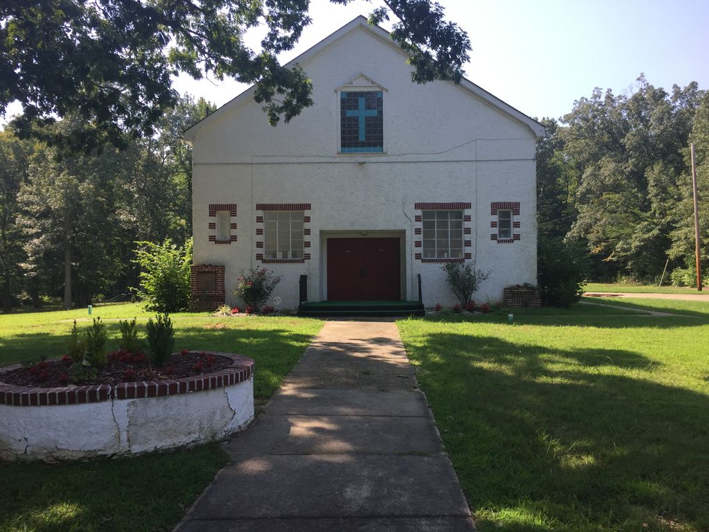
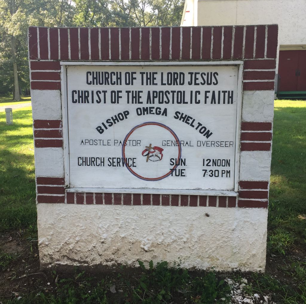
| Description | : | This is a historically black Church which is one of the most prominent public buildings in Ironsides today. The other two buildings are the tiny Ironsides Store, and the Ironsides Volunteer Rescue Squad Company. The town is at the crossroads of Maryland Route 6 (Port Tobacco Road) and Maryland Route 425. Route 425 is called Ironsides Road south of Ironsides, and Mason Springs Road to the north. |
frequently asked questions (FAQ):
-
Where is Church of the Lord Jesus Christ Cemetery?
Church of the Lord Jesus Christ Cemetery is located at 6135 Port Tobacco Road Ironsides, Charles County ,Maryland , 20643USA.
-
Church of the Lord Jesus Christ Cemetery cemetery's updated grave count on graveviews.com?
1 memorials
-
Where are the coordinates of the Church of the Lord Jesus Christ Cemetery?
Latitude: 38.4915600
Longitude: -77.1594600
Nearby Cemetories:
1. Thompson Grave
Ironsides, Charles County, USA
Coordinate: 38.4968500, -77.1688170
2. Saint Ignatius of Loyola Cemetery
Hill Top, Charles County, USA
Coordinate: 38.4841995, -77.1402969
3. Christ Church Durham Parish Cemetery
Ironsides, Charles County, USA
Coordinate: 38.4731300, -77.1549400
4. Mount Hope Baptist Church Cemetery
Nanjemoy, Charles County, USA
Coordinate: 38.4771300, -77.1915400
5. Zion Baptist Church Cemetery
Welcome, Charles County, USA
Coordinate: 38.4897003, -77.1219025
6. Gilroy Family Cemetery
Nanjemoy, Charles County, USA
Coordinate: 38.4893000, -77.2046600
7. Speake Cemetery
Pisgah, Charles County, USA
Coordinate: 38.5166800, -77.1221400
8. Gunston Cemetery
Welcome, Charles County, USA
Coordinate: 38.4550670, -77.1298830
9. Alexandria Cemetery
Indian Head, Charles County, USA
Coordinate: 38.5311600, -77.2010100
10. Pisgah Nazarene Church Cemetery
Pisgah, Charles County, USA
Coordinate: 38.5416400, -77.1440500
11. Nanjemoy Baptist Church Cemetery
Nanjemoy, Charles County, USA
Coordinate: 38.4567400, -77.2083800
12. Pisgah United Methodist Church Cemetery
Pisgah, Charles County, USA
Coordinate: 38.5410995, -77.1342010
13. Smith Chapel Cemetery
La Plata, Charles County, USA
Coordinate: 38.5327988, -77.1117020
14. Poynton Manor Farm Cemetery
Welcome, Charles County, USA
Coordinate: 38.4672240, -77.0887561
15. Smallwood State Park
Marbury, Charles County, USA
Coordinate: 38.5496000, -77.1876700
16. Chicamuxen Methodist Church Cemetery
Chicamuxen, Charles County, USA
Coordinate: 38.5344009, -77.2213974
17. Pleasant Grove Missionary Baptist Church Cemetery
Marbury, Charles County, USA
Coordinate: 38.5586014, -77.1669006
18. Emory Chapel Cemetery
Grayton, Charles County, USA
Coordinate: 38.4291992, -77.1983032
19. Marbury Baptist Church Cemetery
Marbury, Charles County, USA
Coordinate: 38.5686700, -77.1533700
20. Saint Katherines Cemetery
Charles County, USA
Coordinate: 38.5024986, -77.0586014
21. Saint Catherine of Alexandria Cemetery
McConchie, Charles County, USA
Coordinate: 38.5024000, -77.0584600
22. Park Hill Cemetery
Marbury, Charles County, USA
Coordinate: 38.5769005, -77.1580963
23. Downs Family Cemetery
Nanjemoy, Charles County, USA
Coordinate: 38.4033050, -77.1797870
24. Oak Grove Cemetery
Nanjemoy, Charles County, USA
Coordinate: 38.4038900, -77.1840980