
| Memorials | : | 5 |
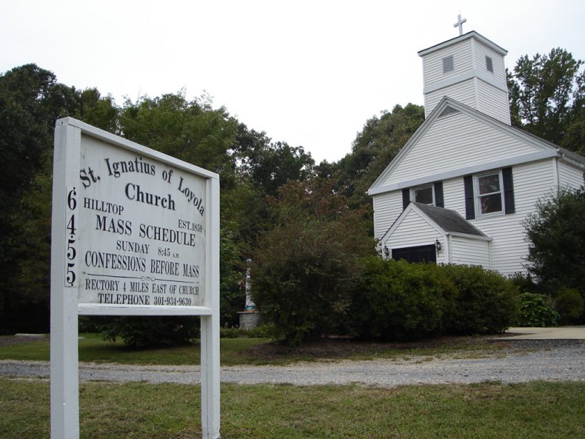
| Location | : | Hill Top, Charles County, USA |
| Coordinate | : | 38.4841995, -77.1402969 |
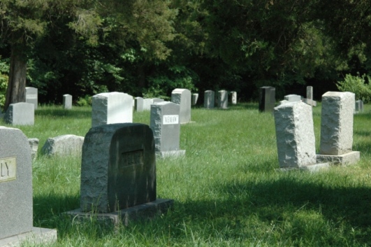
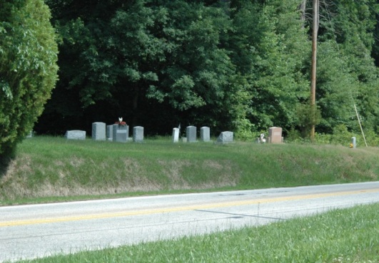
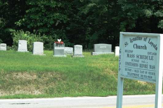
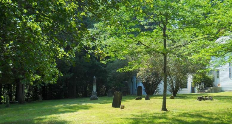
| Description | : | the older main portion is alongside the church. A newer larger area is across Rt 6. Funerals here could be somewhat dicey as there's no roadway into the portion across the road. There is a short concrete walkway. Rt. 6 is the main road from La Plata to the east heading west into this part of the county. Traffic would have to be halted as the deceased was carried across the road to the gravesite. There are numerous graves in this part of the cemetery. |
frequently asked questions (FAQ):
-
Where is Saint Ignatius of Loyola Cemetery?
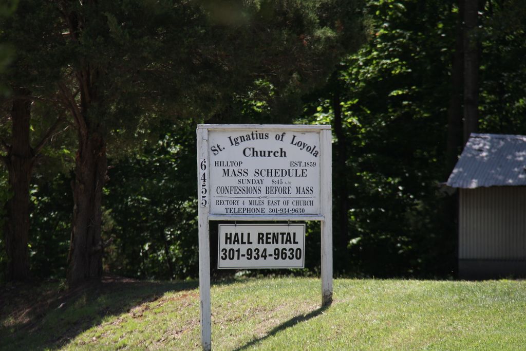
Saint Ignatius of Loyola Cemetery is located at 6455 Port Tobacco Road Hill Top, Charles County ,Maryland , 20677USA.
-
Saint Ignatius of Loyola Cemetery cemetery's updated grave count on graveviews.com?
1 memorials
-
Where are the coordinates of the Saint Ignatius of Loyola Cemetery?
Latitude: 38.4841995
Longitude: -77.1402969
Nearby Cemetories:
1. Zion Baptist Church Cemetery
Welcome, Charles County, USA
Coordinate: 38.4897003, -77.1219025
2. Christ Church Durham Parish Cemetery
Ironsides, Charles County, USA
Coordinate: 38.4731300, -77.1549400
3. Church of the Lord Jesus Christ Cemetery
Ironsides, Charles County, USA
Coordinate: 38.4915600, -77.1594600
4. Thompson Grave
Ironsides, Charles County, USA
Coordinate: 38.4968500, -77.1688170
5. Gunston Cemetery
Welcome, Charles County, USA
Coordinate: 38.4550670, -77.1298830
6. Speake Cemetery
Pisgah, Charles County, USA
Coordinate: 38.5166800, -77.1221400
7. Mount Hope Baptist Church Cemetery
Nanjemoy, Charles County, USA
Coordinate: 38.4771300, -77.1915400
8. Poynton Manor Farm Cemetery
Welcome, Charles County, USA
Coordinate: 38.4672240, -77.0887561
9. Gilroy Family Cemetery
Nanjemoy, Charles County, USA
Coordinate: 38.4893000, -77.2046600
10. Smith Chapel Cemetery
La Plata, Charles County, USA
Coordinate: 38.5327988, -77.1117020
11. Pisgah United Methodist Church Cemetery
Pisgah, Charles County, USA
Coordinate: 38.5410995, -77.1342010
12. Pisgah Nazarene Church Cemetery
Pisgah, Charles County, USA
Coordinate: 38.5416400, -77.1440500
13. Nanjemoy Baptist Church Cemetery
Nanjemoy, Charles County, USA
Coordinate: 38.4567400, -77.2083800
14. Saint Katherines Cemetery
Charles County, USA
Coordinate: 38.5024986, -77.0586014
15. Saint Catherine of Alexandria Cemetery
McConchie, Charles County, USA
Coordinate: 38.5024000, -77.0584600
16. Alexandria Cemetery
Indian Head, Charles County, USA
Coordinate: 38.5311600, -77.2010100
17. Emory Chapel Cemetery
Grayton, Charles County, USA
Coordinate: 38.4291992, -77.1983032
18. Smallwood State Park
Marbury, Charles County, USA
Coordinate: 38.5496000, -77.1876700
19. Pleasant Grove Missionary Baptist Church Cemetery
Marbury, Charles County, USA
Coordinate: 38.5586014, -77.1669006
20. Ellerslie Estate Cemetery
Port Tobacco, Charles County, USA
Coordinate: 38.5037500, -77.0411600
21. Chicamuxen Methodist Church Cemetery
Chicamuxen, Charles County, USA
Coordinate: 38.5344009, -77.2213974
22. Brawner Family Cemetery
McConchie, Charles County, USA
Coordinate: 38.4896870, -77.0344110
23. Marbury Baptist Church Cemetery
Marbury, Charles County, USA
Coordinate: 38.5686700, -77.1533700
24. Downs Family Cemetery
Nanjemoy, Charles County, USA
Coordinate: 38.4033050, -77.1797870