
| Memorials | : | 12 |
| Location | : | Church Point, Northern Beaches Council, Australia |
| Website | : | www.northernbeaches.nsw.gov.au/services/cemeteries |
| Coordinate | : | -33.6450120, 151.2841090 |
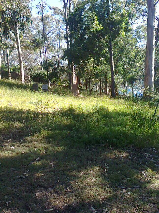
| Description | : | The Cemetery land is part of the original one acre donation by William Oliver to community Trustees. The Cemetery lies opposite the Public Wharf where Pittwater Road meets McCarr's Creek Road. Situated upon elevated land above the roadside, the Cemetery overlooks Pittwater and Scotland Island. The burials at this Cemetery took place between 1882 and 1918. There are only 11 confirmed burials and one cenotaph. It is assumed many more were laid to rest here, but no more records could be found and any other headstones are now gone with time. Even though this Cemetery holds great historical value to the area, it is... Read More |
frequently asked questions (FAQ):
-
Where is Church Point Historic Cemetery?
Church Point Historic Cemetery is located at 1 McCarrs Creek Road Church Point, Northern Beaches Council ,New South Wales , 2105Australia.
-
Church Point Historic Cemetery cemetery's updated grave count on graveviews.com?
0 memorials
-
Where are the coordinates of the Church Point Historic Cemetery?
Latitude: -33.6450120
Longitude: 151.2841090
Nearby Cemetories:
1. Mona Vale Cemetery
Mona Vale, Northern Beaches Council, Australia
Coordinate: -33.6752140, 151.2879720
2. Mona Vale Anglican Church
Mona Vale, Northern Beaches Council, Australia
Coordinate: -33.6745924, 151.3031547
3. Avalon Anglican Columbarium
Avalon, Northern Beaches Council, Australia
Coordinate: -33.6333540, 151.3304900
4. Barrenjoey Head
Palm Beach, Northern Beaches Council, Australia
Coordinate: -33.5802716, 151.3300583
5. Frenchs Forest Cemetery
Davidson, Northern Beaches Council, Australia
Coordinate: -33.7392360, 151.2020750
6. Brooklyn General Cemetery
Brooklyn, Hornsby Shire, Australia
Coordinate: -33.5471710, 151.1990020
7. Frances Peat Lone Grave
Mooney Mooney, Central Coast Council, Australia
Coordinate: -33.5333171, 151.1989208
8. Manly Cemetery
Manly, Northern Beaches Council, Australia
Coordinate: -33.7922700, 151.2715000
9. Church of St. Francis and St. Alban
Gordon, Ku-ring-gai Council, Australia
Coordinate: -33.7563700, 151.1522220
10. St. John's Anglican Church Cemetery
Gordon, Ku-ring-gai Council, Australia
Coordinate: -33.7571060, 151.1519580
11. Bar Island Cemetery
Hornsby Shire, Australia
Coordinate: -33.5262140, 151.1528610
12. The Old Man's Valley Cemetery
Hornsby, Hornsby Shire, Australia
Coordinate: -33.6994480, 151.0923970
13. Sydney North Head Quarantine Cemetery
Manly, Northern Beaches Council, Australia
Coordinate: -33.8177130, 151.2947000
14. Veteran Hall
Saratoga, Central Coast Council, Australia
Coordinate: -33.4786400, 151.3452750
15. Kincumber South Cemetery
Kincumber South, Central Coast Council, Australia
Coordinate: -33.4880610, 151.3759430
16. Northern Suburbs Memorial Gardens and Crematorium
North Ryde, Ryde City, Australia
Coordinate: -33.7954460, 151.1511550
17. Macquarie Park Cemetery and Crematorium
North Ryde, Ryde City, Australia
Coordinate: -33.7937180, 151.1420060
18. St. Thomas Rest Park
Crows Nest, North Sydney Council, Australia
Coordinate: -33.8244490, 151.2063050
19. Rawson Park
Mosman, Mosman Municipality, Australia
Coordinate: -33.8350640, 151.2504980
20. Gore Hill Cemetery
St Leonards, North Sydney Council, Australia
Coordinate: -33.8229500, 151.1887590
21. Greenway Chapel & Memorial Gardens
Kincumber, Central Coast Council, Australia
Coordinate: -33.4639900, 151.3734500
22. St Paul's Anglican Church Cemetery
Kincumber, Central Coast Council, Australia
Coordinate: -33.4697950, 151.3952220
23. Point Frederick Pioneer Cemetery
Point Frederick, Central Coast Council, Australia
Coordinate: -33.4498830, 151.3417900
24. Mary MacKillop Memorial Chapel
North Sydney, North Sydney Council, Australia
Coordinate: -33.8388250, 151.2049160