
| Memorials | : | 769 |
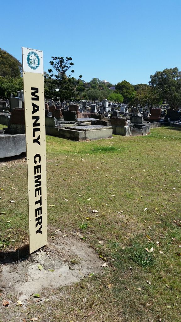
| Location | : | Manly, Northern Beaches Council, Australia |
| Website | : | www.northernbeaches.nsw.gov.au/services/cemeteries |
| Coordinate | : | -33.7922700, 151.2715000 |
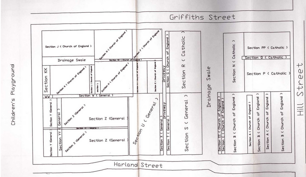
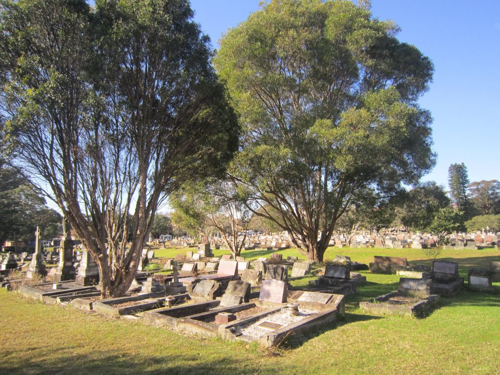
| Description | : | Manly Cemetery was consecrated as a burial ground 5th April 1865 by the Balgowlah (Manly) Church of England and officially became a headstone cemetery in 1872. Monuments were placed prior to formally being named a headstone cemetery, the oldest existing headstone being from 1863. The cemetery is divided into three sections - Anglican, Catholic and General (other denominations). The Northern Beaches Council took over the management of the cemetery in 2016. There are no new plots available, though burials continue today in plots purchased many years ago. In 2000, a columbarium was established. |
frequently asked questions (FAQ):
-
Where is Manly Cemetery?
Manly Cemetery is located at Manly, Northern Beaches Council ,New South Wales ,Australia.
-
Manly Cemetery cemetery's updated grave count on graveviews.com?
747 memorials
-
Where are the coordinates of the Manly Cemetery?
Latitude: -33.7922700
Longitude: 151.2715000

Nearby Cemetories:
1. Sydney North Head Quarantine Cemetery
Manly, Northern Beaches Council, Australia
Coordinate: -33.8177130, 151.2947000
2. Rawson Park
Mosman, Mosman Municipality, Australia
Coordinate: -33.8350640, 151.2504980
3. St. Thomas Rest Park
Crows Nest, North Sydney Council, Australia
Coordinate: -33.8244490, 151.2063050
4. Mary MacKillop Memorial Chapel
North Sydney, North Sydney Council, Australia
Coordinate: -33.8388250, 151.2049160
5. Gore Hill Cemetery
St Leonards, North Sydney Council, Australia
Coordinate: -33.8229500, 151.1887590
6. Garden Island
Potts Point, City of Sydney, Australia
Coordinate: -33.8613635, 151.2280308
7. Frenchs Forest Cemetery
Davidson, Northern Beaches Council, Australia
Coordinate: -33.7392360, 151.2020750
8. Royal Botanic Gardens
Sydney, City of Sydney, Australia
Coordinate: -33.8647440, 151.2170610
9. St Aidan's Anglican Church
Longueville, Lane Cove Municipality, Australia
Coordinate: -33.8281510, 151.1709560
10. Parish Church of Saint James
Sydney, City of Sydney, Australia
Coordinate: -33.8693760, 151.2111540
11. Saint Mary's Cathedral
Sydney, City of Sydney, Australia
Coordinate: -33.8708540, 151.2135820
12. Old Sydney Burial Ground
Sydney, City of Sydney, Australia
Coordinate: -33.8731750, 151.2063850
13. Northern Suburbs Memorial Gardens and Crematorium
North Ryde, Ryde City, Australia
Coordinate: -33.7954460, 151.1511550
14. Devonshire Street Cemetery (Defunct)
Sydney, City of Sydney, Australia
Coordinate: -33.8828080, 151.2066180
15. St. John's Anglican Church Cemetery
Gordon, Ku-ring-gai Council, Australia
Coordinate: -33.7571060, 151.1519580
16. Church of St. Francis and St. Alban
Gordon, Ku-ring-gai Council, Australia
Coordinate: -33.7563700, 151.1522220
17. Macquarie Park Cemetery and Crematorium
North Ryde, Ryde City, Australia
Coordinate: -33.7937180, 151.1420060
18. Mona Vale Cemetery
Mona Vale, Northern Beaches Council, Australia
Coordinate: -33.6752140, 151.2879720
19. Mona Vale Anglican Church
Mona Vale, Northern Beaches Council, Australia
Coordinate: -33.6745924, 151.3031547
20. Saint Jude's Cemetery
Randwick, Randwick City, Australia
Coordinate: -33.9115460, 151.2417130
21. Gladesville Asylum Cemetery
Gladesville, Hunter's Hill Municipality, Australia
Coordinate: -33.8393010, 151.1342490
22. Field of Mars Cemetery
East Ryde, Ryde City, Australia
Coordinate: -33.8120030, 151.1246480
23. Camperdown Cemetery
Newtown, City of Sydney, Australia
Coordinate: -33.8942220, 151.1804900
24. Pioneers Memorial Park
Leichhardt, Inner West Council, Australia
Coordinate: -33.8780800, 151.1575000