
| Memorials | : | 0 |
| Location | : | Bury, Estrie Region, Canada |
| Coordinate | : | 45.4731590, -71.5071190 |
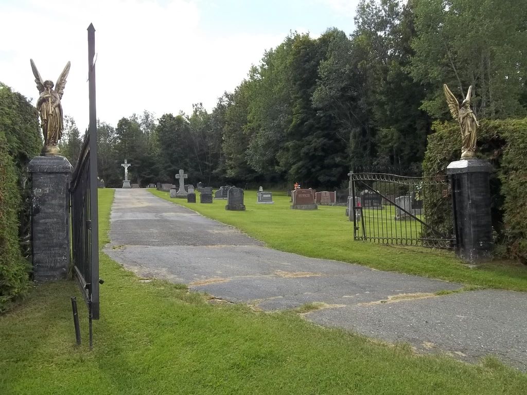
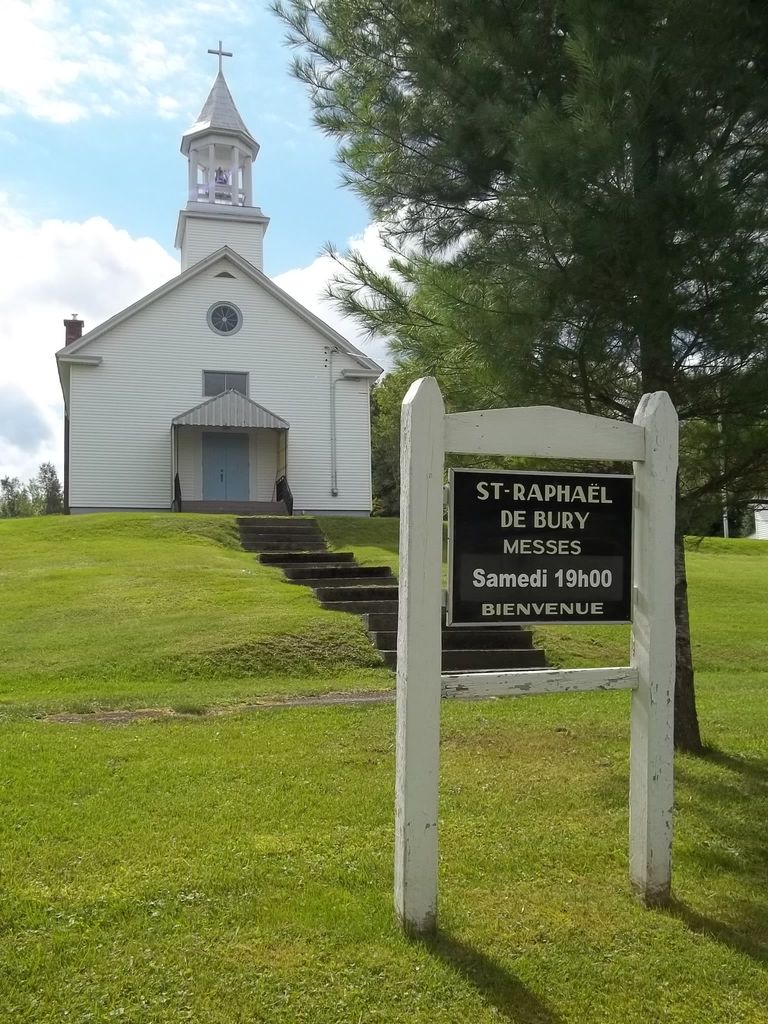
| Description | : | If you are approaching Bury via Route 108 from Cookshire, turn onto Main Street and the cemetery is on your right behind Saint Raphaël Catholic Church. Go up the steep church entrance and go around the back. This Catholic Cemetery dates from the 1860s with the earliest stone dated 1867. It contains both English Catholic and French Catholic graves. The cemetery is not difficult to walk and most headstones are legible. It is well maintained and has one paved drive, and a fence and gate. |
frequently asked questions (FAQ):
-
Where is Cimetière Saint-Raphaël?
Cimetière Saint-Raphaël is located at 533 Main Street Bury, Estrie Region ,Quebec , J0B 1J0Canada.
-
Cimetière Saint-Raphaël cemetery's updated grave count on graveviews.com?
0 memorials
-
Where are the coordinates of the Cimetière Saint-Raphaël?
Latitude: 45.4731590
Longitude: -71.5071190
Nearby Cemetories:
1. Bury Cemetery
Bury, Estrie Region, Canada
Coordinate: 45.4697100, -71.4971300
2. Saint John Cemetery
Brookbury, Estrie Region, Canada
Coordinate: 45.5092400, -71.5454850
3. St-Thomas Bown Anglican Cemetery
Bury, Estrie Region, Canada
Coordinate: 45.4802800, -71.4184700
4. Grace United Cemetery
Brookbury, Estrie Region, Canada
Coordinate: 45.5397500, -71.5393100
5. Cimetière Saint-Jacques le Mineur
Cookshire-Eaton, Estrie Region, Canada
Coordinate: 45.3912260, -71.4778960
6. Cimetière Saint-Camille
Cookshire-Eaton, Estrie Region, Canada
Coordinate: 45.4221800, -71.6088700
7. Island Brook Cemetery
Cookshire-Eaton, Estrie Region, Canada
Coordinate: 45.3881000, -71.4744800
8. Cookshire Community Cemetery
Cookshire-Eaton, Estrie Region, Canada
Coordinate: 45.4213300, -71.6090700
9. Cimetière Saint-Louis
East Angus, Estrie Region, Canada
Coordinate: 45.5046560, -71.6596360
10. Lothrop Cemetery
Bishopton, Estrie Region, Canada
Coordinate: 45.5843170, -71.6009770
11. Cimetière Saint-Clément Bishopton
Dudswell, Estrie Region, Canada
Coordinate: 45.5850500, -71.5995400
12. Lakeside Cemetery
Dudswell, Estrie Region, Canada
Coordinate: 45.5868000, -71.5955000
13. Dudswell Center Cemetery
Bishopton, Estrie Region, Canada
Coordinate: 45.5845160, -71.6012720
14. Grove Hill Cemetery
Cookshire-Eaton, Estrie Region, Canada
Coordinate: 45.3446830, -71.5505710
15. Eaton Cemetery
Eaton, Estrie Region, Canada
Coordinate: 45.3672100, -71.6251500
16. Maple Leaf Cemetery
Maple Leaf, Estrie Region, Canada
Coordinate: 45.3348290, -71.4974690
17. Cimetière Notre-Dame du Saint-Rosaire
Cookshire-Eaton, Estrie Region, Canada
Coordinate: 45.3427900, -71.5808100
18. Lingwick Protestant Cemetery
Gould, Estrie Region, Canada
Coordinate: 45.5939200, -71.3728100
19. Marbleton Methodist Cemetery
Marbleton, Estrie Region, Canada
Coordinate: 45.6277600, -71.5838500
20. Saint Paul Anglican Cemetery
Marbleton, Estrie Region, Canada
Coordinate: 45.6279800, -71.5830200
21. Cimetière Saint-Stanislas
Ascot Corner, Estrie Region, Canada
Coordinate: 45.4507430, -71.7529310
22. Cimetière Saint-Adolphe
Dudswell, Estrie Region, Canada
Coordinate: 45.6402330, -71.5855970
23. Ascot Corner Pioneer Cemetery
Ascot Corner, Estrie Region, Canada
Coordinate: 45.4487080, -71.7588140
24. Cimetière Saint-Pierre
La Patrie, Estrie Region, Canada
Coordinate: 45.4011740, -71.2623790