
| Memorials | : | 3 |
| Location | : | Floss, Washington County, USA |
| Coordinate | : | 35.7935110, -94.3619370 |
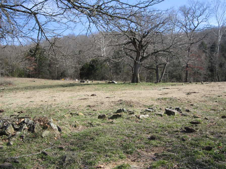
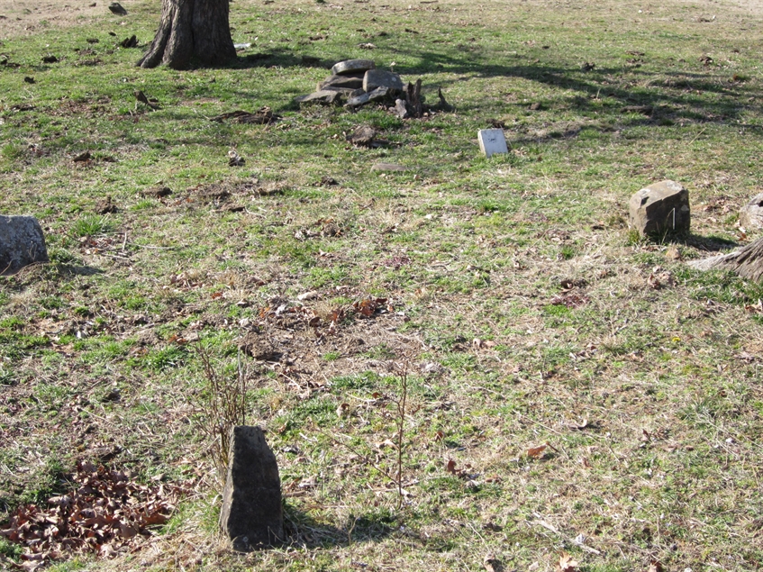
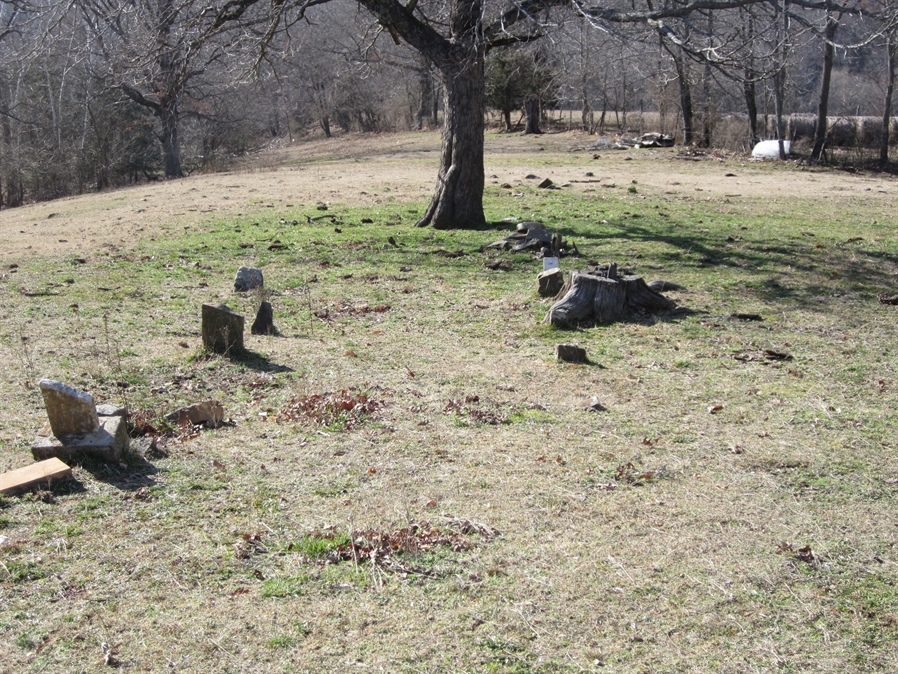
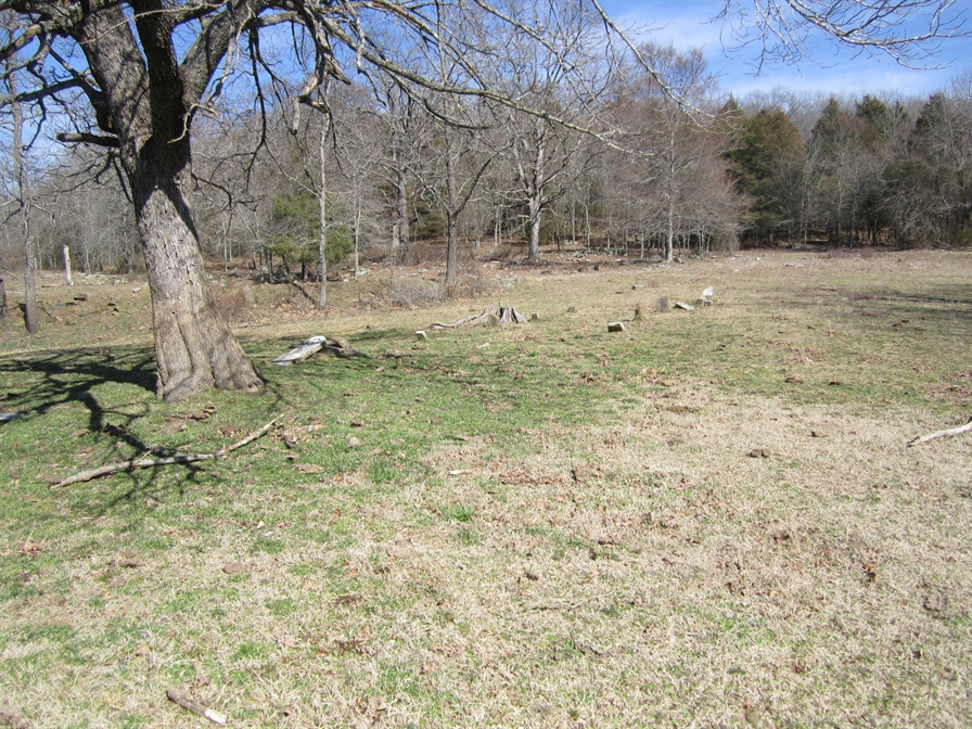
| Description | : | This cemetery lies on the old James A Pierson Farm. The original land owner was a John Parker. Two of Parker's daughters married Clantons. He then sold to Alfred G Clanton,who in turn sold it to his son ,Henry Clanton. Henry Clanton then sold it to James A Pierson,where it is now owned by his grandson,Henry Pierson. There are three marked graves and a number of fieldstone markers,total are about twenty graves. Emma Allen's mother was a Clanton! |
frequently asked questions (FAQ):
-
Where is Clanton Cemetery?
Clanton Cemetery is located at Pierson Road Floss, Washington County ,Arkansas ,USA.
-
Clanton Cemetery cemetery's updated grave count on graveviews.com?
3 memorials
-
Where are the coordinates of the Clanton Cemetery?
Latitude: 35.7935110
Longitude: -94.3619370
Nearby Cemetories:
1. Bugscuffle Cemetery
Strickler, Washington County, USA
Coordinate: 35.7841500, -94.3419460
2. Garrett Creek Cemetery
Washington County, USA
Coordinate: 35.7710991, -94.3792038
3. Dunkard Cemetery
Strickler, Washington County, USA
Coordinate: 35.7775002, -94.3217010
4. Antioch Cemetery
Morrow, Washington County, USA
Coordinate: 35.8129760, -94.4075990
5. Willett Family Cemetery
Morrow, Washington County, USA
Coordinate: 35.8231550, -94.4098840
6. English Cemetery
Strickler, Washington County, USA
Coordinate: 35.7970000, -94.3015770
7. Oak Grove Cemetery
Crawford County, USA
Coordinate: 35.7504005, -94.3262787
8. Dobbs Cemetery
Washington County, USA
Coordinate: 35.7641983, -94.4210968
9. Liberty 86 Cemetery
Strickler, Washington County, USA
Coordinate: 35.7844009, -94.2910995
10. Fall Creek Cemetery
Strickler, Washington County, USA
Coordinate: 35.8344110, -94.3098330
11. Morrow Cemetery
Washington County, USA
Coordinate: 35.8492012, -94.3380966
12. Barker Cemetery
Crawford County, USA
Coordinate: 35.7391100, -94.4035490
13. Shipley Cemetery
Morrow, Washington County, USA
Coordinate: 35.8402470, -94.4200820
14. Scott Cemetery
Prairie Grove, Washington County, USA
Coordinate: 35.8591995, -94.3460999
15. Albert Smith Cemetery
Natural Dam, Crawford County, USA
Coordinate: 35.7265854, -94.3815689
16. Brewster Simpson Cemetery
Washington County, USA
Coordinate: 35.8609620, -94.3390260
17. Leach Cemetery
Crawford County, USA
Coordinate: 35.7498820, -94.4308270
18. Dunagan Cemetery
Evansville, Washington County, USA
Coordinate: 35.8025017, -94.4499969
19. Clawson Cemetery
Natural Dam, Crawford County, USA
Coordinate: 35.7315690, -94.4075350
20. Deason Cemetery
Crawford County, USA
Coordinate: 35.7314550, -94.4073630
21. Cox Cemetery
Morrow, Washington County, USA
Coordinate: 35.8657990, -94.3989029
22. Gray Family Cemetery
Morrow, Washington County, USA
Coordinate: 35.8514830, -94.4274370
23. Zinnamon Cemetery
West Fork, Washington County, USA
Coordinate: 35.8230000, -94.2682000
24. Goddard Cemetery
Washington County, USA
Coordinate: 35.7985992, -94.4636002