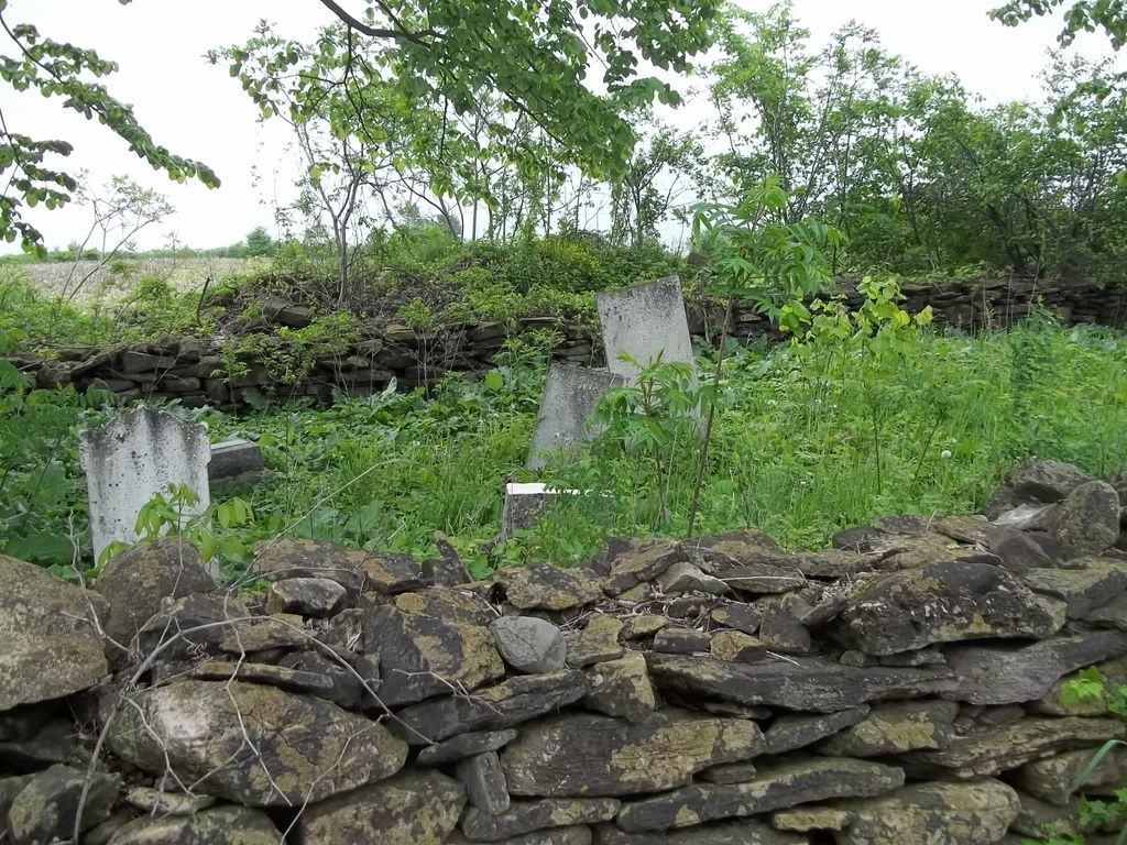
| Memorials | : | 0 |
| Location | : | Cazaville, Monteregie Region, Canada |
| Coordinate | : | 45.0694010, -74.3431760 |
| Description | : | More information about this small family cemetery can be found on Huntingdon County Cemeteries -part of RootsWeb - with more photos taken about 2001. The cemetery seems to be abandoned - many broken stones. The neighbouring farm buildings and equipment are moving ever closer. The stone wall can be seen from the road. |
frequently asked questions (FAQ):
-
Where is Clark Cemetery?
Clark Cemetery is located at Chemin Leahy Road, Cazaville, Monteregie Region ,Quebec ,Canada.
-
Clark Cemetery cemetery's updated grave count on graveviews.com?
0 memorials
-
Where are the coordinates of the Clark Cemetery?
Latitude: 45.0694010
Longitude: -74.3431760
Nearby Cemetories:
1. Rankin Cemetery
Cazaville, Monteregie Region, Canada
Coordinate: 45.0762970, -74.3883690
2. Kensington Cemetery
Godmanchester, Monteregie Region, Canada
Coordinate: 45.0151580, -74.3049470
3. Zion United Church Old Cemetery
Dundee Centre, Monteregie Region, Canada
Coordinate: 45.0298770, -74.4262040
4. Zion United Church Cemetery
Dundee Centre, Monteregie Region, Canada
Coordinate: 45.0269960, -74.4238760
5. Elgin Presbyterian Church Cemetery
Elgin, Monteregie Region, Canada
Coordinate: 45.0209100, -74.2645500
6. Isle of Skye Cemetery
Dundee, Monteregie Region, Canada
Coordinate: 45.0538190, -74.4455030
7. Smith-Moody Cemetery
Dundee, Monteregie Region, Canada
Coordinate: 45.0099140, -74.4192130
8. Saint Bridget's Cemetery
Trout River, Franklin County, USA
Coordinate: 44.9891400, -74.3097800
9. Aubrey Cemetery
Aubrey, Monteregie Region, Canada
Coordinate: 45.0081900, -74.4583100
10. Briggs Street Cemetery
Westville, Franklin County, USA
Coordinate: 44.9668999, -74.3910980
11. Old Cemetery by the Lake
South Lancaster, Stormont, Dundas and Glengarry United Counties, Canada
Coordinate: 45.1288110, -74.4878090
12. The Anglican Church of St. John the Evangelist
South Lancaster, Stormont, Dundas and Glengarry United Counties, Canada
Coordinate: 45.1525570, -74.4637900
13. St. John's Anglican Cemetery
Huntingdon, Monteregie Region, Canada
Coordinate: 45.0877800, -74.1753200
14. Huntingdon Protestant Cemetery
Huntingdon, Monteregie Region, Canada
Coordinate: 45.0940100, -74.1760200
15. Riverside Cemetery
Westville Center, Franklin County, USA
Coordinate: 44.9592018, -74.4135971
16. Saint Andrew's Presbyterian Church Cemetery
South Lancaster, Stormont, Dundas and Glengarry United Counties, Canada
Coordinate: 45.1313900, -74.4907500
17. Saint Joseph Catholic Cemetery Old
Huntingdon, Monteregie Region, Canada
Coordinate: 45.0929883, -74.1720242
18. Saint Joseph Catholic Cemetery
Huntingdon, Monteregie Region, Canada
Coordinate: 45.0928910, -74.1716190
19. Athelstan Presbyterian Cemetery
Athelstan, Monteregie Region, Canada
Coordinate: 45.0378400, -74.1689400
20. St. Joseph Cemetery
Lancaster, Stormont, Dundas and Glengarry United Counties, Canada
Coordinate: 45.1447880, -74.4893430
21. Saint Marys Cemetery
Fort Covington, Franklin County, USA
Coordinate: 44.9902270, -74.4887800
22. Fort Covington Cemetery
Fort Covington, Franklin County, USA
Coordinate: 44.9868900, -74.4959500
23. Saint Marys Parish Cemetery
Fort Covington, Franklin County, USA
Coordinate: 44.9813800, -74.4897820
24. Saint Andrew's United Cemetery
Bainsville, Stormont, Dundas and Glengarry United Counties, Canada
Coordinate: 45.1816590, -74.4529990

