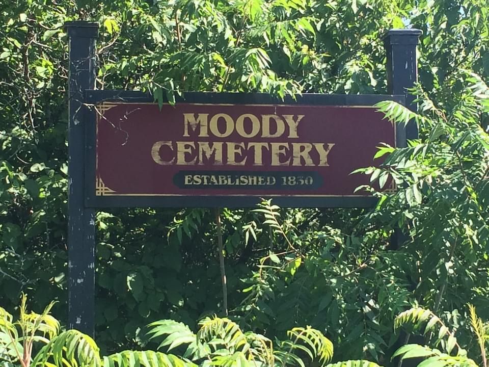
| Memorials | : | 0 |
| Location | : | Dundee, Monteregie Region, Canada |
| Coordinate | : | 45.0099140, -74.4192130 |
| Description | : | Located in Dundee Township about 100 yards east of Ridge Road and north of the McCord Road junction, the Smith-Moody Cemetery is now overgrown and most of the tombstones are no longer visible. The cemetery served many of the families in the southeastern portion of Dundee. Known as Smith Cemetery, the Smith-Moody Cemetery, and also Miller Cemetery, the different names come from early settlers in the immediate vicinity. Smith likely comes from Malcolm Smith, one of the first Elders of Dundee Presbyterian Church and whose home was used for the first church service performed in Dundee by Rev. Duncan Moody.... Read More |
frequently asked questions (FAQ):
-
Where is Smith-Moody Cemetery?
Smith-Moody Cemetery is located at Chemin Ridge Road Dundee, Monteregie Region ,Quebec ,Canada.
-
Smith-Moody Cemetery cemetery's updated grave count on graveviews.com?
0 memorials
-
Where are the coordinates of the Smith-Moody Cemetery?
Latitude: 45.0099140
Longitude: -74.4192130
Nearby Cemetories:
1. Zion United Church Cemetery
Dundee Centre, Monteregie Region, Canada
Coordinate: 45.0269960, -74.4238760
2. Zion United Church Old Cemetery
Dundee Centre, Monteregie Region, Canada
Coordinate: 45.0298770, -74.4262040
3. Aubrey Cemetery
Aubrey, Monteregie Region, Canada
Coordinate: 45.0081900, -74.4583100
4. Briggs Street Cemetery
Westville, Franklin County, USA
Coordinate: 44.9668999, -74.3910980
5. Isle of Skye Cemetery
Dundee, Monteregie Region, Canada
Coordinate: 45.0538190, -74.4455030
6. Riverside Cemetery
Westville Center, Franklin County, USA
Coordinate: 44.9592018, -74.4135971
7. Saint Marys Cemetery
Fort Covington, Franklin County, USA
Coordinate: 44.9902270, -74.4887800
8. Saint Marys Parish Cemetery
Fort Covington, Franklin County, USA
Coordinate: 44.9813800, -74.4897820
9. Elmwood Cemetery
Franklin County, USA
Coordinate: 44.9822006, -74.4922028
10. Fort Covington Cemetery
Fort Covington, Franklin County, USA
Coordinate: 44.9868900, -74.4959500
11. Wilson Cemetery
Fort Covington, Franklin County, USA
Coordinate: 44.9598660, -74.4646750
12. Saint Mary's Cemetery
Fort Covington, Franklin County, USA
Coordinate: 44.9849230, -74.5038240
13. Blood Family Cemetery
Fort Covington, Franklin County, USA
Coordinate: 44.9477300, -74.4616100
14. Rankin Cemetery
Cazaville, Monteregie Region, Canada
Coordinate: 45.0762970, -74.3883690
15. Saint Bridget's Cemetery
Trout River, Franklin County, USA
Coordinate: 44.9891400, -74.3097800
16. Clark Cemetery
Cazaville, Monteregie Region, Canada
Coordinate: 45.0694010, -74.3431760
17. Kensington Cemetery
Godmanchester, Monteregie Region, Canada
Coordinate: 45.0151580, -74.3049470
18. Pine Grove Cemetery
Westville, Franklin County, USA
Coordinate: 44.9331017, -74.3647003
19. Gleason Grave
Fort Covington, Franklin County, USA
Coordinate: 44.9883667, -74.5409167
20. Coal Hill Cemetery
Westville Center, Franklin County, USA
Coordinate: 44.9122009, -74.4011002
21. Elgin Presbyterian Church Cemetery
Elgin, Monteregie Region, Canada
Coordinate: 45.0209100, -74.2645500
22. Salem United Church Cemetery
Summerstown, Stormont, Dundas and Glengarry United Counties, Canada
Coordinate: 45.0536360, -74.5745090
23. Hillside Rest Cemetery
Franklin County, USA
Coordinate: 44.9397011, -74.5661011
24. Constable Cemetery
Constable, Franklin County, USA
Coordinate: 44.9219200, -74.2920000

