
| Memorials | : | 0 |
| Location | : | Dundee, Monteregie Region, Canada |
| Coordinate | : | 45.0538190, -74.4455030 |
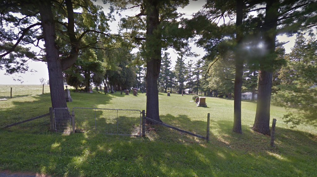
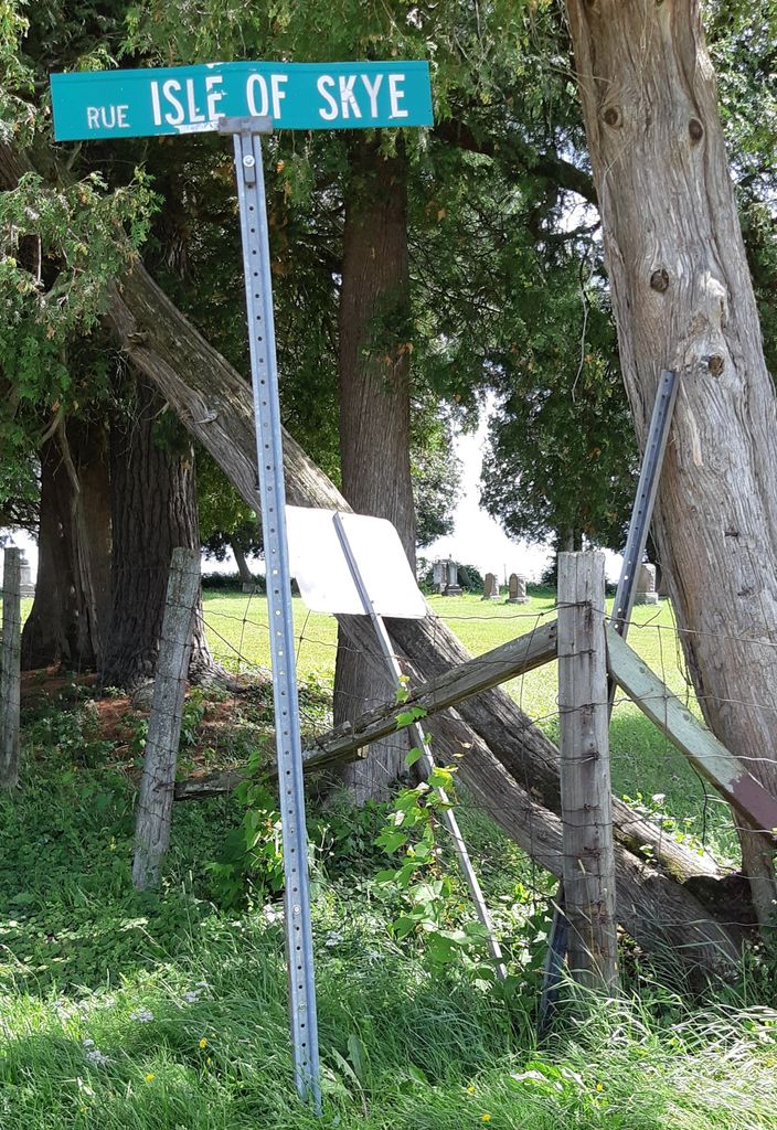
| Description | : | Isle of Skye is a district in Dundee Township with boundaries Fraser Point Road, Route 132 (the old Front Road), Murchison Sideroad, and the shore of Lake St. Francis. The area took its name from Skye, Scotland . Most of those buried in the cemetery were Scottish Presbyterian. It is not officially connected with any religion. According to Robert Fraser, in "As Others See Us", the land for Isle of Skye Cemetery was given to the first settlers by the Mohawk Chiefs of St. Regis. there are wonderful photographs of these memorial available online - Huntingdon County GenWeb home... Read More |
frequently asked questions (FAQ):
-
Where is Isle of Skye Cemetery?
Isle of Skye Cemetery is located at Montee Murchisson and Chemin Isle of Skye Dundee, Monteregie Region ,Quebec ,Canada.
-
Isle of Skye Cemetery cemetery's updated grave count on graveviews.com?
0 memorials
-
Where are the coordinates of the Isle of Skye Cemetery?
Latitude: 45.0538190
Longitude: -74.4455030
Nearby Cemetories:
1. Zion United Church Old Cemetery
Dundee Centre, Monteregie Region, Canada
Coordinate: 45.0298770, -74.4262040
2. Zion United Church Cemetery
Dundee Centre, Monteregie Region, Canada
Coordinate: 45.0269960, -74.4238760
3. Rankin Cemetery
Cazaville, Monteregie Region, Canada
Coordinate: 45.0762970, -74.3883690
4. Aubrey Cemetery
Aubrey, Monteregie Region, Canada
Coordinate: 45.0081900, -74.4583100
5. Smith-Moody Cemetery
Dundee, Monteregie Region, Canada
Coordinate: 45.0099140, -74.4192130
6. Saint Marys Cemetery
Fort Covington, Franklin County, USA
Coordinate: 44.9902270, -74.4887800
7. Clark Cemetery
Cazaville, Monteregie Region, Canada
Coordinate: 45.0694010, -74.3431760
8. Fort Covington Cemetery
Fort Covington, Franklin County, USA
Coordinate: 44.9868900, -74.4959500
9. Elmwood Cemetery
Franklin County, USA
Coordinate: 44.9822006, -74.4922028
10. Saint Marys Parish Cemetery
Fort Covington, Franklin County, USA
Coordinate: 44.9813800, -74.4897820
11. Saint Mary's Cemetery
Fort Covington, Franklin County, USA
Coordinate: 44.9849230, -74.5038240
12. Old Cemetery by the Lake
South Lancaster, Stormont, Dundas and Glengarry United Counties, Canada
Coordinate: 45.1288110, -74.4878090
13. Saint Andrew's Presbyterian Church Cemetery
South Lancaster, Stormont, Dundas and Glengarry United Counties, Canada
Coordinate: 45.1313900, -74.4907500
14. Salem United Church Cemetery
Summerstown, Stormont, Dundas and Glengarry United Counties, Canada
Coordinate: 45.0536360, -74.5745090
15. Gleason Grave
Fort Covington, Franklin County, USA
Coordinate: 44.9883667, -74.5409167
16. Wilson Cemetery
Fort Covington, Franklin County, USA
Coordinate: 44.9598660, -74.4646750
17. Briggs Street Cemetery
Westville, Franklin County, USA
Coordinate: 44.9668999, -74.3910980
18. St. Joseph Cemetery
Lancaster, Stormont, Dundas and Glengarry United Counties, Canada
Coordinate: 45.1447880, -74.4893430
19. Riverside Cemetery
Westville Center, Franklin County, USA
Coordinate: 44.9592018, -74.4135971
20. The Anglican Church of St. John the Evangelist
South Lancaster, Stormont, Dundas and Glengarry United Counties, Canada
Coordinate: 45.1525570, -74.4637900
21. Kensington Cemetery
Godmanchester, Monteregie Region, Canada
Coordinate: 45.0151580, -74.3049470
22. Blood Family Cemetery
Fort Covington, Franklin County, USA
Coordinate: 44.9477300, -74.4616100
23. Saint Bridget's Cemetery
Trout River, Franklin County, USA
Coordinate: 44.9891400, -74.3097800
24. Saint Andrew's United Cemetery
Bainsville, Stormont, Dundas and Glengarry United Counties, Canada
Coordinate: 45.1816590, -74.4529990