
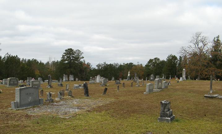
| Memorials | : | 0 |
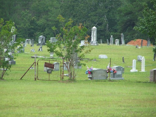
| Location | : | Taylorsville, Smith County, USA |
| Coordinate | : | 31.8659200, -89.3816200 |
| Description | : | From Taylorsville, MS proceed East on Mississippi Highway 28 (MS 28 aka Comfort Street) 2 miles to the intersection of Mississippi Highway 531 (MS 531.) Turn Left (North) onto MS 531 and proceed 2.8 miles to the intersection of Smith County Road 33 (SCR 33.) Turn Right (East) on SCR 33 and continue approximately three tenths of a mile to the cemetery entrance which will be on the Left (North,) specifically SW1/4 NW1/4, S2, T10N-R14W, Smith, Taylorsville Quadrangle Map, USNG 16R BA 74686 28048. |
frequently asked questions (FAQ):
-
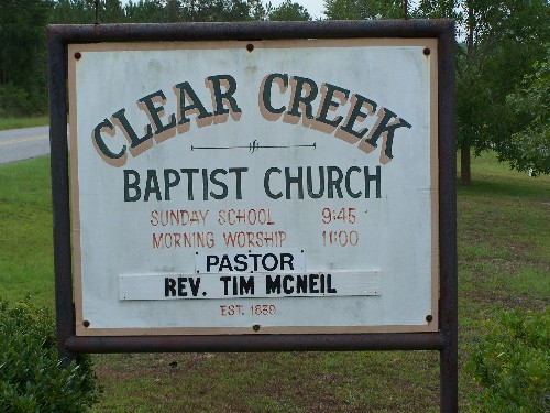
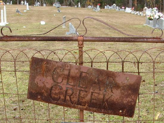
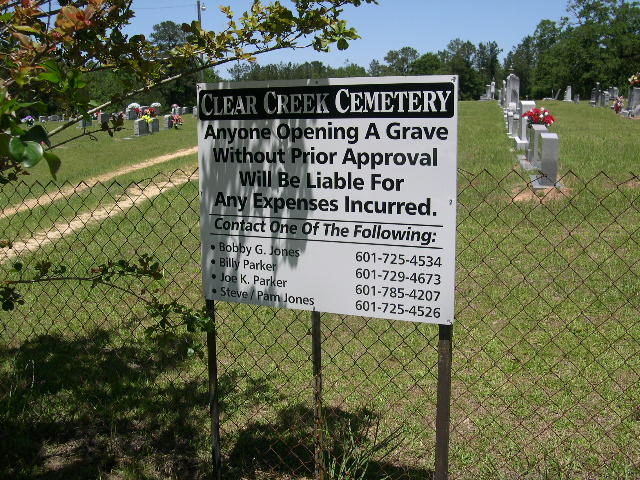
Where is Clear Creek Baptist Church Cemetery?
Clear Creek Baptist Church Cemetery is located at Smith County Road 33 Taylorsville, Smith County ,Mississippi , 39168USA.
-
Clear Creek Baptist Church Cemetery cemetery's updated grave count on graveviews.com?
0 memorials
-
Where are the coordinates of the Clear Creek Baptist Church Cemetery?
Latitude: 31.8659200
Longitude: -89.3816200
Nearby Cemetories:
1. Cherry Grove M.B. Church Cemetery
Taylorsville, Smith County, USA
Coordinate: 31.8465300, -89.3916100
2. Leaf River Missionary Baptist Church Cemetery
Taylorsville, Smith County, USA
Coordinate: 31.8463430, -89.3923780
3. Rogers Cemetery
Taylorsville, Smith County, USA
Coordinate: 31.8477100, -89.3962100
4. Old Bay Springs Church
Smith County, USA
Coordinate: 31.8426970, -89.3600240
5. New Home Baptist Church Cemetery
Smith County, USA
Coordinate: 31.8896500, -89.3459900
6. Joseph Martin Cemetery
Smith County, USA
Coordinate: 31.8978176, -89.3562698
7. Union Baptist Church Cemetery
Taylorsville, Smith County, USA
Coordinate: 31.8969200, -89.3335900
8. Shady Grove Missionary Baptist Church Cemetery
Taylorsville, Smith County, USA
Coordinate: 31.9184100, -89.3563900
9. Mount Zion Baptist Church Cemetery
Taylorsville, Smith County, USA
Coordinate: 31.8816700, -89.4463196
10. Pine Valley Cemetery
Taylorsville, Smith County, USA
Coordinate: 31.8108900, -89.3470500
11. Edon Cemetery
Jasper County, USA
Coordinate: 31.8438400, -89.3121700
12. Summerland Baptist Cemetery
Taylorsville, Smith County, USA
Coordinate: 31.8006001, -89.3630981
13. Fellowship Cemetery
Taylorsville, Smith County, USA
Coordinate: 31.8302500, -89.4507000
14. Providence Cemetery
Stringer, Jasper County, USA
Coordinate: 31.8587400, -89.2954600
15. Hinton Cemetery
Taylorsville, Smith County, USA
Coordinate: 31.7908001, -89.3799973
16. McCraw Cemetery
Taylorsville, Smith County, USA
Coordinate: 31.9390300, -89.3606500
17. New Beginnings Baptist Church Cemetery
Stringer, Jasper County, USA
Coordinate: 31.8874715, -89.2956650
18. Shelby Cemetery
Jasper County, USA
Coordinate: 31.8717995, -89.2908707
19. Maranatha Mennonite Church Cemetery
Covington County, USA
Coordinate: 31.7896160, -89.4369000
20. Hancock Family Cemetery
Sylvarena, Smith County, USA
Coordinate: 31.9585680, -89.3775183
21. Mineral Springs Missionary Baptist Cemetery
Taylorsville, Smith County, USA
Coordinate: 31.9522400, -89.4261900
22. Blue Mountain Cemetery
Bay Springs, Jasper County, USA
Coordinate: 31.9402900, -89.3134200
23. Knights Mill Cemetery
Jones County, USA
Coordinate: 31.7838993, -89.3268967
24. Speir Cemetery
Mize, Smith County, USA
Coordinate: 31.9158800, -89.4784100