
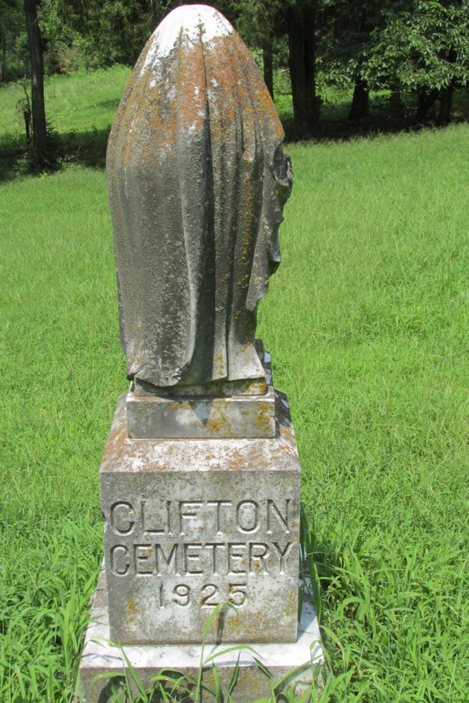
| Memorials | : | 7 |
| Location | : | Clifton, Boyle County, USA |
| Coordinate | : | 37.6475470, -84.6919410 |
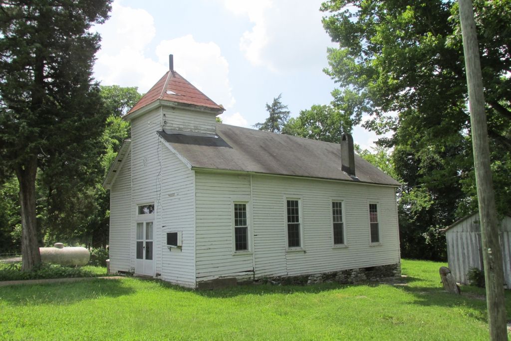
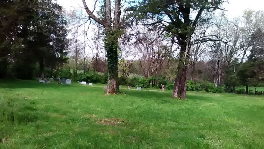
| Description | : | After the Civil War, many former enslaved African-Americans settled in the Clifton area, among other parts of Boyle County. The cemetery is on the left side of a dirt road on left directly after the Clifton Baptist Church. The church does not look as though it is used, and another building on the property, directly on the corner, is falling in. |
frequently asked questions (FAQ):
-
Where is Clifton Cemetery?
Clifton Cemetery is located at Clifton, Boyle County ,Kentucky ,USA.
-
Clifton Cemetery cemetery's updated grave count on graveviews.com?
7 memorials
-
Where are the coordinates of the Clifton Cemetery?
Latitude: 37.6475470
Longitude: -84.6919410
Nearby Cemetories:
1. Stony Point Cemetery
Danville, Boyle County, USA
Coordinate: 37.6681900, -84.7242100
2. Needmore African American Cemetery
Little Needmore, Boyle County, USA
Coordinate: 37.6608600, -84.7343500
3. Engleman Cemetery
Hubble, Lincoln County, USA
Coordinate: 37.6136800, -84.6744600
4. Davistown African American Baptist Church Cemetery
Davistown, Garrard County, USA
Coordinate: 37.6858240, -84.6979590
5. Helm-Engleman Cemetery
Hubble, Lincoln County, USA
Coordinate: 37.6150600, -84.6630700
6. Grace Baptist Church Cemetery
Danville, Boyle County, USA
Coordinate: 37.6200620, -84.7291880
7. Bright Cemetery
Hubble, Lincoln County, USA
Coordinate: 37.6089500, -84.6694900
8. Pleasant Grove Christian Church Cemetery
Garrard County, USA
Coordinate: 37.6879590, -84.6745640
9. Forks of the Dix River Baptist Church Cemetery
Lancaster, Garrard County, USA
Coordinate: 37.6751700, -84.6448500
10. Worner-Ball Cemetery
Lancaster, Garrard County, USA
Coordinate: 37.6372160, -84.6327740
11. Meauxtown African American Cemetery
Danville, Boyle County, USA
Coordinate: 37.6768750, -84.7431280
12. Boones Creek Cemetery
Lancaster, Garrard County, USA
Coordinate: 37.6419700, -84.6269700
13. Blackerby Cemetery
Lincoln County, USA
Coordinate: 37.6025000, -84.6578000
14. Barlow Cemetery
Garrard County, USA
Coordinate: 37.6456200, -84.6239690
15. Rochester Cemetery
Danville, Boyle County, USA
Coordinate: 37.6443120, -84.7632430
16. Floyd Cemetery
Garrard County, USA
Coordinate: 37.6861060, -84.6388880
17. Wooley Cemetery
Stanford, Lincoln County, USA
Coordinate: 37.5952200, -84.6609100
18. William Lear Cemetery
Lancaster, Garrard County, USA
Coordinate: 37.6694270, -84.6236060
19. Hilldale Cemetery
Danville, Boyle County, USA
Coordinate: 37.6314011, -84.7628021
20. Danville Memorial Gardens
Danville, Boyle County, USA
Coordinate: 37.5942001, -84.7281036
21. John Sleet Cemetery
Garrard County, USA
Coordinate: 37.6223907, -84.6220627
22. Bellevue Cemetery
Danville, Boyle County, USA
Coordinate: 37.6521988, -84.7686005
23. Christopher Burial Place
Danville, Boyle County, USA
Coordinate: 37.6316100, -84.7662100
24. Danville National Cemetery
Danville, Boyle County, USA
Coordinate: 37.6515656, -84.7689667