
| Memorials | : | 0 |
| Location | : | Powiat stargardzki, Poland |
| Coordinate | : | 53.4684140, 15.1759636 |
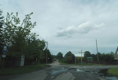
| Description | : | This cemetery may have incorporated the previous German Evangelical Lutheran Church burials. Chlebówko (German Sassenhagen) is a village in the administrative district of Gmina Stara Dąbrowa, within Stargard County, West Pomeranian Voivodeship, in north-western Poland. It lies approximately 4 kilometres (2 mi) north-east of Stara Dąbrowa, 16 km (10 mi) north-east of Stargard, and 39 km (24 mi) east of the regional capital Szczecin. Before 1945 the area was part of Germany. After World War II the area became part of Poland and the German population was expelled. |
frequently asked questions (FAQ):
-
Where is Cmentarz w Chlebówku?
Cmentarz w Chlebówku is located at Powiat stargardzki ,Zachodniopomorskie ,Poland.
-
Cmentarz w Chlebówku cemetery's updated grave count on graveviews.com?
0 memorials
-
Where are the coordinates of the Cmentarz w Chlebówku?
Latitude: 53.4684140
Longitude: 15.1759636
Nearby Cemetories:
1. Cmentarz w Kania
Powiat stargardzki, Poland
Coordinate: 53.4989516, 15.2433455
2. Evangelisch-Lutheranischer Friedhof von Karkow
Powiat stargardzki, Poland
Coordinate: 53.4753318, 15.2854060
3. Poland Evangelical Cemetery
Szczecin, Miasto Szczecin, Poland
Coordinate: 53.4125100, 15.2373470
4. Voßberg
Powiat stargardzki, Poland
Coordinate: 53.4284883, 15.3067841
5. Voßberg
Powiat stargardzki, Poland
Coordinate: 53.4284883, 15.3067841
6. Cmentarz Komunalny w Chociwlu
Powiat stargardzki, Poland
Coordinate: 53.4684722, 15.3443890
7. Cmentarz w Małkocin
Powiat stargardzki, Poland
Coordinate: 53.4042790, 15.0290288
8. Evangelisch-Lutheranischer Friedhof von Roggow
Powiat stargardzki, Poland
Coordinate: 53.4015718, 14.9828398
9. Evangelisch Lutheranischer Friedhof v Vehlingsdorf
Powiat stargardzki, Poland
Coordinate: 53.5048258, 15.3935038
10. Evangelisch-Lutheranischer Friedhof von Plantikow
Szczecin, Miasto Szczecin, Poland
Coordinate: 53.6006035, 15.2411593
11. Evangelisch-Lutheranischer Friedhof von Saarow
Powiat stargardzki, Poland
Coordinate: 53.3844372, 14.9905812
12. Cmentarz w Poczernin
Powiat stargardzki, Poland
Coordinate: 53.4244760, 14.9547506
13. Cmentarz Dobra
Szczecin, Miasto Szczecin, Poland
Coordinate: 53.5859698, 15.3021461
14. Cmentarz w Grzędzicach
Powiat stargardzki, Poland
Coordinate: 53.3686129, 14.9688987
15. Friedhof Gross Benz
Powiat łobeski, Poland
Coordinate: 53.6141030, 15.2989770
16. Cmentarz Komunalny w Stargardzie - Stary
Powiat stargardzki, Poland
Coordinate: 53.3304143, 15.0233839
17. Cieszyno Cmentarz
Powiat łobeski, Poland
Coordinate: 53.5207633, 15.4421941
18. Evangelisch-Lutheranischer Friedhof von Karlsbach
Powiat stargardzki, Poland
Coordinate: 53.4465560, 14.8874502
19. Cmentarz Komunalny w Stargardzie - Nowy
Powiat stargardzki, Poland
Coordinate: 53.3246820, 15.0106728
20. Evangelisch-Lutheranischer Friedhof von Horst
Powiat łobeski, Poland
Coordinate: 53.5444566, 15.4497067
21. Ev.-lutherischer Kirchfriedhof Kriewitz (Krzywice)
Powiat goleniowski, Poland
Coordinate: 53.6012116, 14.9643436
22. Cmentarz Komunalny w Nowogard
Szczecin, Miasto Szczecin, Poland
Coordinate: 53.6628579, 15.1180895
23. Evangelisch-Lutheranischer Friedhof von Roggow A
Powiat łobeski, Poland
Coordinate: 53.6355946, 15.3581663
24. Sielsko Cmentarz komunalny
Powiat łobeski, Poland
Coordinate: 53.5808105, 15.4683237