
| Memorials | : | 0 |
| Location | : | Powiat goleniowski, Poland |
| Coordinate | : | 53.6012116, 14.9643436 |
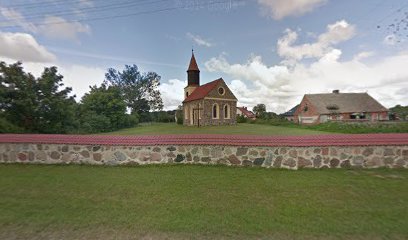
| Description | : | Der Kirchfriedhof der ev.-lutherischen Kirche des bis 1945 deutschen Dorfes Kriewitz im Kreis Naugard (Pommern) ist heute aufgelassen und beräumt. Das heute polnische Dorf trägt nun den Namen Krzywice – in der Wojwodschaft Zachodniopomorski, im Powiat (Bezirk) Goleniów, Gminia (Gemeinde) Osina. Die ehemals evangelisch-lutherische Kirche mit ihrem Friedhof ist heute die römisch-katholische Filialkirche vom Allerheiligten Herzen Jesu (Kościół filialny pw Najświętszego Serca Pana Jezusa). The church cemetery of the Lutheran church of the until 1945 German village Kriewitz in the district Naugard (Pomerania) is today abandoned and cleared. The now Polish village now bears the name Krzywice - in the Zachodniopomorski... Read More |
frequently asked questions (FAQ):
-
Where is Ev.-lutherischer Kirchfriedhof Kriewitz (Krzywice)?
Ev.-lutherischer Kirchfriedhof Kriewitz (Krzywice) is located at Krzywice 15, 72-221, Poland Powiat goleniowski ,Zachodniopomorskie , 72-221Poland.
-
Ev.-lutherischer Kirchfriedhof Kriewitz (Krzywice) cemetery's updated grave count on graveviews.com?
0 memorials
-
Where are the coordinates of the Ev.-lutherischer Kirchfriedhof Kriewitz (Krzywice)?
Latitude: 53.6012116
Longitude: 14.9643436
Nearby Cemetories:
1. Ev.-lutherischer Friedhof von Glewitz (Glewice)
Powiat goleniowski, Poland
Coordinate: 53.6069373, 14.9132945
2. Ev.-lutherischer Kirchfriedhof Basenthin (Bodzęcin
Powiat goleniowski, Poland
Coordinate: 53.6348427, 14.9268505
3. Evangelisch-Lutheranischer Friedhof von Fanger
Powiat goleniowski, Poland
Coordinate: 53.6602298, 14.9775693
4. Cmentarz Komunalny w Strzelewie
Powiat goleniowski, Poland
Coordinate: 53.6756662, 14.9990416
5. Evangelisch-Lutheranischer Friedhof von Gollnow
Szczecin, Miasto Szczecin, Poland
Coordinate: 53.5573402, 14.8215340
6. Ev.-lutherischer Friedhof Dischenhagen (Dzisna)
Powiat goleniowski, Poland
Coordinate: 53.6846897, 14.8439832
7. Cmentarz Komunalny w Nowogard
Szczecin, Miasto Szczecin, Poland
Coordinate: 53.6628579, 15.1180895
8. Evangelisch-Lutheranischer Friedhof von Trechel
Powiat goleniowski, Poland
Coordinate: 53.7346668, 14.9650317
9. Cmentarz Komunalny w Blotno
Powiat goleniowski, Poland
Coordinate: 53.7559511, 15.0178137
10. Evangelisch-Lutheranischer Friedhof von Karlsbach
Powiat stargardzki, Poland
Coordinate: 53.4465560, 14.8874502
11. Evangelisch-Lutheranischer Friedhof von Plantikow
Szczecin, Miasto Szczecin, Poland
Coordinate: 53.6006035, 15.2411593
12. Cmentarz w Borzysławcu
Powiat goleniowski, Poland
Coordinate: 53.5190030, 14.7191929
13. Cmentarz w Poczernin
Powiat stargardzki, Poland
Coordinate: 53.4244760, 14.9547506
14. Lubczyna Lapidarium
Powiat goleniowski, Poland
Coordinate: 53.5073500, 14.7100500
15. Cmentarz w Chlebówku
Powiat stargardzki, Poland
Coordinate: 53.4684140, 15.1759636
16. Cmentarz w Kania
Powiat stargardzki, Poland
Coordinate: 53.4989516, 15.2433455
17. Friedhof Gross Benz
Powiat łobeski, Poland
Coordinate: 53.6141030, 15.2989770
18. Evangelisch-Lutheranischer Friedhof von Roggow
Powiat stargardzki, Poland
Coordinate: 53.4015718, 14.9828398
19. Cmentarz w Małkocin
Powiat stargardzki, Poland
Coordinate: 53.4042790, 15.0290288
20. Cmentarz Dobra
Szczecin, Miasto Szczecin, Poland
Coordinate: 53.5859698, 15.3021461
21. Evangelisch-Lutheranischer Friedhof von Saarow
Powiat stargardzki, Poland
Coordinate: 53.3844372, 14.9905812
22. Evangelisch-Lutheranischer Friedhof von Karkow
Powiat stargardzki, Poland
Coordinate: 53.4753318, 15.2854060
23. Ev.-lutherischer Friedhof Ludwigshorst (Taczały)
Powiat łobeski, Poland
Coordinate: 53.7439460, 15.2721200
24. Cmentarz w Grzędzicach
Powiat stargardzki, Poland
Coordinate: 53.3686129, 14.9688987