
| Memorials | : | 0 |
| Location | : | Grainger County, USA |
| Coordinate | : | 36.3189011, -83.3644028 |
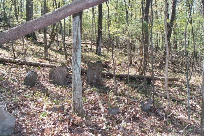
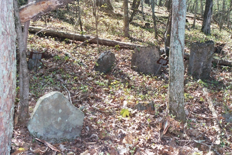
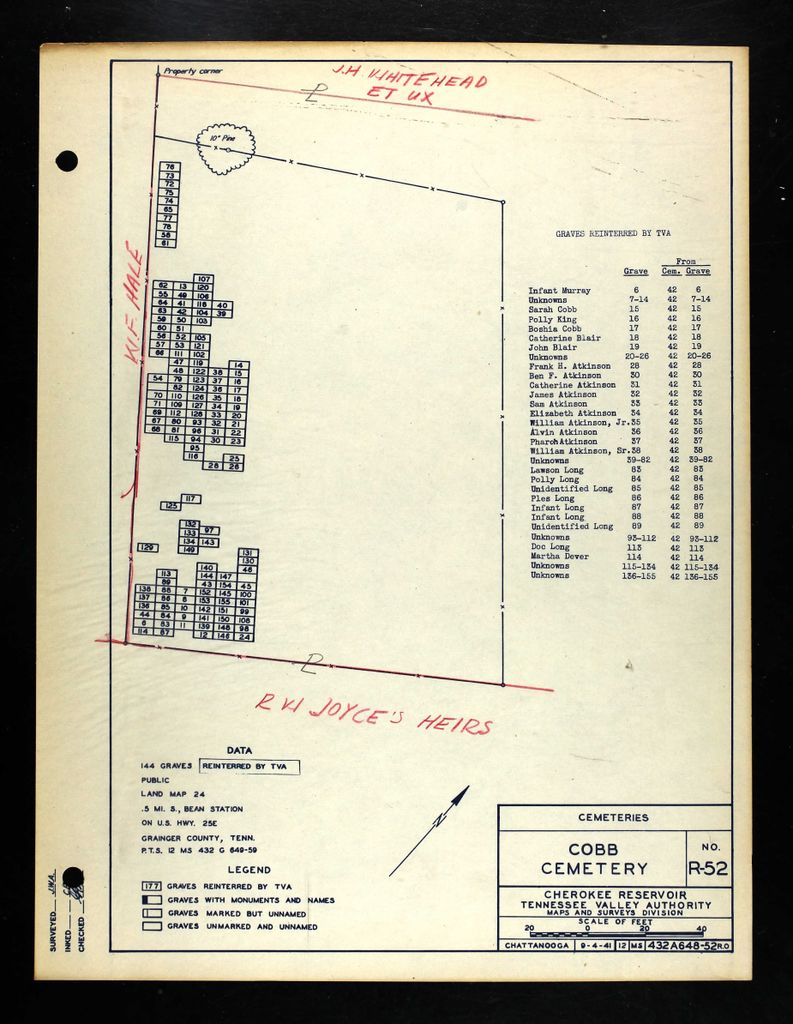
| Description | : | Established in the 1790's, Cobb Cemetery was originally a large public cemetery, located south of old Bean's Station. It appears that burials in Cobb Cemetery ceased by the early 1900's. When TVA surveyed the cemetery in 1941 prior to the creation of Cherokee Lake, they found 155 graves, and determined that all were located below water level of the future lake. All the graves were removed by TVA, mostly to relocated Cobb Cemetery, which was located just above the original site about 200 feet. Only 36 graves were identified, mainly belonging to the Blair, Cobb, and related families; eleven of... Read More |
frequently asked questions (FAQ):
-
Where is Cobb Cemetery?
Cobb Cemetery is located at Grainger County ,Tennessee ,USA.
-
Cobb Cemetery cemetery's updated grave count on graveviews.com?
0 memorials
-
Where are the coordinates of the Cobb Cemetery?
Latitude: 36.3189011
Longitude: -83.3644028
Nearby Cemetories:
1. Bean Station Cemetery
Bean Station, Grainger County, USA
Coordinate: 36.3283000, -83.3697000
2. Buck Hollow Cemetery
Grainger County, USA
Coordinate: 36.3344120, -83.3589440
3. Harrell Cemetery
Bean Station, Grainger County, USA
Coordinate: 36.3074989, -83.3463974
4. Marys Chapel Cemetery
Grainger County, USA
Coordinate: 36.3011017, -83.3569031
5. Noeton Baptist Church Cemetery Original
Bean Station, Grainger County, USA
Coordinate: 36.3012600, -83.3342200
6. Harris Cemetery
Grainger County, USA
Coordinate: 36.3055992, -83.3308029
7. Helton Cemetery
Bean Station, Grainger County, USA
Coordinate: 36.3451190, -83.3831290
8. Heath Chapel Cemetery
Grainger County, USA
Coordinate: 36.2851730, -83.3615220
9. Atkins Cemetery
Grainger County, USA
Coordinate: 36.3506000, -83.3792000
10. Dalton Cemetery
Bean Station, Grainger County, USA
Coordinate: 36.3428001, -83.3296967
11. Helton Cemetery
Bean Station, Grainger County, USA
Coordinate: 36.2910995, -83.3993988
12. Hodge Cemetery
Helton, Grainger County, USA
Coordinate: 36.2985360, -83.4077340
13. Freedom Chapel Missionary Baptist Church Cemetery
Grainger County, USA
Coordinate: 36.2865410, -83.3948480
14. Lakeshore Missionary Baptist Church Cemetery
Bean Station, Grainger County, USA
Coordinate: 36.2797470, -83.3780200
15. Holston Baptist Church Cemetery
Bean Station, Grainger County, USA
Coordinate: 36.2775002, -83.3796997
16. Samsel Cemetery
Bean Station, Grainger County, USA
Coordinate: 36.3424020, -83.3167060
17. Floyd Cemetery
Grainger County, USA
Coordinate: 36.3328018, -83.4188995
18. Samsel Lakeview Cemetery
Bean Station, Grainger County, USA
Coordinate: 36.3475800, -83.3189468
19. Garrett Cemetery
Grainger County, USA
Coordinate: 36.3414001, -83.3082962
20. Bray Cemetery
Grainger County, USA
Coordinate: 36.3563995, -83.4085999
21. Clinch Valley American Christian Church Cemetery
Grainger County, USA
Coordinate: 36.3492300, -83.4171700
22. Lathim Cemetery
Grainger County, USA
Coordinate: 36.3572006, -83.4105988
23. Ford Cemetery
Grainger County, USA
Coordinate: 36.2902985, -83.3071976
24. Bowen Cemetery
Grainger County, USA
Coordinate: 36.3093987, -83.4328003