
| Memorials | : | 0 |
| Location | : | Mountaintown, Gilmer County, USA |
| Coordinate | : | 34.7391434, -84.5958862 |
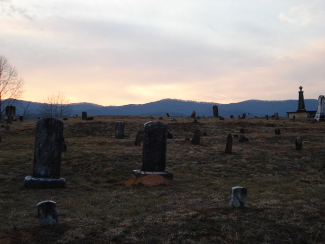
| Description | : | The old Cohutta Methodist Church that stood adjacent to this cemetery no longer exists. The church was moved in the late 1800's and preceded present day Nine Mile United Methodist Church which is located some three miles away on Hwy 52. Directions: From the square in Ellijay, Ga. (Gilmer Co.) take Ga. Hwy 52 approx 7 miles. Turn left on Mountaintown Church Rd. Go approx 3.7 miles and turn left on the dirt driveway. The cemetery is located .01 miles on the right on top of the hill. |
frequently asked questions (FAQ):
-
Where is Cohutta Cemetery?
Cohutta Cemetery is located at Mountaintown, Gilmer County ,Georgia ,USA.
-
Cohutta Cemetery cemetery's updated grave count on graveviews.com?
0 memorials
-
Where are the coordinates of the Cohutta Cemetery?
Latitude: 34.7391434
Longitude: -84.5958862
Nearby Cemetories:
1. Dupree Cemetery
Ellijay, Gilmer County, USA
Coordinate: 34.7462500, -84.5985500
2. Pleasant Hill Baptist Church Cemetery
Gilmer County, USA
Coordinate: 34.7536100, -84.6025260
3. Pence Hill Cemetery
Ellijay, Gilmer County, USA
Coordinate: 34.7310364, -84.5649493
4. Mountaintown Baptist Church Cemetery
Ellijay, Gilmer County, USA
Coordinate: 34.7491989, -84.5633011
5. Seventh-day Adventist Church Cemetery
Tails Creek, Gilmer County, USA
Coordinate: 34.7145670, -84.5758140
6. Nine Mile United Methodist Church Cemetery
Gilmer County, USA
Coordinate: 34.7698330, -84.5829890
7. Tails Creek Baptist Church Cemetery
Ellijay, Gilmer County, USA
Coordinate: 34.7056007, -84.6132965
8. Pleasant Gap Baptist Church Cemetery
Ellijay, Gilmer County, USA
Coordinate: 34.7127100, -84.5611180
9. John Osborn Gravesite
Gilmer County, USA
Coordinate: 34.7596000, -84.5527900
10. Ratcliff Cemetery
Tails Creek, Gilmer County, USA
Coordinate: 34.6993904, -84.5752182
11. Old Faith Baptist Church Cemetery
Gilmer County, USA
Coordinate: 34.7082100, -84.5567500
12. Old Dovers Chapel Cemetery
Tails Creek, Gilmer County, USA
Coordinate: 34.6975550, -84.5733980
13. Dover's Chapel Cemetery
Ellijay, Gilmer County, USA
Coordinate: 34.7060450, -84.5500600
14. Ballew Memorial Cemetery
Ellijay, Gilmer County, USA
Coordinate: 34.7350710, -84.5334170
15. Crossroads Baptist Church Cemetery
Ellijay, Gilmer County, USA
Coordinate: 34.6855580, -84.5850060
16. Mount Nebo Cemetery
Gilmer County, USA
Coordinate: 34.7857513, -84.5471725
17. Gates Chapel UMC Cemetery
Mountaintown, Gilmer County, USA
Coordinate: 34.7943520, -84.5566790
18. Whisenant Mountain Cemetery
Ellijay, Gilmer County, USA
Coordinate: 34.7525880, -84.5178930
19. New Hope Baptist Church Cemetery
Ellijay, Gilmer County, USA
Coordinate: 34.7331009, -84.5128021
20. Pleasant Grove Baptist Church Cemetery
Ellijay, Gilmer County, USA
Coordinate: 34.6991690, -84.5269530
21. Logan Family Cemetery
Gilmer County, USA
Coordinate: 34.6923080, -84.5291920
22. Zion Hill Baptist Church Cemetery
Ellijay, Gilmer County, USA
Coordinate: 34.7864700, -84.5256030
23. Calvary Way Baptist Church Cemetery
Ellijay, Gilmer County, USA
Coordinate: 34.7202220, -84.5010210
24. Ridgeway Baptist Church Cemetery
Ellijay, Gilmer County, USA
Coordinate: 34.6618580, -84.6435430