
| Memorials | : | 0 |
| Location | : | Mountaintown, Gilmer County, USA |
| Coordinate | : | 34.7943520, -84.5566790 |
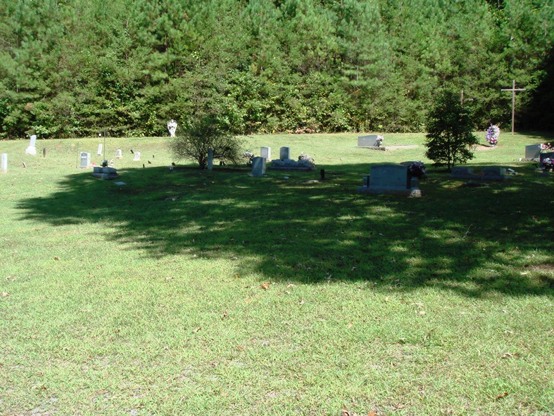
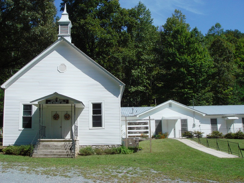
| Description | : | Direction: From Ellijay, Gilmer Co. Georgia, take Ga. 52 (Chatsworth Hwy) west approximately four miles to Gates Chapel Road on the right. Travel approximately four miles to the church on the right. The cemetery is beside the church. |
frequently asked questions (FAQ):
-
Where is Gates Chapel UMC Cemetery?
Gates Chapel UMC Cemetery is located at Mountaintown, Gilmer County ,Georgia ,USA.
-
Gates Chapel UMC Cemetery cemetery's updated grave count on graveviews.com?
0 memorials
-
Where are the coordinates of the Gates Chapel UMC Cemetery?
Latitude: 34.7943520
Longitude: -84.5566790
Nearby Cemetories:
1. Mount Nebo Cemetery
Gilmer County, USA
Coordinate: 34.7857513, -84.5471725
2. Zion Hill Baptist Church Cemetery
Ellijay, Gilmer County, USA
Coordinate: 34.7864700, -84.5256030
3. Nine Mile United Methodist Church Cemetery
Gilmer County, USA
Coordinate: 34.7698330, -84.5829890
4. John Osborn Gravesite
Gilmer County, USA
Coordinate: 34.7596000, -84.5527900
5. Mountaintown Baptist Church Cemetery
Ellijay, Gilmer County, USA
Coordinate: 34.7491989, -84.5633011
6. Whisenant Mountain Cemetery
Ellijay, Gilmer County, USA
Coordinate: 34.7525880, -84.5178930
7. Pleasant Hill Baptist Church Cemetery
Gilmer County, USA
Coordinate: 34.7536100, -84.6025260
8. Dupree Cemetery
Ellijay, Gilmer County, USA
Coordinate: 34.7462500, -84.5985500
9. Flat Branch Baptist Church Cemetery
Flat Branch, Gilmer County, USA
Coordinate: 34.7724460, -84.4893530
10. Ballew Memorial Cemetery
Ellijay, Gilmer County, USA
Coordinate: 34.7350710, -84.5334170
11. Pence Hill Cemetery
Ellijay, Gilmer County, USA
Coordinate: 34.7310364, -84.5649493
12. Cohutta Cemetery
Mountaintown, Gilmer County, USA
Coordinate: 34.7391434, -84.5958862
13. New Hope Baptist Church Cemetery
Ellijay, Gilmer County, USA
Coordinate: 34.7331009, -84.5128021
14. Seventh-day Adventist Church Cemetery
Tails Creek, Gilmer County, USA
Coordinate: 34.7145670, -84.5758140
15. Pleasant Gap Baptist Church Cemetery
Ellijay, Gilmer County, USA
Coordinate: 34.7127100, -84.5611180
16. Dyer Mountain Cemetery
Fannin County, USA
Coordinate: 34.8692017, -84.5147018
17. Cashes Valley Church of Christ Cemetery
Gilmer County, USA
Coordinate: 34.8361015, -84.4700012
18. Old Faith Baptist Church Cemetery
Gilmer County, USA
Coordinate: 34.7082100, -84.5567500
19. Johnson Family Cemetery
Gilmer County, USA
Coordinate: 34.8335880, -84.4629230
20. Calvary Way Baptist Church Cemetery
Ellijay, Gilmer County, USA
Coordinate: 34.7202220, -84.5010210
21. Dover's Chapel Cemetery
Ellijay, Gilmer County, USA
Coordinate: 34.7060450, -84.5500600
22. Jones Cemetery
Ellijay, Gilmer County, USA
Coordinate: 34.7743988, -84.4443970
23. Salem Baptist Church Cemetery
Ellijay, Gilmer County, USA
Coordinate: 34.7642479, -84.4466705
24. Ratcliff Cemetery
Tails Creek, Gilmer County, USA
Coordinate: 34.6993904, -84.5752182