
| Memorials | : | 1 |
| Location | : | Gilmer County, USA |
| Coordinate | : | 34.7857513, -84.5471725 |
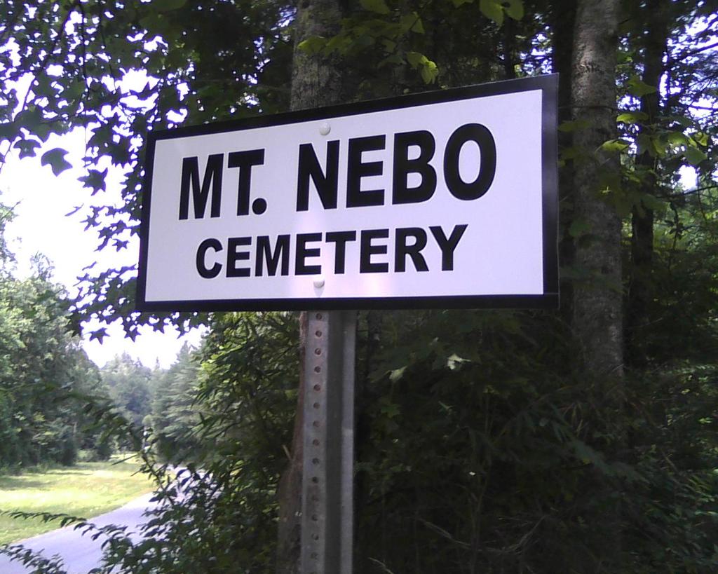
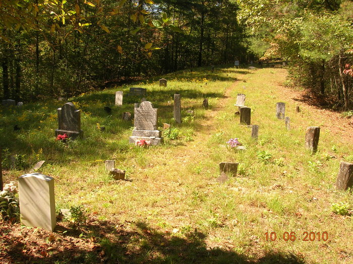
| Description | : | Mount Nebo Cemetery Mount Nebo Methodist Church was active during the time of the American Civil War. No remains of the church remain on the site now except the cemetery where several of the community's earliest settlers are buried. Directions: From the square at Ellijay, Ga. take Ga. Hwy 52 (Chatsworth Hwy) west 5 miles. Turn right on Gates Chapel Rd. Go approx two and a half miles till you see the cemetery sign posted on the right. Follow the narrow dirt road some 200 feet up the hill to reach the cemetery. |
frequently asked questions (FAQ):
-
Where is Mount Nebo Cemetery?
Mount Nebo Cemetery is located at Gilmer County ,Georgia ,USA.
-
Mount Nebo Cemetery cemetery's updated grave count on graveviews.com?
1 memorials
-
Where are the coordinates of the Mount Nebo Cemetery?
Latitude: 34.7857513
Longitude: -84.5471725
Nearby Cemetories:
1. Gates Chapel UMC Cemetery
Mountaintown, Gilmer County, USA
Coordinate: 34.7943520, -84.5566790
2. Zion Hill Baptist Church Cemetery
Ellijay, Gilmer County, USA
Coordinate: 34.7864700, -84.5256030
3. John Osborn Gravesite
Gilmer County, USA
Coordinate: 34.7596000, -84.5527900
4. Nine Mile United Methodist Church Cemetery
Gilmer County, USA
Coordinate: 34.7698330, -84.5829890
5. Mountaintown Baptist Church Cemetery
Ellijay, Gilmer County, USA
Coordinate: 34.7491989, -84.5633011
6. Whisenant Mountain Cemetery
Ellijay, Gilmer County, USA
Coordinate: 34.7525880, -84.5178930
7. Flat Branch Baptist Church Cemetery
Flat Branch, Gilmer County, USA
Coordinate: 34.7724460, -84.4893530
8. Ballew Memorial Cemetery
Ellijay, Gilmer County, USA
Coordinate: 34.7350710, -84.5334170
9. Pleasant Hill Baptist Church Cemetery
Gilmer County, USA
Coordinate: 34.7536100, -84.6025260
10. Pence Hill Cemetery
Ellijay, Gilmer County, USA
Coordinate: 34.7310364, -84.5649493
11. Dupree Cemetery
Ellijay, Gilmer County, USA
Coordinate: 34.7462500, -84.5985500
12. New Hope Baptist Church Cemetery
Ellijay, Gilmer County, USA
Coordinate: 34.7331009, -84.5128021
13. Cohutta Cemetery
Mountaintown, Gilmer County, USA
Coordinate: 34.7391434, -84.5958862
14. Pleasant Gap Baptist Church Cemetery
Ellijay, Gilmer County, USA
Coordinate: 34.7127100, -84.5611180
15. Seventh-day Adventist Church Cemetery
Tails Creek, Gilmer County, USA
Coordinate: 34.7145670, -84.5758140
16. Calvary Way Baptist Church Cemetery
Ellijay, Gilmer County, USA
Coordinate: 34.7202220, -84.5010210
17. Old Faith Baptist Church Cemetery
Gilmer County, USA
Coordinate: 34.7082100, -84.5567500
18. Dover's Chapel Cemetery
Ellijay, Gilmer County, USA
Coordinate: 34.7060450, -84.5500600
19. Cashes Valley Church of Christ Cemetery
Gilmer County, USA
Coordinate: 34.8361015, -84.4700012
20. Johnson Family Cemetery
Gilmer County, USA
Coordinate: 34.8335880, -84.4629230
21. Kell Family Cemetery
Ellijay, Gilmer County, USA
Coordinate: 34.7277050, -84.4720750
22. Jones Cemetery
Ellijay, Gilmer County, USA
Coordinate: 34.7743988, -84.4443970
23. Salem Baptist Church Cemetery
Ellijay, Gilmer County, USA
Coordinate: 34.7642479, -84.4466705
24. Dyer Mountain Cemetery
Fannin County, USA
Coordinate: 34.8692017, -84.5147018